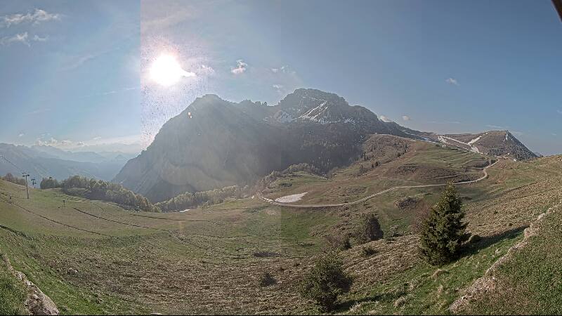
Mountains in Italy
Monte Valletto
2,371 m7,779 ft
Mountain · Alpi Orobie Occidentali · Italy
Monte Valletto is a mountain, 2,371 metres (7,779 ft) high, in the Orobie Alps of Lombardy, northern Italy. It rises on the watershed between the upper Val Brembana, in the Province of Bergamo, and the Val Gerola, a side valley of the Valtellina in the Province of Sondrio.
From Wikipedia, CC BY-SA · Read the article
At the summit · forecast for 12:00 PM
7 °CClear · wind 6 km/h from the W
 See it in 3D
Weather at the summit of Monte Valletto, 2,371 m
- 12:00 PM7 °CW 6 km/h–
- 3:00 PM7 °CW 5 km/h–
- 6:00 PM1 °CN 2 km/h–
- 9:00 PM-1 °CSE 1 km/h–
- 12:00 AM-2 °CE 1 km/h–
- 3:00 AM-2 °CE 2 km/h–
- 6:00 AM-3 °CE 3 km/h–
- 9:00 AM3 °CE 5 km/h–
| Day | Sky | High / low | Rain | Wind up to |
|---|---|---|---|---|
| Wed, Oct 28 | Clear | 9 °C / -3 °C | – | 6 km/h |
| Thu, Oct 29 | Light rain | 5 °C / -3 °C | 0.8 mm | 8 km/h |
| Fri, Oct 30 | Cloudy | 2 °C / -2 °C | 1.4 mm | 4 km/h |
| Sat, Oct 31 | Mostly clear | 4 °C / -5 °C | – | 4 km/h |
| Sun, Nov 1 | Mostly clear | 5 °C / -6 °C | – | 4 km/h |
| Mon, Nov 2 | Clear | 7 °C / -4 °C | – | 5 km/h |
| Tue, Nov 3 | Partly cloudy | 8 °C / -5 °C | – | 3 km/h |
Forecast by MET Norway (CC BY 4.0), updated 10:22 AM GMT+1. Times are local.
Facts
- What it is
- Mountain
- Height above sea level
- 2,371 m (7,779 ft)
- Range
- Alpi Orobie Occidentali
- Country
- Italy
- Coordinates
- 46.024°N 9.588°E
- Source
- Wikidata, CC0
Peaks near Monte Valletto
- Monte Resegone1,875 m · 21 km awayOn the map
- Cima della Bondasca3,289 m · 29 km awayOn the map
- Pizzo di Zocca3,174 m · 30 km awayOn the map
- Monte Disgrazia3,678 m · 30 km awayOn the map
- Pizzo Badile3,308 m · 30 km awayOn the map
- Pizzo Cengalo3,369 m · 30 km awayOn the map
- Ago di Sciora3,204 m · 31 km awayOn the map
- Cima di Castello3,379 m · 32 km awayOn the map
- Cima dal Cantun3,354 m · 33 km awayOn the map
- Cima di Rosso3,366 m · 33 km awayOn the map
Highest in the Alpi Orobie Occidentali
- Pizzo Redorta3,038 mOn the map
- Monte Masoni2,663 mOn the map
- Monte Legnone2,609 mOn the map
- Pizzo Tre Signori2,554 mOn the map
- Mount Toro2,524 mOn the map
- Monte Cadelle2,483 mOn the map
- Monte Valletto2,371 mOn the map
- Monte Pegherolo2,369 mOn the map
- Cime di Lemma2,348 mOn the map
Highest mountains in Italy
- Mont Blanc4,806 mOn the map
- Lyskamm4,532 mOn the map
- Matterhorn4,478 mOn the map
- Pointe Walker4,208 mOn the map
- Grandes Jorasses4,208 mOn the map
- Dent d'Hérens4,173 mOn the map
- Breithorn4,160 mOn the map
- Monte Valletto2,371 mOn the map