Mountains in United States
Mount Alice
13,315 ft4,058 m
Mountain · Front Range · United States
At the summit · forecast for 6:00 PM
21 °FClear · wind 3 mph from the SW
 See it in 3D

Weather at the summit of Mount Alice, 13,315 ft
- 6:00 PM21 °FSW 3 mph–
- 9:00 PM18 °FSW 4 mph–
- 12:00 AM19 °FSW 6 mph–
- 3:00 AM19 °FSW 6 mph–
- 6:00 AM19 °FSW 9 mph–
- 9:00 AM22 °FSW 9 mph–
- 12:00 PM29 °FSW 12 mph–
- 3:00 PM32 °FSW 10 mph–
| Day | Sky | High / low | Rain | Wind up to |
|---|---|---|---|---|
| Tue, Oct 27 | Clear | 32 °F / 18 °F | – | 12 mph |
| Wed, Oct 28 | Partly cloudy | 30 °F / 19 °F | – | 16 mph |
| Thu, Oct 29 | Partly cloudy | 33 °F / 18 °F | – | 6 mph |
| Fri, Oct 30 | Cloudy | 35 °F / 22 °F | – | 7 mph |
| Sat, Oct 31 | Partly cloudy | 31 °F / 22 °F | 0.02 in | 6 mph |
| Sun, Nov 1 | Snow | 33 °F / 17 °F | 0.32 in | 9 mph |
| Mon, Nov 2 | Light snow | 6 °F / 4 °F | 0.59 in | 12 mph |
Forecast by MET Norway (CC BY 4.0), updated 05:19 PM MDT. Times are local.
Facts
- What it is
- Mountain
- Height above sea level
- 13,315 ft (4,058 m)
- Range
- Front Range
- Country
- United States
- Coordinates
- 40.239°N 105.663°W
- Source
- Wikidata, CC0
Peaks near Mount Alice
- Powell Peak13,173 ft · 3 km awayOn the map
- Taylor Peak13,136 ft · 4.2 km awayOn the map
- Longs Peak14,255 ft · 4.4 km awayOn the map
- Petit Grepon12,305 ft · 4.6 km awayOn the map
- Mount Meeker13,916 ft · 5 km awayOn the map
- Hallett Peak12,703 ft · 7.4 km awayOn the map
- Twin Sisters Peaks11,433 ft · 13 km awayOn the map
- Mount Audubon13,229 ft · 16 km awayOn the map
- Mount Julian12,933 ft · 17 km awayOn the map
- Chief Cheley Peak12,815 ft · 17 km awayOn the map
Highest in the Front Range
- Grays Peak14,272 ftOn the map
- Mount Blue Sky14,265 ftOn the map
- Longs Peak14,255 ftOn the map
- Pikes Peak14,114 ftOn the map
- Mount Bierstadt14,062 ftOn the map
- Mount Silverheels13,829 ftOn the map
- Bard Peak13,647 ftOn the map
- North Arapaho Peak13,508 ftOn the map
- Mount Alice13,315 ftOn the map
Highest mountains in United States
- Denali20,308 ftOn the map
- Mount Saint Elias18,009 ftOn the map
- Mount Foraker17,402 ftOn the map
- Mount Bona16,535 ftOn the map
- Mount Blackburn16,390 ftOn the map
- Mount Sanford16,237 ftOn the map
- Mount Vancouver15,787 ftOn the map
- Mount Churchill15,636 ftOn the map
- Mount Fairweather15,325 ftOn the map
- Mount Hubbard14,951 ftOn the map
Webcams near Mount Alice
 NEON Site - D10 (Central Plains) Rocky Mountain National Park CASTNET, Colorado - tower top11 km from the summit
 NEON Site - D10 (Central Plains) Rocky Mountain National Park CASTNET, Colorado - mid-tower11 km from the summit
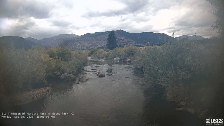 Big Thompson bl Moraine Park nr Estes Park14 km from the summit
 Colorado River below Baker Gulch nr Grand Lake19 km from the summit
Towns near Mount Alice
- Grand Lake14 km away
- Granby29 km away
- Lyons34 km away
- Fraser37 km away
- Winter Park41 km away
- Boulder42 km away