Mountains in Japan
Mount Azuma-kofuji
1,707 m5,600 ft
Volcano · Japan
Mount Azuma-kofuji (吾妻小富士) is an active stratovolcano in Fukushima prefecture, Japan.
From Wikipedia, CC BY-SA · Read the article
At the summit · forecast for 2:00 PM
-1 °CLight snow · wind 28 km/h from the W
 See it in 3D
Weather at the summit of Mount Azuma-kofuji, 1,707 m
- 2:00 PM-1 °CW 28 km/h0.3 mm
- 5:00 PM-4 °CW 24 km/h–
- 8:00 PM-4 °CW 20 km/h–
- 11:00 PM-4 °CW 17 km/h–
- 2:00 AM-4 °CW 14 km/h–
- 5:00 AM-4 °CW 10 km/h–
- 8:00 AM-1 °CSW 3 km/h–
- 11:00 AM4 °CS 12 km/h–
| Day | Sky | High / low | Rain | Wind up to |
|---|---|---|---|---|
| Thu, Oct 29 | Mostly clear | 5 °C / -5 °C | – | 17 km/h |
| Fri, Oct 30 | Cloudy | 12 °C / 3 °C | 0.6 mm | 9 km/h |
| Sat, Oct 31 | Sleet | 5 °C / -0 °C | 6.7 mm | 21 km/h |
| Sun, Nov 1 | Cloudy | 1 °C / -3 °C | 1.5 mm | 14 km/h |
| Mon, Nov 2 | Rain | 5 °C / 1 °C | 3.8 mm | 10 km/h |
| Tue, Nov 3 | Light snow | 3 °C / -1 °C | 3 mm | 17 km/h |
| Wed, Nov 4 | Cloudy | 2 °C / -4 °C | 0.4 mm | 13 km/h |
Forecast by MET Norway (CC BY 4.0), updated 10:17 AM GMT+9. Times are local.
Facts
- What it is
- Volcano
- Height above sea level
- 1,707 m (5,600 ft)
- Country
- Japan
- Coordinates
- 37.730°N 140.250°E
- Volcano number
- 283180 at the Global Volcanism Program
- Source
- Wikidata, CC0
24 recorded eruptions
- Eruption in 1977
- Eruption in 1966
- Eruption in 1952
- Eruption in 1950
- Eruption in 1914
- Eruption in 1896
- Eruption in 1895
- Eruption in 1894
- Eruption in 1893
- Eruption in 1893
- Eruption in 1844
- Eruption in 1800
The latest 12 of 24, from the Smithsonian’s Global Volcanism Program through History.
Peaks near Mount Azuma-kofuji
- Mount Issaikyō1,949 m · 0.8 km awayOn the map
- Mount Higashiazuma1,975 m · 2.7 km awayOn the map
- Mount Nakaazuma1,931 m · 5.9 km awayOn the map
- Mount Azuma2,035 m · 9.7 km awayOn the map
- Mount Nishiazuma2,035 m · 9.7 km awayOn the map
- Mount Adatara1,728 m · 11 km awayOn the map
- Mount Shinobu275 m · 20 km awayOn the map
- Mount Bandai1,819 m · 21 km awayOn the map
- Mount Nekomagadake1,404 m · 24 km awayOn the map
- Mount Iimori314 m · 36 km awayOn the map
Highest mountains in Japan
- Mount Fuji3,777 mOn the map
- Mount Kita3,193 mOn the map
- Hotaka Mountains3,190 mOn the map
- Ainodake3,189 mOn the map
- Mount Yari3,180 mOn the map
- Mount Warusawa3,141 mOn the map
- Mount Akaishi3,120 mOn the map
- Mount Ontake3,067 mOn the map
- Mount Shiomi3,047 mOn the map
- Mount Senjō3,033 mOn the map
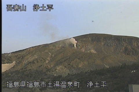
Webcams near Mount Azuma-kofuji

History around Mount Azuma-kofuji
- Fukushima Incident1882
- Battle of Bonari Pass1868
- 庭坂事件1948
- Battle of Ishinazaka1189
Towns near Mount Azuma-kofuji
- Fukushima19 km away
- Nihommatsu23 km away
- Yonezawa23 km away
- Date24 km away
- Motomiya27 km away
- Hobaramachi28 km away