Mountains in United States
Mount Conness
12,649 ft3,855 m
Mountain · Sierra Nevada · United States
Mount Conness is a 12,590 foot (3,840 m) mountain in the Sierra Nevada range, to the west of the Hall Natural Area. Conness is on the boundary between the Inyo National Forest and Yosemite National Park. The Conness Glacier lies north of the summit.
From Wikipedia, CC BY-SA · Read the article
At the summit · forecast for 4:00 PM
31 °FClear · wind 13 mph from the SW
 See it in 3D
Weather at the summit of Mount Conness, 12,649 ft
- 4:00 PM31 °FSW 13 mph–
- 7:00 PM20 °FSW 6 mph–
- 10:00 PM20 °FSW 6 mph–
- 1:00 AM21 °FSW 6 mph–
- 4:00 AM21 °FSW 7 mph–
- 7:00 AM20 °FSW 8 mph–
- 10:00 AM32 °FSW 10 mph–
- 1:00 PM35 °FSW 15 mph–
| Day | Sky | High / low | Rain | Wind up to |
|---|---|---|---|---|
| Tue, Oct 27 | Clear | 35 °F / 17 °F | – | 16 mph |
| Wed, Oct 28 | Mostly clear | 37 °F / 18 °F | – | 9 mph |
| Thu, Oct 29 | Cloudy | 33 °F / 19 °F | 0.08 in | 8 mph |
| Fri, Oct 30 | Cloudy | 20 °F / 11 °F | 0.14 in | 9 mph |
| Sat, Oct 31 | Light snow | 19 °F / 13 °F | 0.04 in | 12 mph |
| Sun, Nov 1 | Clear | 14 °F / 11 °F | 0.02 in | 6 mph |
| Mon, Nov 2 | Clear | 33 °F / 14 °F | – | 3 mph |
Forecast by MET Norway (CC BY 4.0), updated 12:17 PM PDT. Times are local.
Facts
- What it is
- Mountain
- Height above sea level
- 12,649 ft (3,855 m)
- Range
- Sierra Nevada
- Parent peak
- Mount Dana
- Country
- United States
- Coordinates
- 37.967°N 119.321°W
- Source
- Wikidata, CC0
Peaks near Mount Conness
- North Peak12,248 ft · 1.8 km awayOn the map
- Excelsior Mountain12,438 ft · 6.6 km awayOn the map
- Tioga Peak11,526 ft · 6.8 km awayOn the map
- Lembert Dome9,455 ft · 9.7 km awayOn the map
- Mount Dana13,061 ft · 12 km awayOn the map
- Doda Dome8,907 ft · 13 km awayOn the map
- Daff Dome9,158 ft · 13 km awayOn the map
- Fairview Dome9,728 ft · 13 km awayOn the map
- Twin Peaks12,293 ft · 13 km awayOn the map
- Whorl Mountain12,034 ft · 13 km awayOn the map
Parent peak
The nearest higher peak its prominence is measured to.
- Mount Dana13,061 ftOn the map
Highest in the Sierra Nevada
- Mount Whitney14,505 ftOn the map
- Mount Williamson14,403 ftOn the map
- Mount Russell14,094 ftOn the map
- Mount Langley14,032 ftOn the map
- Mount Tyndall14,025 ftOn the map
- Mount Humphreys13,992 ftOn the map
- Mount Keith13,982 ftOn the map
- Mount LeConte13,936 ftOn the map
- Mount Conness12,649 ftOn the map
Highest mountains in United States
- Denali20,308 ftOn the map
- Mount Saint Elias18,009 ftOn the map
- Mount Foraker17,402 ftOn the map
- Mount Bona16,535 ftOn the map
- Mount Blackburn16,390 ftOn the map
- Mount Sanford16,237 ftOn the map
- Mount Vancouver15,787 ftOn the map
- Mount Churchill15,636 ftOn the map
- Mount Fairweather15,325 ftOn the map
- Mount Hubbard14,951 ftOn the map
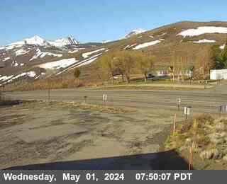
Webcams near Mount Conness

Towns near Mount Conness
- Mammoth Lakes48 km away