Mountains in United States
Mount Defiance
Mountain · Oregon Cascades · United States
Mount Defiance is a peak near the Columbia River Gorge in the US state of Oregon. It rises to an elevation of 5,010 feet (1,527 m) in the Mount Hood National Forest in Hood River County, Oregon. The northern and western flanks of the mountain are in the Mark O. Hatfield Wilderness.
From Wikipedia, CC BY-SA · Read the article
At the summit · forecast for 5:00 PM
36 °FSleet · wind 7 mph from the W
 See it in 3D
Mount Defiance weather forecast
- 5:00 PM36 °FW 7 mph0.06 in
- 8:00 PM33 °FW 4 mph0.05 in
- 11:00 PM31 °FN 2 mph0 in
- 2:00 AM30 °FN 2 mph0.02 in
- 5:00 AM29 °FNE 2 mph–
- 8:00 AM28 °FE 3 mph–
- 11:00 AM34 °FE 4 mph–
- 2:00 PM39 °FE 5 mph–
| Day | Sky | High / low | Rain | Wind up to |
|---|---|---|---|---|
| Thu, Oct 29 | Cloudy | 39 °F / 28 °F | 0.03 in | 6 mph |
| Fri, Oct 30 | Sleet | 39 °F / 29 °F | 0.22 in | 5 mph |
| Sat, Oct 31 | Partly cloudy | 38 °F / 28 °F | 0.06 in | 3 mph |
| Sun, Nov 1 | Cloudy | 39 °F / 28 °F | – | 8 mph |
| Mon, Nov 2 | Cloudy | 39 °F / 27 °F | – | 5 mph |
| Tue, Nov 3 | Partly cloudy | 41 °F / 29 °F | – | 4 mph |
| Wed, Nov 4 | Cloudy | 40 °F / 27 °F | – | 7 mph |
Forecast by MET Norway (CC BY 4.0), updated 12:18 PM PDT. Times are local.
Facts
- What it is
- Mountain
- Range
- Oregon Cascades
- Country
- United States
- Coordinates
- 45.648°N 121.722°W
- Source
- Wikidata, CC0
Peaks near Mount Defiance
- Dog Mountain2,948 ft · 7.8 km awayOn the map
- Greenleaf Peak3,422 ft · 20 km awayOn the map
- Table Mountain3,417 ft · 21 km awayOn the map
- Mount Hood11,237 ft · 31 km awayOn the map
- Larch Mountain4,061 ft · 31 km awayOn the map
- Indian Heaven5,925 ft · 33 km awayOn the map
- Lookout Mountain6,536 ft · 37 km awayOn the map
- Lemei Rock5,925 ft · 41 km awayOn the map
- Silver Star Mountain4,364 ft · 42 km awayOn the map
- Lone Butte4,760 ft · 46 km awayOn the map
Highest in the Oregon Cascades
- Mount Hood11,237 ftOn the map
- Mount Jefferson10,495 ftOn the map
- Three Sisters10,364 ftOn the map
- Mount Bachelor9,068 ftOn the map
- Mount Scott8,930 ftOn the map
- Diamond Peak8,748 ftOn the map
- Newberry Volcano7,986 ftOn the map
- Three Fingered Jack7,844 ftOn the map
Highest mountains in United States
- Denali20,308 ftOn the map
- Mount Saint Elias18,009 ftOn the map
- Mount Foraker17,402 ftOn the map
- Mount Bona16,535 ftOn the map
- Mount Blackburn16,390 ftOn the map
- Mount Sanford16,237 ftOn the map
- Mount Vancouver15,787 ftOn the map
- Mount Churchill15,636 ftOn the map
- Mount Fairweather15,325 ftOn the map
- Mount Hubbard14,951 ftOn the map
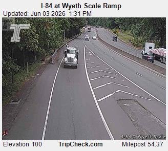
Webcams near Mount Defiance

History around Mount Defiance
- Tunnel 5 Fire2023
Towns near Mount Defiance
- Stevenson14 km away
- The Dalles43 km away
- Washougal50 km away
- Camas53 km away
- Troutdale53 km away
- Wood Village56 km away