Mountains in United States
Mount Independence
305 ft93 m
Mountain · Adirondack Mountains · United States
Mount Independence on Lake Champlain in Orwell, Vermont, was the site of extensive fortifications built during the American Revolutionary War by the American army to stop a British invasion. Construction began in July 1776, following the American defeat in Canada, and continued through the winter and spring of 1777.
From Wikipedia, CC BY-SA · Read the article
At the summit · forecast for 3:00 PM
46 °FClear · wind 7 mph from the NE
 See it in 3D
Weather at the summit of Mount Independence, 305 ft
- 3:00 PM46 °FNE 7 mph–
- 6:00 PM40 °FN 4 mph–
- 9:00 PM37 °FNW 4 mph–
- 12:00 AM36 °FNW 4 mph–
- 3:00 AM35 °FNW 3 mph–
- 6:00 AM35 °FW 1 mph–
- 9:00 AM39 °FSW 3 mph–
- 12:00 PM46 °FS 7 mph–
| Day | Sky | High / low | Rain | Wind up to |
|---|---|---|---|---|
| Wed, Oct 28 | Partly cloudy | 52 °F / 35 °F | – | 7 mph |
| Thu, Oct 29 | Clear | 62 °F / 41 °F | 0.05 in | 14 mph |
| Fri, Oct 30 | Mostly clear | 56 °F / 46 °F | 0.07 in | 12 mph |
| Sat, Oct 31 | Cloudy | 50 °F / 41 °F | – | 6 mph |
| Sun, Nov 1 | Clear | 56 °F / 35 °F | – | 7 mph |
| Mon, Nov 2 | Cloudy | 63 °F / 38 °F | – | 7 mph |
| Tue, Nov 3 | Rain | 52 °F / 43 °F | 0.15 in | 7 mph |
Forecast by MET Norway (CC BY 4.0), updated 01:17 PM EDT. Times are local.
Facts
- What it is
- Mountain
- Height above sea level
- 305 ft (93 m)
- Range
- Adirondack Mountains
- Country
- United States
- Coordinates
- 43.826°N 73.380°W
- Source
- Wikidata, CC0
Peaks near Mount Independence
- Snake Mountain1,283 ft · 27 km awayOn the map
- Grace Peak4,026 ft · 40 km awayOn the map
- Macomb Mountain4,405 ft · 41 km awayOn the map
- South Dix4,075 ft · 41 km awayOn the map
- Mount Wilson3,763 ft · 41 km awayOn the map
- Hough Peak4,409 ft · 42 km awayOn the map
- Dix Mountain4,840 ft · 43 km awayOn the map
- Mount Grant3,625 ft · 44 km awayOn the map
- Rocky Peak Ridge4,420 ft · 45 km awayOn the map
- Nippletop4,610 ft · 46 km awayOn the map
Highest in the Adirondack Mountains
- Mount Marcy5,344 ftOn the map
- Whiteface Mountain4,867 ftOn the map
- Giant Mountain4,627 ftOn the map
- Table Top Mountain4,427 ftOn the map
- Big Slide Mountain4,240 ftOn the map
- Cascade Mountain4,098 ftOn the map
- Snowy Mountain3,899 ftOn the map
- Lyon Mountain3,839 ftOn the map
- Mount Independence305 ftOn the map
Highest mountains in United States
- Denali20,308 ftOn the map
- Mount Saint Elias18,009 ftOn the map
- Mount Foraker17,402 ftOn the map
- Mount Bona16,535 ftOn the map
- Mount Blackburn16,390 ftOn the map
- Mount Sanford16,237 ftOn the map
- Mount Vancouver15,787 ftOn the map
- Mount Churchill15,636 ftOn the map
- Mount Fairweather15,325 ftOn the map
- Mount Hubbard14,951 ftOn the map
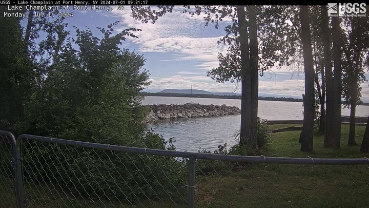
Webcams near Mount Independence

History around Mount Independence
Towns near Mount Independence
- Rutland41 km away
- Queensbury53 km away
- Glens Falls61 km away
- South Burlington73 km away
- Burlington73 km away
- Wilton78 km away