Facts
- What it is
- Mountain
- Height above sea level
- 9,148 ft (2,788 m)
- Prominence
- 2,068 ft (630 m)
- Range
- Sierra Nevada
- Country
- United States
- Coordinates
- 39.433°N 120.365°W
- Source
- Wikidata, CC0
Peaks near Mount Lola
- Castle Peak9,109 ft · 7.6 km awayOn the map
- Donner Peak8,019 ft · 15 km awayOn the map
- Tinker Knob8,950 ft · 22 km awayOn the map
- Schroeder Mountain6,942 ft · 26 km awayOn the map
- Granite Chief9,006 ft · 27 km awayOn the map
- Crystal Peak8,107 ft · 27 km awayOn the map
- Mount Pluto, California8,617 ft · 29 km awayOn the map
- Sierra Buttes8,589 ft · 30 km awayOn the map
- Mount Ina Coolbrith8,064 ft · 35 km awayOn the map
- Mount Baldy9,275 ft · 36 km awayOn the map
Highest in the Sierra Nevada
- Mount Whitney14,505 ftOn the map
- Mount Williamson14,403 ftOn the map
- Mount Russell14,094 ftOn the map
- Mount Langley14,032 ftOn the map
- Mount Tyndall14,025 ftOn the map
- Mount Humphreys13,992 ftOn the map
- Mount Keith13,982 ftOn the map
- Mount LeConte13,936 ftOn the map
- Mount Lola9,148 ftOn the map
Highest mountains in United States
- Denali20,308 ftOn the map
- Mount Saint Elias18,009 ftOn the map
- Mount Foraker17,402 ftOn the map
- Mount Bona16,535 ftOn the map
- Mount Blackburn16,390 ftOn the map
- Mount Sanford16,237 ftOn the map
- Mount Vancouver15,787 ftOn the map
- Mount Churchill15,636 ftOn the map
- Mount Fairweather15,325 ftOn the map
- Mount Hubbard14,951 ftOn the map
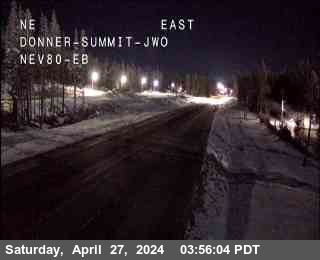
Webcams near Mount Lola


Towns near Mount Lola
- Truckee20 km away
- Reno49 km away
- Sun Valley54 km away
- Sparks54 km away
- Carson City60 km away
- Nevada City61 km away