Mount Lougheed
3,107 m10,194 ft
Mountain · Canadian Rockies · Canada
Mount Lougheed is a 3,107-metre (10,194-foot) triple-peak mountain located between Spray Lakes Reservoir and the Wind Valley of Kananaskis Country in the Canadian Rockies of Alberta, Canada. The highest summit is known as Peak 2. Peak 1 to the northwest is 3,080 metres. Peak 3 to the southeast is 3,010 metres.
From Wikipedia, CC BY-SA · Read the article
At the summit · forecast for 3:00 AM
-12 °CCloudy · wind 6 km/h from the SW
 See it in 3D
Weather at the summit of Mount Lougheed, 3,107 m
- 3:00 AM-12 °CSW 6 km/h–
- 6:00 AM-12 °CSW 6 km/h–
- 9:00 AM-12 °CSW 6 km/h0.2 mm
- 12:00 PM-7 °CW 7 km/h0.4 mm
- 3:00 PM-6 °CSW 8 km/h1.1 mm
- 6:00 PM-8 °CSW 6 km/h0.3 mm
- 9:00 PM-9 °CSW 6 km/h–
- 12:00 AM-10 °CSW 5 km/h–
| Day | Sky | High / low | Rain | Wind up to |
|---|---|---|---|---|
| Today | Light snow | -6 °C / -12 °C | 2 mm | 8 km/h |
| Wed, Oct 28 | Light snow | -10 °C / -15 °C | 4.1 mm | 8 km/h |
| Thu, Oct 29 | Cloudy | -14 °C / -17 °C | 0.6 mm | 5 km/h |
| Fri, Oct 30 | Clear | -9 °C / -21 °C | 0.2 mm | 3 km/h |
| Sat, Oct 31 | Partly cloudy | -10 °C / -18 °C | – | 6 km/h |
| Sun, Nov 1 | Cloudy | -9 °C / -21 °C | 2.3 mm | 5 km/h |
| Mon, Nov 2 | Clear | -10 °C / -21 °C | – | 7 km/h |
Forecast by MET Norway (CC BY 4.0), updated 07:17 PM MDT. Times are local.
Facts
- What it is
- Mountain
- Height above sea level
- 3,107 m (10,194 ft)
- Range
- Canadian Rockies
- Country
- Canada
- Coordinates
- 50.966°N 115.263°W
- Source
- Wikidata, CC0
Mount Lougheed
Mountain in Alberta, Canada
Mount Lougheed is a 3,107-metre (10,194-foot) triple-peak mountain located between Spray Lakes Reservoir and the Wind Valley of Kananaskis Country in the Canadian Rockies of Alberta, Canada. The highest summit is known as Peak 2. Peak 1 to the northwest is 3,080 metres. Peak 3 to the southeast is 3,010 metres. The nearest higher peak is Wind Mountain, 2.0 km (1.2 mi) to the southeast.
From Wikipedia, CC BY-SA · Read the article
Peaks near Mount Lougheed
- Pigeon Mountain2,394 m · 8 km awayOn the map
- The Three Sisters2,936 m · 8.1 km awayOn the map
- Mount Nestor2,970 m · 8.3 km awayOn the map
- Mount Buller2,805 m · 9.1 km awayOn the map
- Skogan Peak2,662 m · 9.2 km awayOn the map
- Mount McGillivray2,451 m · 9.8 km awayOn the map
- Heart Mountain2,135 m · 12 km awayOn the map
- Mount Galatea3,185 m · 14 km awayOn the map
- The Fortress3,000 m · 15 km awayOn the map
- Mount Lady Macdonald2,606 m · 18 km awayOn the map
Highest in the Canadian Rockies
- Mount Saskatchewan3,342 mOn the map
- Blackfriars Peak3,215 mOn the map
- Nigel Peak3,211 mOn the map
- Mount Bess3,203 mOn the map
- Cathedral Mountain3,189 mOn the map
- The Marshall3,180 mOn the map
- Brussels Peak3,161 mOn the map
- Mount Sarbach3,155 mOn the map
- Mount Lougheed3,107 mOn the map
Highest mountains in Canada
- Mount Logan5,959 mOn the map
- Mount Saint Elias18,009 ftOn the map
- Mount Lucania5,240 mOn the map
- King Peak5,173 mOn the map
- Mount Steele5,073 mOn the map
- Mount Wood4,850 mOn the map
- Mount Vancouver15,787 ftOn the map
- Mount Slaggard4,742 mOn the map
- Mount Macaulay4,700 mOn the map
- Mount Fairweather15,325 ftOn the map
Webcams near Mount Lougheed
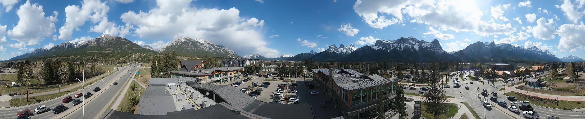
Towns near Mount Lougheed
- Cochrane61 km away