Mountains in United States
Mount Sylvania
978 ft298 m
Mountain · Tualatin Mountains · United States
Mount Sylvania is an extinct volcano, part of the Boring Lava Field, on the outskirts of Portland, Oregon. Parts of the mountain are within the cities of Portland, Lake Oswego, and Tigard.
From Wikipedia, CC BY-SA · Read the article
At the summit · forecast for 4:00 PM
51 °FRain · wind 14 mph from the S
 See it in 3D
Weather at the summit of Mount Sylvania, 978 ft
- 4:00 PM51 °FS 14 mph0.06 in
- 7:00 PM49 °FS 11 mph0.06 in
- 10:00 PM47 °FS 10 mph–
- 1:00 AM46 °FSW 9 mph0.09 in
- 4:00 AM46 °FS 9 mph0.12 in
- 7:00 AM46 °FSW 7 mph0.05 in
- 10:00 AM48 °FSW 6 mph–
- 1:00 PM52 °FSW 6 mph0.06 in
| Day | Sky | High / low | Rain | Wind up to |
|---|---|---|---|---|
| Tue, Oct 27 | Cloudy | 53 °F / 45 °F | 0.33 in | 12 mph |
| Wed, Oct 28 | Light rain | 53 °F / 42 °F | 0.31 in | 16 mph |
| Thu, Oct 29 | Rain | 47 °F / 38 °F | 0.15 in | 6 mph |
| Fri, Oct 30 | Rain | 47 °F / 37 °F | 0.14 in | 5 mph |
| Sat, Oct 31 | Partly cloudy | 46 °F / 35 °F | 0.08 in | 3 mph |
| Sun, Nov 1 | Cloudy | 47 °F / 36 °F | – | 3 mph |
| Mon, Nov 2 | Cloudy | 53 °F / 35 °F | – | 4 mph |
Forecast by MET Norway (CC BY 4.0), updated 12:16 PM PDT. Times are local.
Facts
- What it is
- Mountain
- Height above sea level
- 978 ft (298 m)
- Range
- Tualatin Mountains
- Country
- United States
- Coordinates
- 45.438°N 122.722°W
- Source
- Wikidata, CC0
Peaks near Mount Sylvania
- Cooper Mountain764 ft · 12 km awayOn the map
- Mount Scott1,091 ft · 13 km awayOn the map
- Rocky Butte612 ft · 17 km awayOn the map
- Powell Butte614 ft · 18 km awayOn the map
- Elkhorn Mountain2,225 ft · 43 km awayOn the map
- Amity Hills791 ft · 49 km awayOn the map
- Larch Mountain4,061 ft · 50 km awayOn the map
- Silver Star Mountain4,364 ft · 51 km awayOn the map
- South Saddle Mountain3,465 ft · 52 km awayOn the map
- Round Top2,983 ft · 57 km awayOn the map
Highest mountains in United States
- Denali20,308 ftOn the map
- Mount Saint Elias18,009 ftOn the map
- Mount Foraker17,402 ftOn the map
- Mount Bona16,535 ftOn the map
- Mount Blackburn16,390 ftOn the map
- Mount Sanford16,237 ftOn the map
- Mount Vancouver15,787 ftOn the map
- Mount Churchill15,636 ftOn the map
- Mount Fairweather15,325 ftOn the map
- Mount Hubbard14,951 ftOn the map
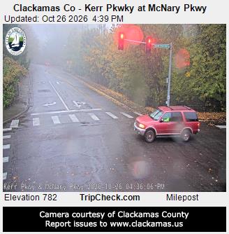
Webcams near Mount Sylvania


History around Mount Sylvania
- Alaska Airlines Flight 1282 on 5 January 20242024
- murder of Mulugeta Seraw1988
- United Airlines Flight 1731978
- 2026 Portland shooting2026
- 2024 Portland State University pro-Palestinian campus occupation2024
- Normandale Park shooting2022
- George Floyd protests in Portland, Oregon2020
- End Domestic Terrorism rally2019