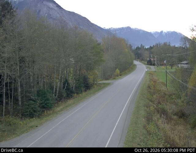
Nusatsum Mountain
2,575 m8,448 ft
Mountain · Canada
Nusq’lst Mountain is a mountain in the Pacific Ranges of the Coast Mountains of British Columbia, Canada, located near the Nusatsum River and south of and between the communities of Firvale and Hagensborg.
From Wikipedia, CC BY-SA · Read the article
At the summit · forecast for 2:00 PM
-9 °CLight snow · wind 4 km/h from the NW
 See it in 3D
Weather at the summit of Nusatsum Mountain, 2,575 m
- 2:00 PM-9 °CNW 4 km/h0.2 mm
- 5:00 PM-10 °CNW 4 km/h–
- 8:00 PM-11 °CSE 3 km/h0.8 mm
- 11:00 PM-11 °CNE 6 km/h0.2 mm
- 2:00 AM-11 °CNE 7 km/h–
- 5:00 AM-12 °CNE 7 km/h–
- 8:00 AM-13 °CNE 8 km/h0.3 mm
- 11:00 AM-11 °CNE 11 km/h–
| Day | Sky | High / low | Rain | Wind up to |
|---|---|---|---|---|
| Wed, Oct 28 | Cloudy | -9 °C / -14 °C | 0.4 mm | 13 km/h |
| Thu, Oct 29 | Partly cloudy | -9 °C / -17 °C | – | 8 km/h |
| Fri, Oct 30 | Partly cloudy | -10 °C / -19 °C | – | 5 km/h |
| Sat, Oct 31 | Cloudy | -8 °C / -17 °C | – | 2 km/h |
| Sun, Nov 1 | Partly cloudy | -8 °C / -22 °C | 4.4 mm | 3 km/h |
| Mon, Nov 2 | Heavy snow | -8 °C / -10 °C | 32.8 mm | 2 km/h |
| Tue, Nov 3 | Partly cloudy | -6 °C / -16 °C | 0.1 mm | 4 km/h |
Forecast by MET Norway (CC BY 4.0), updated 10:17 AM PDT. Times are local.
Facts
- What it is
- Mountain
- Height above sea level
- 2,575 m (8,448 ft)
- Country
- Canada
- Coordinates
- 52.397°N 126.378°W
- Source
- Wikidata, CC0
Nusatsum Mountain
Mountain in British Columbia, Canada
Nusq’lst Mountain is a mountain in the Pacific Ranges of the Coast Mountains of British Columbia, Canada, located near the Nusatsum River and south of and between the communities of Firvale and Hagensborg. The peak can be seen from Highway 20. The mountain is the equivalent of Mount Ararat in the traditions of the Nuxalk, as the place where survivors found refuge from the Great Flood.
From Wikipedia, CC BY-SA · Read the article
Peaks near Nusatsum Mountain
- Defiance Mountain2,659 m · 5.4 km awayOn the map
- Salloomt Peak1,873 m · 7.4 km awayOn the map
- Mount Saugstad2,908 m · 18 km awayOn the map
- Noohalk Mountain2,099 m · 18 km awayOn the map
- Luna Peak2,470 m · 29 km awayOn the map
- Mount Mackenzie2,143 m · 31 km awayOn the map
- Anahim Volcanic Belt2,410 m · 48 km awayOn the map
- Tsitsutl Peak2,495 m · 54 km awayOn the map
- Stupendous MountainMountain · 12 km awayOn the map
- Big Snow MountainMountain · 27 km awayOn the map
Highest mountains in Canada
- Mount Logan5,959 mOn the map
- Mount Saint Elias18,009 ftOn the map
- Mount Lucania5,240 mOn the map
- King Peak5,173 mOn the map
- Mount Steele5,073 mOn the map
- Mount Wood4,850 mOn the map
- Mount Vancouver15,787 ftOn the map
- Mount Slaggard4,742 mOn the map
- Mount Macaulay4,700 mOn the map
- Mount Fairweather15,325 ftOn the map