Obstruction Peak
6,450 ft1,966 m
Mountain · Olympic Mountains · United States
Obstruction Peak is a 6,450-foot-elevation (1,966-meter) summit in the Olympic Mountains and is located in Clallam County of Washington state. It is set within Olympic National Park and is situated at the eastern end of Obstruction Point Road which is a narrow eight-mile dirt road on Hurricane Ridge.
From Wikipedia, CC BY-SA · Read the article
At the summit · forecast for 4:00 PM
33 °FSnow · wind 3 mph from the N
 See it in 3D
Weather at the summit of Obstruction Peak, 6,450 ft
- 4:00 PM33 °FN 3 mph0.01 in
- 7:00 PM31 °FN 1 mph–
- 10:00 PM29 °FS 1 mph–
- 1:00 AM28 °FS 1 mph–
- 4:00 AM27 °FSW 2 mph–
- 7:00 AM26 °FS 2 mph–
- 10:00 AM30 °FSW 3 mph–
- 1:00 PM33 °FSW 6 mph0.01 in
| Day | Sky | High / low | Rain | Wind up to |
|---|---|---|---|---|
| Tue, Oct 27 | Light snow | 34 °F / 24 °F | 0.06 in | 7 mph |
| Wed, Oct 28 | Mostly clear | 30 °F / 19 °F | 0.05 in | 6 mph |
| Thu, Oct 29 | Light snow | 26 °F / 17 °F | 0.03 in | 5 mph |
| Fri, Oct 30 | Light snow | 27 °F / 17 °F | 0.03 in | 3 mph |
| Sat, Oct 31 | Light snow | 28 °F / 16 °F | 0.03 in | 2 mph |
| Sun, Nov 1 | Cloudy | 29 °F / 15 °F | – | 4 mph |
| Mon, Nov 2 | Cloudy | 39 °F / 26 °F | – | 4 mph |
Forecast by MET Norway (CC BY 4.0), updated 12:16 PM PDT. Times are local.
Facts
- What it is
- Mountain
- Height above sea level
- 6,450 ft (1,966 m)
- Range
- Olympic Mountains
- Country
- United States
- Coordinates
- 47.922°N 123.382°W
- Source
- Wikidata, CC0
Obstruction Peak
Mountain in Washington (state), United States
Obstruction Peak is a 6,450-foot-elevation (1,966-meter) summit in the Olympic Mountains and is located in Clallam County of Washington state. It is set within Olympic National Park and is situated at the eastern end of Obstruction Point Road which is a narrow eight-mile dirt road on Hurricane Ridge. The road ends below the south slope of Obstruction Peak, and a short hike leads to the summit.
From Wikipedia, CC BY-SA · Read the article
Peaks near Obstruction Peak
- Mount Angeles6,454 ft · 10 km awayOn the map
- Mount Cameron7,192 ft · 11 km awayOn the map
- Lost Peak6,516 ft · 13 km awayOn the map
- Mount Claywood6,837 ft · 14 km awayOn the map
- Mount Fromme6,706 ft · 14 km awayOn the map
- Mount Clark7,530 ft · 15 km awayOn the map
- Sentinel Peak6,591 ft · 16 km awayOn the map
- Mount Deception7,788 ft · 16 km awayOn the map
- Mount Dana6,213 ft · 16 km awayOn the map
- Mount Norton6,319 ft · 18 km awayOn the map
Highest in the Olympic Mountains
- Mount Olympus7,979 ftOn the map
- Mount Deception7,788 ftOn the map
- Mount Constance7,756 ftOn the map
- Gray Wolf Ridge7,218 ftOn the map
- Mount Cameron7,192 ftOn the map
- Mount Mathias7,146 ftOn the map
- Mount Carrie6,995 ftOn the map
- Buckhorn Mountain6,988 ftOn the map
- Obstruction Peak6,450 ftOn the map
Highest mountains in United States
- Denali20,308 ftOn the map
- Mount Saint Elias18,009 ftOn the map
- Mount Foraker17,402 ftOn the map
- Mount Bona16,535 ftOn the map
- Mount Blackburn16,390 ftOn the map
- Mount Sanford16,237 ftOn the map
- Mount Vancouver15,787 ftOn the map
- Mount Churchill15,636 ftOn the map
- Mount Fairweather15,325 ftOn the map
- Mount Hubbard14,951 ftOn the map
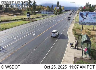
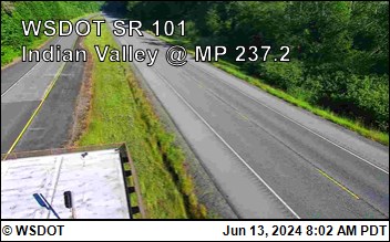
Webcams near Obstruction Peak


Towns near Obstruction Peak
- Port Angeles22 km away
- Sequim28 km away
- Port Townsend49 km away
- Sooke56 km away
- Esquimalt57 km away
- Victoria57 km away