Mountains in Czechia
Osser
1,293 m4,242 ft
Mountain · Kunisch Mountains · Czechia · Germany
The Osser is a mountain on the border between Germany and the Czech Republic, in the Bavarian Forest and Bohemian Forest and which belongs to the Kunisch Mountains.
From Wikipedia, CC BY-SA · Read the article
At the summit · forecast for 12:00 AM
-1 °CMostly clear · wind 10 km/h from the SE
 See it in 3D
Weather at the summit of Osser, 1,293 m
- 12:00 AM-1 °CSE 10 km/h–
- 3:00 AM-1 °CSE 10 km/h–
- 6:00 AM2 °CSE 10 km/h–
- 9:00 AM6 °CSE 10 km/h–
- 12:00 PM10 °CSW 7 km/h–
- 3:00 PM10 °CS 8 km/h–
- 6:00 PM3 °CSE 10 km/h–
- 9:00 PM2 °CSE 10 km/h–
| Day | Sky | High / low | Rain | Wind up to |
|---|---|---|---|---|
| Tue, Oct 27 | Clear | 11 °C / -1 °C | – | 11 km/h |
| Wed, Oct 28 | Heavy rain | 7 °C / 2 °C | 7.8 mm | 13 km/h |
| Thu, Oct 29 | Partly cloudy | 6 °C / -1 °C | – | 9 km/h |
| Fri, Oct 30 | Clear | 6 °C / -1 °C | – | 8 km/h |
| Sat, Oct 31 | Cloudy | 5 °C / -1 °C | 0.3 mm | 9 km/h |
| Sun, Nov 1 | Cloudy | 3 °C / -4 °C | – | 5 km/h |
| Mon, Nov 2 | Cloudy | 1 °C / -3 °C | 0.3 mm | 6 km/h |
Forecast by MET Norway (CC BY 4.0), updated 08:16 PM GMT+1. Times are local.
Facts
- What it is
- Mountain
- Height above sea level
- 1,293 m (4,242 ft)
- Range
- Kunisch Mountains
- Coordinates
- 49.202°N 13.105°E
- Source
- Wikidata, CC0
Peaks near Osser
- Zwercheck1,334 m · 5.5 km awayOn the map
- Schwarzeck1,236 m · 6.9 km awayOn the map
- Hindenburgkanzel1,062 m · 7.2 km awayOn the map
- Ödriegel1,156 m · 7.5 km awayOn the map
- Mühlriegel1,080 m · 8.2 km awayOn the map
- Heugstatt1,262 m · 8.6 km awayOn the map
- Enzian1,285 m · 8.9 km awayOn the map
- Hochstein1,134 m · 9.2 km awayOn the map
- Kleiner Arber1,384 m · 9.9 km awayOn the map
- Großer Arber1,456 m · 10 km awayOn the map
Highest in the Kunisch Mountains
- Jezerní hora1,344 mOn the map
- Osser1,293 mOn the map
Highest mountains in Czechia
- Sněžka1,603 mOn the map
- Wielki Szyszak1,510 mOn the map
- Praděd1,491 mOn the map
- Smogornia1,490 mOn the map
- Mały Szyszak1,440 mOn the map
- Keprník1,423 mOn the map
- Králický Sněžník1,423 mOn the map
- Plechý / Plöckenstein1,379 mOn the map
- Bayerischer Plöckenstein1,362 mOn the map
- Boubín1,362 mOn the map
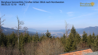
Webcams near Osser


History around Osser
- Battle of Nýrsk1467
Towns near Osser
- Klatovy26 km away
- Cham33 km away
- Deggendorf42 km away
- Straubing53 km away
- Strakonice58 km away
- Pilsen64 km away