Osterhorn
1,746 m5,728 ft
Mountain · Salzkammergut Mountains · Austria
Das Osterhorn ist ein 1748 m ü. A. hoher Gipfel der Salzkammergut-Berge in Österreich. Obwohl er nur der dritthöchste benannte Gipfel der Osterhorngruppe ist, trägt diese trotzdem seinen Namen.
From German Wikipedia, CC BY-SA · Read the article
At the summit · forecast for 12:00 AM
-5 °CClear · wind 7 km/h from the S
 See it in 3D
Weather at the summit of Osterhorn, 1,746 m
- 12:00 AM-5 °CS 7 km/h–
- 3:00 AM-6 °CS 8 km/h–
- 6:00 AM-2 °CS 7 km/h–
- 9:00 AM2 °CS 8 km/h–
- 12:00 PM9 °CS 5 km/h–
- 3:00 PM10 °CNE 5 km/h–
- 6:00 PM4 °CS 5 km/h–
- 9:00 PM1 °CS 6 km/h–
| Day | Sky | High / low | Rain | Wind up to |
|---|---|---|---|---|
| Tue, Oct 27 | Clear | 10 °C / -6 °C | – | 9 km/h |
| Wed, Oct 28 | Rain | 7 °C / -2 °C | 9.1 mm | 18 km/h |
| Thu, Oct 29 | Cloudy | 4 °C / -0 °C | 0.1 mm | 8 km/h |
| Fri, Oct 30 | Clear | 6 °C / -5 °C | – | 5 km/h |
| Sat, Oct 31 | Mostly clear | 3 °C / -5 °C | – | 9 km/h |
| Sun, Nov 1 | Partly cloudy | 2 °C / -7 °C | – | 6 km/h |
| Mon, Nov 2 | Cloudy | 0 °C / -5 °C | – | 7 km/h |
Forecast by MET Norway (CC BY 4.0), updated 08:16 PM GMT+1. Times are local.
Facts
- What it is
- Mountain
- Height above sea level
- 1,746 m (5,728 ft)
- Range
- Salzkammergut Mountains
- Country
- Austria
- Coordinates
- 47.673°N 13.363°E
- Source
- Wikidata, CC0
Osterhorn (Salzkammergut-Berge)
Berg in den Salzkammergut-Bergen in Salzburg
Das Osterhorn ist ein 1748 m ü. A. hoher Gipfel der Salzkammergut-Berge in Österreich. Obwohl er nur der dritthöchste benannte Gipfel der Osterhorngruppe ist, trägt diese trotzdem seinen Namen. Das Osterhorn befindet sich auf den Gemeindegebieten von Strobl und Abtenau, wobei das Gipfelkreuz genau auf der Grenzlinie steht.
From German Wikipedia, CC BY-SA · Read the article
Peaks near Osterhorn
- Gamsfeld2,027 m · 10 km awayOn the map
- Schafberg1,782 m · 13 km awayOn the map
- Raucheck2,430 m · 22 km awayOn the map
- Werfener Hochthron2,363 m · 22 km awayOn the map
- Bischofsmütze2,458 m · 23 km awayOn the map
- Gaisberg1,287 m · 24 km awayOn the map
- Hoher Göll2,522 m · 24 km awayOn the map
- Brunnkogel1,708 m · 26 km awayOn the map
- Kapuzinerberg636 m · 27 km awayOn the map
- Festungsberg542 m · 27 km awayOn the map
Highest in the Salzkammergut Mountains
- Gamsfeld2,027 mOn the map
- Braunedlkogel1,894 mOn the map
- Rinnkogel1,823 mOn the map
- Schafberg1,782 mOn the map
- Hoher Zinken1,764 mOn the map
- Osterhorn1,746 mOn the map
- Leonsberg1,745 mOn the map
- Schmittenstein1,695 mOn the map
- Schlenken1,648 mOn the map
Highest mountains in Austria
- Grossglockner3,798 mOn the map
- Wildspitze3,768 mOn the map
- Weißkugel3,738 mOn the map
- Großvenediger3,657 mOn the map
- Hintere Schwärze3,624 mOn the map
- Großes Wiesbachhorn3,564 mOn the map
- Ramolkogel3,549 mOn the map
- Schalfkogel3,537 mOn the map
- Watzespitze3,532 mOn the map
- Fineilspitze3,514 mOn the map
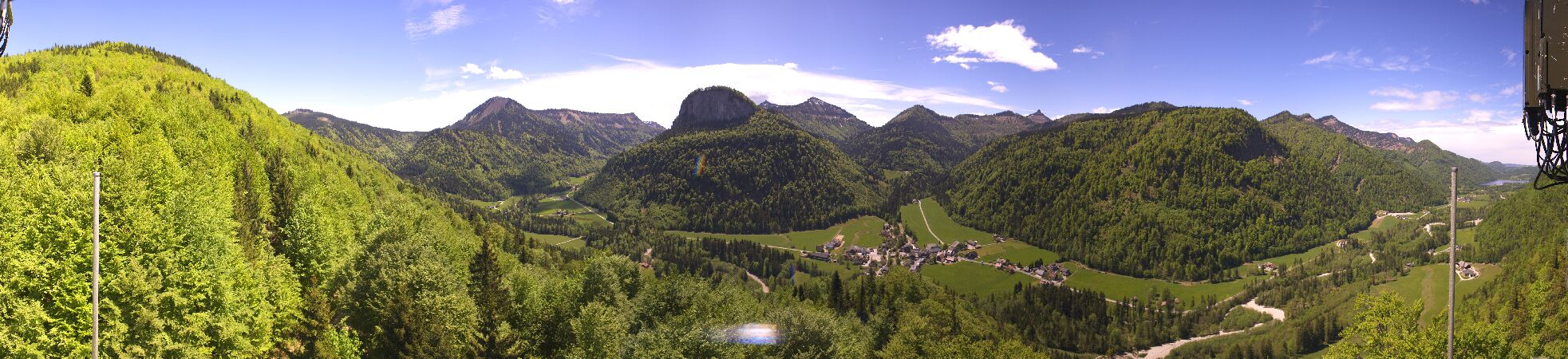
Webcams near Osterhorn



History around Osterhorn
Towns near Osterhorn
- Salzburg28 km away
- Freilassing34 km away
- Bad Reichenhall37 km away
- Saalfelden am Steinernen Meer47 km away
- Traunstein58 km away
- Traunreut66 km away