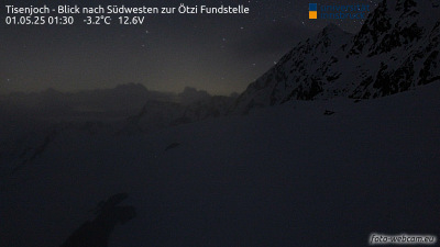
Mountains in Italy
Pfasserspitze
3,444 m11,299 ft
Mountain · Ötztal Alps · Italy · Austria
Die Pfasserspitze ist ein 3444 m hoher Berg im Schnalskamm in den Ötztaler Alpen. Sie liegt genau auf der Grenze zwischen der italienischen Provinz Südtirol und dem österreichischen Bundesland Tirol.
From German Wikipedia, CC BY-SA · Read the article
At the summit · forecast for 4:00 AM
-5 °CCloudy · wind 5 km/h from the NW
 See it in 3D
Weather at the summit of Pfasserspitze, 3,444 m
- 4:00 AM-5 °CNW 5 km/h–
- 7:00 AM-5 °CNW 5 km/h–
- 10:00 AM-2 °CNW 4 km/h–
- 1:00 PM-1 °CN 4 km/h–
- 4:00 PM-2 °CNW 5 km/h–
- 7:00 PM-6 °CNW 6 km/h–
- 10:00 PM-6 °CNW 6 km/h–
- 1:00 AM-7 °CNW 6 km/h–
| Day | Sky | High / low | Rain | Wind up to |
|---|---|---|---|---|
| Today | Clear | -1 °C / -6 °C | – | 6 km/h |
| Wed, Oct 28 | Partly cloudy | -4 °C / -9 °C | 0.2 mm | 6 km/h |
| Thu, Oct 29 | Mostly clear | -5 °C / -13 °C | – | 5 km/h |
| Fri, Oct 30 | Clear | -6 °C / -13 °C | – | 5 km/h |
| Sat, Oct 31 | Clear | -3 °C / -12 °C | – | 4 km/h |
| Sun, Nov 1 | Clear | -2 °C / -9 °C | – | 5 km/h |
| Mon, Nov 2 | Clear | -3 °C / -10 °C | – | 5 km/h |
Forecast by MET Norway (CC BY 4.0), updated 02:17 AM GMT+1. Times are local.
Facts
- What it is
- Mountain
- Height above sea level
- 3,444 m (11,299 ft)
- Isolation
- 0.5 km to higher ground
- Range
- Ötztal Alps
- Coordinates
- 46.773°N 10.927°E
- Source
- Wikidata, CC0
Peaks near Pfasserspitze
- Hintere Schwärze3,624 m · 0.9 km awayOn the map
- Similaun3,597 m · 3.7 km awayOn the map
- Fineilspitze3,514 m · 7.3 km awayOn the map
- Wildspitze3,768 m · 13 km awayOn the map
- Hinterer Brochkogel3,628 m · 14 km awayOn the map
- Schwemser Spitze3,459 m · 14 km awayOn the map
- Saldurspitze3,433 m · 15 km awayOn the map
- Weißkugel3,738 m · 16 km awayOn the map
- Äußerer Bärenbartkogel3,473 m · 18 km awayOn the map
- Weißseespitze3,498 m · 18 km awayOn the map
Highest in the Ötztal Alps
- Bliggspitze3,453 mOn the map
- Pfasserspitze3,444 mOn the map
- Verpeilspitze3,425 mOn the map
Highest mountains in Italy
- Mont Blanc4,806 mOn the map
- Lyskamm4,532 mOn the map
- Matterhorn4,478 mOn the map
- Pointe Walker4,208 mOn the map
- Grandes Jorasses4,208 mOn the map
- Dent d'Hérens4,173 mOn the map
- Breithorn4,160 mOn the map
- Pfasserspitze3,444 mOn the map