Mountains in United States
Punchbowl Crater
Mountain · Hawaiian–Emperor seamount chain · United States
At the summit · forecast for 12:00 PM
79 °FHeavy rain · wind 11 mph from the NE
 See it in 3D
Punchbowl Crater weather forecast
- 12:00 PM79 °FNE 11 mph0.09 in
- 3:00 PM76 °FNE 13 mph0.27 in
- 6:00 PM73 °FNE 15 mph0.39 in
- 9:00 PM73 °FNE 19 mph0.5 in
- 12:00 AM74 °FNE 20 mph1.76 in
- 3:00 AM74 °FNE 25 mph1.17 in
- 6:00 AM73 °FNE 20 mph–
- 9:00 AM74 °FNE 22 mph–
| Day | Sky | High / low | Rain | Wind up to |
|---|---|---|---|---|
| Today | Rain | 79 °F / 73 °F | 1.26 in | 21 mph |
| Wed, Oct 28 | Light rain | 78 °F / 72 °F | 3.05 in | 27 mph |
| Thu, Oct 29 | Cloudy | 80 °F / 74 °F | 0.01 in | 23 mph |
| Fri, Oct 30 | Cloudy | 80 °F / 75 °F | 0 in | 19 mph |
| Sat, Oct 31 | Partly cloudy | 80 °F / 74 °F | – | 11 mph |
| Sun, Nov 1 | Cloudy | 79 °F / 73 °F | 0.04 in | 13 mph |
| Mon, Nov 2 | Cloudy | 76 °F / 69 °F | 0.01 in | 19 mph |
Forecast by MET Norway (CC BY 4.0), updated 09:17 AM HST. Times are local.
Facts
- What it is
- Mountain
- Range
- Hawaiian–Emperor seamount chain
- Country
- United States
- Coordinates
- 21.313°N 157.846°W
- Source
- Wikidata, CC0
Peaks near Punchbowl Crater
- Tantalus2,014 ft · 3.9 km awayOn the map
- Diamond Head761 ft · 6.9 km awayOn the map
- Olomana1,643 ft · 11 km awayOn the map
- Koʻolau Range3,104 ft · 16 km awayOn the map
- Kaʻala4,026 ft · 38 km awayOn the map
- Āliamanu CraterVolcano · 8.6 km awayOn the map
- Puʻu HawaiʻiloaMountain · 18 km awayOn the map
- Mauna LahilahiMountain · 41 km awayOn the map
Highest in the Hawaiian–Emperor seamount chain
- Mauna Kea13,803 ftOn the map
- Mauna Loa13,679 ftOn the map
- Haleakalā10,023 ftOn the map
- Hualālai8,271 ftOn the map
- Kohala5,479 ftOn the map
- Kawaikini5,243 ftOn the map
- Mount Waialeale5,148 ftOn the map
- Kamakou4,961 ftOn the map
Highest mountains in United States
- Denali20,308 ftOn the map
- Mount Saint Elias18,009 ftOn the map
- Mount Foraker17,402 ftOn the map
- Mount Bona16,535 ftOn the map
- Mount Blackburn16,390 ftOn the map
- Mount Sanford16,237 ftOn the map
- Mount Vancouver15,787 ftOn the map
- Mount Churchill15,636 ftOn the map
- Mount Fairweather15,325 ftOn the map
- Mount Hubbard14,951 ftOn the map
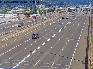
Webcams near Punchbowl Crater




History around Punchbowl Crater
- Attack on Pearl Harbor1941
- 2024 Manoa murders2024
- Xerox murders1999
- Overthrow of the Hawaiian Kingdom1893
- Battle of Nuʻuanu1795
- Transair Flight 810, a cargo flight from Honolulu to Kahului, ditches off the coast of Oahu2021
- Marco Polo condo fire2017
- 1996 Honolulu hostage crisis: A gunman takes hostages at his former place of employment in Honolulu, Hawaii1996
Towns near Punchbowl Crater
- Honolulu1.4 km away
- Makiki / Lower Punchbowl / Tantalus1.6 km away
- Waikīkī3.2 km away
- Manoa4.4 km away
- Diamond Head / Kapahulu / Saint Louis Heights5.3 km away
- Kalihi Valley5.7 km away