Mountains in France
Roc Cornafion
2,049 m6,722 ft
Mountain · Vercors Massif · France
At the summit · forecast for 1:00 AM
0 °CClear · wind 4 km/h from the SW
 See it in 3D
Weather at the summit of Roc Cornafion, 2,049 m
- 1:00 AM0 °CSW 4 km/h–
- 4:00 AM-0 °CSW 5 km/h–
- 7:00 AM-0 °CSW 5 km/h–
- 10:00 AM9 °CS 5 km/h–
- 1:00 PM13 °CN 4 km/h–
- 4:00 PM11 °CN 4 km/h–
- 7:00 PM4 °CW 3 km/h–
- 10:00 PM3 °CW 4 km/h–
| Day | Sky | High / low | Rain | Wind up to |
|---|---|---|---|---|
| Today | Partly cloudy | 13 °C / -0 °C | – | 6 km/h |
| Wed, Oct 28 | Light rain | 3 °C / 0 °C | 1.6 mm | 10 km/h |
| Thu, Oct 29 | Mostly clear | 7 °C / 0 °C | – | 5 km/h |
| Fri, Oct 30 | Clear | 8 °C / -0 °C | – | 5 km/h |
| Sat, Oct 31 | Mostly clear | 8 °C / -2 °C | – | 6 km/h |
| Sun, Nov 1 | Clear | 6 °C / -2 °C | – | 5 km/h |
| Mon, Nov 2 | Mostly clear | 2 °C / -2 °C | – | 4 km/h |
Forecast by MET Norway (CC BY 4.0), updated 12:20 AM GMT+1. Times are local.
Facts
- What it is
- Mountain
- Height above sea level
- 2,049 m (6,722 ft)
- Range
- Vercors Massif
- Country
- France
- Coordinates
- 45.062°N 5.601°E
- Source
- Wikidata, CC0
Peaks near Roc Cornafion
- Moucherotte1,901 m · 10 km awayOn the map
- Néron1,298 m · 21 km awayOn the map
- Le Tabor2,389 m · 22 km awayOn the map
- Grand Veymont2,341 m · 22 km awayOn the map
- Mount Aiguille2,087 m · 25 km awayOn the map
- Le Taillefer2,857 m · 26 km awayOn the map
- Mont Saint-Eynard1,379 m · 27 km awayOn the map
- Chamechaude2,082 m · 29 km awayOn the map
- La Grande Sure1,920 m · 31 km awayOn the map
- Charmant Som1,867 m · 32 km awayOn the map
Highest in the Vercors Massif
- Grand Veymont2,341 mOn the map
- La Grande Moucherolle2,284 mOn the map
- Arêtes du Gerbier2,109 mOn the map
- Sommet de Malaval2,097 mOn the map
- Mount Aiguille2,087 mOn the map
- Rochers de la Balme2,063 mOn the map
- Roc Cornafion2,049 mOn the map
- Pié Ferré2,041 mOn the map
- Moucherotte1,901 mOn the map
Highest mountains in France
- Mont Blanc4,806 mOn the map
- Pointe Walker4,208 mOn the map
- Grandes Jorasses4,208 mOn the map
- Aiguille Verte4,122 mOn the map
- Barre des Écrins4,102 mOn the map
- Meije3,983 mOn the map
- Ailefroide3,954 mOn the map
- Mont Pelvoux3,946 mOn the map
- Pic Sans Nom3,913 mOn the map
- Aiguille de Tré la Tête3,911 mOn the map
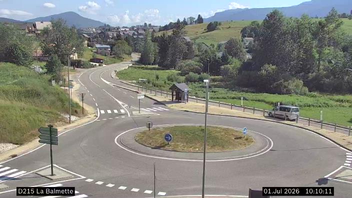
Webcams near Roc Cornafion




History around Roc Cornafion
- Day of the Tiles1788
- The 1968 Winter Olympics are held in Grenoble, France1968
- 2019 Grenoble riots2019
- 25 October International Exhibition of Hydropower and Tourism in Grenoble1925
- Battle of Jarrie1587
- 2025 Grenoble attack – Twelve people are injured in a grenade attack on a bar in Grenoble2025
- murder of Kévin Noubissi et Sofiane Tadbirt2012
- Accident on the Rampe de Laffrey2007
Towns near Roc Cornafion
- Échirolles13 km away
- Grenoble16 km away
- Fontaine16 km away
- Saint-Martin-d'Hères18 km away
- Saint-Égrève20 km away
- Meylan21 km away