Mountains in Austria
Salzbödenkopf
1,765 m5,791 ft
Mountain · Bregenz Forest Mountains · Austria
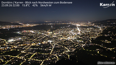
Der Salzbödenkopf ist ein 1765 m ü. A. hoher Berg im Bregenzerwaldgebirge, der sich auf dem Gemeindegebiet von Dornbirn in Österreich befindet. Der Gipfel des Berges ist zu Fuß gut erreichbar und gehört zum Dornbirner First, einer Bergkette, die an klaren Tagen noch von Friedrichshafen aus gut erkennbar ist.
From German Wikipedia, CC BY-SA · Read the article
At the summit · forecast for 10:00 PM
5 °CClear · wind 4 km/h from the SE
 See it in 3D
Weather at the summit of Salzbödenkopf, 1,765 m
- 10:00 PM5 °CSE 4 km/h–
- 1:00 AM2 °CSE 4 km/h–
- 4:00 AM2 °CE 4 km/h–
- 7:00 AM2 °CSE 5 km/h–
- 10:00 AM6 °CNW 6 km/h0.7 mm
- 1:00 PM4 °CNW 9 km/h0.7 mm
- 4:00 PM3 °CN 6 km/h1 mm
- 7:00 PM3 °CN 4 km/h0.7 mm
| Day | Sky | High / low | Rain | Wind up to |
|---|---|---|---|---|
| Wed, Oct 28 | Rain | 6 °C / 2 °C | 3.2 mm | 9 km/h |
| Thu, Oct 29 | Partly cloudy | 5 °C / -1 °C | – | 8 km/h |
| Fri, Oct 30 | Mostly clear | 5 °C / -3 °C | – | 7 km/h |
| Sat, Oct 31 | Mostly clear | 4 °C / -4 °C | – | 6 km/h |
| Sun, Nov 1 | Mostly clear | 4 °C / -4 °C | – | 6 km/h |
| Mon, Nov 2 | Partly cloudy | 1 °C / -3 °C | – | 5 km/h |
| Tue, Nov 3 | Partly cloudy | 1 °C / -6 °C | 0.2 mm | 6 km/h |
Forecast by MET Norway (CC BY 4.0), updated 08:17 PM GMT+1. Times are local.
Facts
- What it is
- Mountain
- Height above sea level
- 1,765 m (5,791 ft)
- Prominence
- 156 m (512 ft)
- Isolation
- 1.3 km to higher ground
- Range
- Bregenz Forest Mountains
- Parent peak
- Alpkopf
- Country
- Austria
- Coordinates
- 47.330°N 9.794°E
- Source
- Wikidata, CC0
Peaks near Salzbödenkopf
- Damülser Mittagsspitze2,095 m · 7.2 km awayOn the map
- Glatthorn2,133 m · 9.7 km awayOn the map
- Pfänder1,062 m · 20 km awayOn the map
- Rote Wand2,703 m · 22 km awayOn the map
- Hoher Ifen2,230 m · 23 km awayOn the map
- Braunarlspitze2,649 m · 23 km awayOn the map
- Mohnenfluh2,542 m · 26 km awayOn the map
- Widderstein2,533 m · 26 km awayOn the map
- Hochgrat1,834 m · 28 km awayOn the map
- Geißhorn2,366 m · 29 km awayOn the map
Parent peak
The nearest higher peak its prominence is measured to.
- Alpkopf1,788 mOn the map
Highest in the Bregenz Forest Mountains
- Damülser Mittagsspitze2,095 mOn the map
- Winterstaude1,877 mOn the map
- Hirschberg1,834 mOn the map
- Salzbödenkopf1,765 mOn the map
Highest mountains in Austria
- Grossglockner3,798 mOn the map
- Wildspitze3,768 mOn the map
- Weißkugel3,738 mOn the map
- Großvenediger3,657 mOn the map
- Hintere Schwärze3,624 mOn the map
- Großes Wiesbachhorn3,564 mOn the map
- Ramolkogel3,549 mOn the map
- Schalfkogel3,537 mOn the map
- Watzespitze3,532 mOn the map
- Fineilspitze3,514 mOn the map