Facts
- What it is
- Mountain
- Height above sea level
- 1,688 m (5,538 ft)
- Range
- Rätikon
- Countries
- Austria, Liechtenstein
- Coordinates
- 47.185°N 9.573°E
- Source
- Wikidata, CC0
Peaks near Sattelköpfle
- Drei Schwestern2,053 m · 1.1 km awayOn the map
- Naafkopf2,571 m · 14 km awayOn the map
- Grauspitz2,599 m · 15 km awayOn the map
- Falknis2,562 m · 15 km awayOn the map
- Schesaplana2,965 m · 18 km awayOn the map
- Säntis2,501 m · 19 km awayOn the map
- Glatthorn2,133 m · 25 km awayOn the map
- Damülser Mittagsspitze2,095 m · 27 km awayOn the map
- Pizol2,844 m · 29 km awayOn the map
- Rote Wand2,703 m · 31 km awayOn the map
Highest in the Rätikon
- Schesaplana2,965 mOn the map
- Drei Türme2,830 mOn the map
- Madrisahorn2,826 mOn the map
- Sulzfluh2,818 mOn the map
- Seekopf2,698 mOn the map
- Grauspitz2,599 mOn the map
- Schollberg2,570 mOn the map
- Kirchlispitzen2,551 mOn the map
- Sattelköpfle1,688 mOn the map
Highest mountains in Austria
- Grossglockner3,798 mOn the map
- Wildspitze3,768 mOn the map
- Weißkugel3,738 mOn the map
- Großvenediger3,657 mOn the map
- Hintere Schwärze3,624 mOn the map
- Großes Wiesbachhorn3,564 mOn the map
- Ramolkogel3,549 mOn the map
- Schalfkogel3,537 mOn the map
- Watzespitze3,532 mOn the map
- Fineilspitze3,514 mOn the map
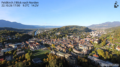
Webcams near Sattelköpfle


History around Sattelköpfle
- Battle of Frastanz1499
- Battle of Feldkirch1799
- 2016 Nenzing shooting2016
- The home and office of Klaus Zumwinkel, CEO of Deutsche Post, is searched by police investigating tax evasion2008
- Vaduz Convention1960
- The 1939 Liechtenstein putsch takes place; members of the (VDBL) unsuccessfully attempt to provoke a clash with the Liechtenstein government with the aim…1939
- Rotter kidnapping1933
- November 1918 Liechtenstein putsch1918