Stanley Peak
3,155 m10,351 ft
Mountain · Ball Range · Canada
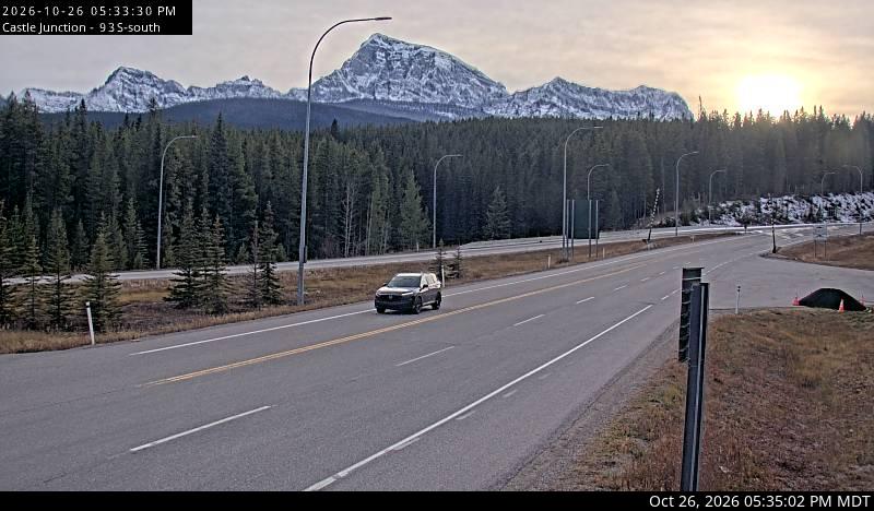
Stanley Peak is a 3,155-metre (10,351 ft) mountain located in the Ball Range, at the northeastern section of Kootenay National Park, in the Canadian Rocky Mountains.
From Wikipedia, CC BY-SA · Read the article
At the summit · forecast for 5:00 PM
-3 °CCloudy · wind 2 km/h from the S
 See it in 3D
Weather at the summit of Stanley Peak, 3,155 m
- 5:00 PM-3 °CS 2 km/h–
- 8:00 PM-8 °CW 1 km/h–
- 11:00 PM-9 °CW 2 km/h–
- 2:00 AM-10 °CW 3 km/h–
- 5:00 AM-10 °CW 4 km/h0.1 mm
- 8:00 AM-10 °CSW 3 km/h0.8 mm
- 11:00 AM-9 °CSW 4 km/h0.6 mm
- 2:00 PM-7 °CSW 5 km/h0.9 mm
| Day | Sky | High / low | Rain | Wind up to |
|---|---|---|---|---|
| Tue, Oct 27 | Light snow | -7 °C / -12 °C | 2.7 mm | 5 km/h |
| Wed, Oct 28 | Snow | -10 °C / -15 °C | 7.8 mm | 8 km/h |
| Thu, Oct 29 | Cloudy | -13 °C / -18 °C | 0.6 mm | 4 km/h |
| Fri, Oct 30 | Partly cloudy | -11 °C / -21 °C | 0.3 mm | 3 km/h |
| Sat, Oct 31 | Cloudy | -13 °C / -20 °C | – | 2 km/h |
| Sun, Nov 1 | Clear | -12 °C / -22 °C | – | 4 km/h |
| Mon, Nov 2 | Partly cloudy | -9 °C / -19 °C | – | 5 km/h |
Forecast by MET Norway (CC BY 4.0), updated 01:16 PM MDT. Times are local.
Facts
- What it is
- Mountain
- Height above sea level
- 3,155 m (10,351 ft)
- Prominence
- 243 m (797 ft)
- Range
- Ball Range
- Country
- Canada
- First ascent
- 1901
- Coordinates
- 51.171°N 116.054°W
- Source
- Wikidata, CC0
Stanley Peak (Ball Range)
Mountain in Kootenay NP, British Columbia, Canada
Stanley Peak is a 3,155-metre (10,351 ft) mountain located in the Ball Range, at the northeastern section of Kootenay National Park, in the Canadian Rocky Mountains. The mountain was named in 1901 by its first climber, the English explorer Edward Whymper, after Frederick Stanley, 16th Earl of Derby, the sixth Governor-General of Canada. There are sources that date the naming in 1912 after Stanley H.
From Wikipedia, CC BY-SA · Read the article
Peaks near Stanley Peak
- Mount Ball3,311 m · 3.7 km awayOn the map
- Mount Whymper2,845 m · 6.7 km awayOn the map
- Floe Peak3,006 m · 16 km awayOn the map
- Pilot Mountain2,954 m · 16 km awayOn the map
- Mount Fay3,235 m · 16 km awayOn the map
- Mount Brett2,984 m · 16 km awayOn the map
- Mount Little3,134 m · 17 km awayOn the map
- Mount Babel3,103 m · 17 km awayOn the map
- Castle Mountain2,766 m · 17 km awayOn the map
- Mount Allen3,310 m · 18 km awayOn the map
Highest in the Ball Range
- Mount Ball3,311 mOn the map
- Storm Mountain3,158 mOn the map
- Stanley Peak3,155 mOn the map
- Scarab Peak2,918 mOn the map
- The Monarch2,895 mOn the map
- Mount Shanks2,838 mOn the map
- Copper Mountain2,795 mOn the map
- Pharaoh Peaks2,713 mOn the map
Highest mountains in Canada
- Mount Logan5,959 mOn the map
- Mount Saint Elias18,009 ftOn the map
- Mount Lucania5,240 mOn the map
- King Peak5,173 mOn the map
- Mount Steele5,073 mOn the map
- Mount Wood4,850 mOn the map
- Mount Vancouver15,787 ftOn the map
- Mount Slaggard4,742 mOn the map
- Mount Macaulay4,700 mOn the map
- Mount Fairweather15,325 ftOn the map