Mountains in Austria
Strahlkopf
1,336 m4,383 ft
Mountain · Bregenz Forest Mountains · Austria
At the summit · forecast for 4:00 PM
12 °CClear · wind 3 km/h from the NW
 See it in 3D

Weather at the summit of Strahlkopf, 1,336 m
- 4:00 PM12 °CNW 3 km/h–
- 7:00 PM7 °CSE 3 km/h–
- 10:00 PM5 °CSE 4 km/h–
- 1:00 AM3 °CSE 5 km/h–
- 4:00 AM2 °CSE 5 km/h–
- 7:00 AM4 °CSE 5 km/h0.2 mm
- 10:00 AM6 °CN 4 km/h1.8 mm
- 1:00 PM5 °CN 7 km/h0.3 mm
| Day | Sky | High / low | Rain | Wind up to |
|---|---|---|---|---|
| Wed, Oct 28 | Light rain | 6 °C / 2 °C | 2.8 mm | 8 km/h |
| Thu, Oct 29 | Mostly clear | 7 °C / 0 °C | – | 8 km/h |
| Fri, Oct 30 | Partly cloudy | 5 °C / -2 °C | – | 6 km/h |
| Sat, Oct 31 | Mostly clear | 5 °C / -4 °C | – | 6 km/h |
| Sun, Nov 1 | Partly cloudy | 5 °C / -4 °C | – | 6 km/h |
| Mon, Nov 2 | Cloudy | 3 °C / -1 °C | – | 4 km/h |
| Tue, Nov 3 | Partly cloudy | 4 °C / -6 °C | 0.1 mm | 6 km/h |
Forecast by MET Norway (CC BY 4.0), updated 02:17 PM GMT+1. Times are local.
Facts
- What it is
- Mountain
- Height above sea level
- 1,336 m (4,383 ft)
- Prominence
- 86 m (282 ft)
- Isolation
- 0.4 km to higher ground
- Range
- Bregenz Forest Mountains
- Parent peak
- Hohe Kugel
- Country
- Austria
- Coordinates
- 47.354°N 9.722°E
- Source
- Wikidata, CC0
Peaks near Strahlkopf
- Damülser Mittagsspitze2,095 m · 13 km awayOn the map
- Glatthorn2,133 m · 15 km awayOn the map
- Pfänder1,062 m · 18 km awayOn the map
- Rote Wand2,703 m · 27 km awayOn the map
- Hoher Ifen2,230 m · 29 km awayOn the map
- Braunarlspitze2,649 m · 29 km awayOn the map
- Säntis2,501 m · 31 km awayOn the map
- Hochgrat1,834 m · 31 km awayOn the map
- Widderstein2,533 m · 32 km awayOn the map
- Mohnenfluh2,542 m · 32 km awayOn the map
Parent peak
The nearest higher peak its prominence is measured to.
- Hohe Kugel1,645 mOn the map
Highest in the Bregenz Forest Mountains
- Damülser Mittagsspitze2,095 mOn the map
- Winterstaude1,877 mOn the map
- Hirschberg1,834 mOn the map
- Strahlkopf1,336 mOn the map
Highest mountains in Austria
- Grossglockner3,798 mOn the map
- Wildspitze3,768 mOn the map
- Weißkugel3,738 mOn the map
- Großvenediger3,657 mOn the map
- Hintere Schwärze3,624 mOn the map
- Großes Wiesbachhorn3,564 mOn the map
- Ramolkogel3,549 mOn the map
- Schalfkogel3,537 mOn the map
- Watzespitze3,532 mOn the map
- Fineilspitze3,514 mOn the map
Webcams near Strahlkopf
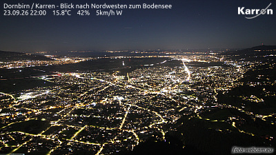 Dornbirn / Karren - Blick nach Nordwesten zum Bodensee4.4 km from the summit
A14, bei Hohenems, Blickrichtung Bregenz - Km 23,604.6 km from the summit
A14, bei Raststation Hohenems, Blickrichtung LKW Stellplatz - Km 24,354.9 km from the summit
A14, bei Raststation Hohenems, Blickrichtung LKW Stellplatz - Km 24,354.9 km from the summit