Mountains in Austria
Tauernkogel
2,988 m9,803 ft
Mountain · Venediger Group · Austria
The Tauernkogel is a mountain, 2,988 m (AA), in the Venediger Group of Austria's High Tauern. It lies west of the Felber Tauern and the border between the states of Salzburg and Tyrol runs over the summit. It may be climbed on a difficult mountain tour via a steep snowfield in about 1.½ hours from the St. Pöltner Hut.
From Wikipedia, CC BY-SA · Read the article
At the summit · forecast for 6:00 AM
-5 °CCloudy · wind 4 km/h from the S
 See it in 3D
Weather at the summit of Tauernkogel, 2,988 m
- 6:00 AM-5 °CS 4 km/h–
- 9:00 AM-2 °CS 3 km/h–
- 12:00 PM1 °CSW 3 km/h–
- 3:00 PM1 °CSE 3 km/h–
- 6:00 PM-4 °CS 3 km/h–
- 9:00 PM-4 °CS 4 km/h–
- 12:00 AM-5 °CSW 5 km/h–
- 3:00 AM-7 °CSW 6 km/h–
| Day | Sky | High / low | Rain | Wind up to |
|---|---|---|---|---|
| Today | Mostly clear | 1 °C / -5 °C | – | 5 km/h |
| Wed, Oct 28 | Snow | -1 °C / -7 °C | 7.5 mm | 8 km/h |
| Thu, Oct 29 | Clear | -4 °C / -9 °C | – | 7 km/h |
| Fri, Oct 30 | Clear | -2 °C / -12 °C | – | 3 km/h |
| Sat, Oct 31 | Clear | 1 °C / -11 °C | – | 4 km/h |
| Sun, Nov 1 | Clear | 1 °C / -9 °C | – | 5 km/h |
| Mon, Nov 2 | Clear | -3 °C / -10 °C | – | 3 km/h |
Forecast by MET Norway (CC BY 4.0), updated 02:17 AM GMT+1. Times are local.
Facts
- What it is
- Mountain
- Height above sea level
- 2,988 m (9,803 ft)
- Isolation
- 3.2 km to higher ground
- Range
- Venediger Group
- Country
- Austria
- Coordinates
- 47.158°N 12.484°E
- Source
- Wikidata, CC0
Peaks near Tauernkogel
- Rainerhorn3,559 m · 11 km awayOn the map
- Großvenediger3,657 m · 12 km awayOn the map
- Großer Muntanitz3,232 m · 12 km awayOn the map
- Johannisberg3,453 m · 15 km awayOn the map
- Kitzsteinhorn3,203 m · 16 km awayOn the map
- Glocknerwand3,721 m · 18 km awayOn the map
- Grossglockner3,798 m · 18 km awayOn the map
- Großes Wiesbachhorn3,564 m · 21 km awayOn the map
- Dreiherrnspitze3,499 m · 21 km awayOn the map
- Rötspitze3,496 m · 26 km awayOn the map
Highest in the Venediger Group
- Großvenediger3,657 mOn the map
- Dreiherrnspitze3,499 mOn the map
- Rötspitze3,496 mOn the map
- Hoher Eichham3,371 mOn the map
- Großer Geiger3,360 mOn the map
- Keeskogel3,291 mOn the map
- Schlieferspitze3,290 mOn the map
- Tauernkogel2,988 mOn the map
Highest mountains in Austria
- Grossglockner3,798 mOn the map
- Wildspitze3,768 mOn the map
- Weißkugel3,738 mOn the map
- Großvenediger3,657 mOn the map
- Hintere Schwärze3,624 mOn the map
- Großes Wiesbachhorn3,564 mOn the map
- Ramolkogel3,549 mOn the map
- Schalfkogel3,537 mOn the map
- Watzespitze3,532 mOn the map
- Fineilspitze3,514 mOn the map
Webcams near Tauernkogel

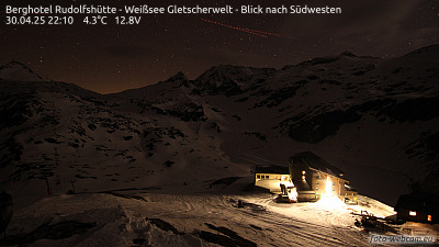

History around Tauernkogel
- Kaprun disaster2000
Towns near Tauernkogel
- Saalfelden am Steinernen Meer41 km away
- Bad Reichenhall70 km away
- Bressanone80 km away
- Traunstein80 km away