Mountains in Italy
Texelspitze
3,318 m10,886 ft
Mountain · Texel Group · Italy
The Texelspitze is the second highest mountain in the Texel group of the Ötztal Alps. The highest mountain of this group is Roteck which is 19m higher.
From Wikipedia, CC BY-SA · Read the article
At the summit · forecast for 12:00 AM
-5 °CPartly cloudy · wind 6 km/h from the NW
 See it in 3D
Weather at the summit of Texelspitze, 3,318 m
- 12:00 AM-5 °CNW 6 km/h–
- 3:00 AM-7 °CNW 6 km/h–
- 6:00 AM-7 °CNW 6 km/h–
- 9:00 AM-3 °CNW 5 km/h–
- 12:00 PM-0 °CSE 3 km/h0.8 mm
- 3:00 PM-1 °CE 4 km/h0.5 mm
- 6:00 PM-4 °CN 4 km/h0.2 mm
- 9:00 PM-5 °CNW 4 km/h0.2 mm
| Day | Sky | High / low | Rain | Wind up to |
|---|---|---|---|---|
| Today | Light snow | 0 °C / -7 °C | 1.7 mm | 6 km/h |
| Thu, Oct 29 | Clear | -2 °C / -10 °C | – | 5 km/h |
| Fri, Oct 30 | Clear | -2 °C / -10 °C | – | 4 km/h |
| Sat, Oct 31 | Clear | -2 °C / -10 °C | – | 3 km/h |
| Sun, Nov 1 | Clear | -0 °C / -9 °C | – | 3 km/h |
| Mon, Nov 2 | Clear | -2 °C / -9 °C | – | 2 km/h |
| Tue, Nov 3 | Mostly clear | -3 °C / -13 °C | – | 4 km/h |
Forecast by MET Norway (CC BY 4.0), updated 02:17 PM GMT+1. Times are local.
Facts
- What it is
- Mountain
- Height above sea level
- 3,318 m (10,886 ft)
- Prominence
- 145 m (476 ft)
- Isolation
- 1 km to higher ground
- Range
- Texel Group
- Parent peak
- Roteck
- Country
- Italy
- Coordinates
- 46.721°N 10.971°E
- Source
- Wikidata, CC0
Peaks near Texelspitze
- Hintere Schwärze3,624 m · 7.3 km awayOn the map
- Similaun3,597 m · 8.4 km awayOn the map
- Schalfkogel3,537 m · 9 km awayOn the map
- Fineilspitze3,514 m · 13 km awayOn the map
- Saldurspitze3,433 m · 18 km awayOn the map
- Schwemser Spitze3,459 m · 19 km awayOn the map
- Wildspitze3,768 m · 20 km awayOn the map
- Weißkugel3,738 m · 21 km awayOn the map
- Hinterer Brochkogel3,628 m · 21 km awayOn the map
- Hochvernagtspitze3,535 m · 22 km awayOn the map
Parent peak
The nearest higher peak its prominence is measured to.
- Roteck3,337 mOn the map
Highest in the Texel Group
- Roteck3,337 mOn the map
- Texelspitze3,318 mOn the map
- Hohe Weisse3,281 mOn the map
- Tschigat2,998 mOn the map
- Kolbenspitze2,868 mOn the map
- Spronser Rötelspitze2,625 mOn the map
- Mutspitze2,291 mOn the map
Highest mountains in Italy
- Mont Blanc4,806 mOn the map
- Lyskamm4,532 mOn the map
- Matterhorn4,478 mOn the map
- Pointe Walker4,208 mOn the map
- Grandes Jorasses4,208 mOn the map
- Dent d'Hérens4,173 mOn the map
- Breithorn4,160 mOn the map
- Texelspitze3,318 mOn the map
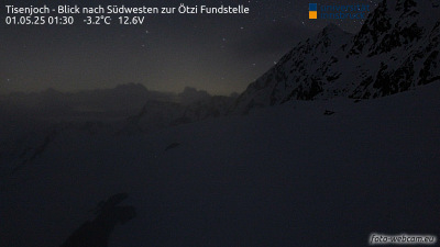
Webcams near Texelspitze



History around Texelspitze
- Merano derailment2010
- Battle of Meran1809