Mountains in Austria
Tredeberspitze
3,134 m10,282 ft
Mountain · Umbalkamm · Austria
Das Tredeberspitze ist ein Berggipfel im Umbalkamm der Venedigergruppe im Westen Osttirols. Er wurde erstmals am 27. September 1904 durch Th. Schimmelbuch und J. Unterberger über den Südgrat erstiegen, den I. Hechenbleikner und K. Berger am 27. September 1904 auch bei ihrem Abstieg vom Hohen Kreuz benutzten.
From German Wikipedia, CC BY-SA · Read the article
At the summit · forecast for 8:00 PM
-4 °CClear · wind 6 km/h from the N
 See it in 3D
Weather at the summit of Tredeberspitze, 3,134 m
- 8:00 PM-4 °CN 6 km/h–
- 11:00 PM-4 °CN 5 km/h–
- 2:00 AM-5 °CN 6 km/h–
- 5:00 AM-7 °CN 6 km/h–
- 8:00 AM-5 °CN 8 km/h–
- 11:00 AM-3 °CN 8 km/h0.4 mm
- 2:00 PM-3 °CN 7 km/h1.5 mm
- 5:00 PM-4 °CN 8 km/h0.3 mm
| Day | Sky | High / low | Rain | Wind up to |
|---|---|---|---|---|
| Wed, Oct 28 | Snow | -3 °C / -7 °C | 2.2 mm | 9 km/h |
| Thu, Oct 29 | Clear | -5 °C / -12 °C | – | 10 km/h |
| Fri, Oct 30 | Clear | -3 °C / -12 °C | – | 6 km/h |
| Sat, Oct 31 | Clear | -3 °C / -11 °C | – | 6 km/h |
| Sun, Nov 1 | Clear | -5 °C / -11 °C | – | 10 km/h |
| Mon, Nov 2 | Clear | -7 °C / -12 °C | 1.5 mm | 10 km/h |
| Tue, Nov 3 | Light snow | -9 °C / -11 °C | 7.4 mm | 13 km/h |
Forecast by MET Norway (CC BY 4.0), updated 06:17 PM GMT+1. Times are local.
Facts
- What it is
- Mountain
- Height above sea level
- 3,134 m (10,282 ft)
- Range
- Umbalkamm
- Country
- Austria
- Coordinates
- 47.017°N 12.215°E
- Source
- Wikidata, CC0
Peaks near Tredeberspitze
- Rötspitze3,496 m · 1.4 km awayOn the map
- Dreiherrnspitze3,499 m · 6.1 km awayOn the map
- Hochgall3,436 m · 13 km awayOn the map
- Großvenediger3,657 m · 14 km awayOn the map
- Rainerhorn3,559 m · 15 km awayOn the map
- Schneebiger Nock3,358 m · 16 km awayOn the map
- Großer Löffler3,379 m · 23 km awayOn the map
- Schwarzenstein3,369 m · 26 km awayOn the map
- Großer Muntanitz3,232 m · 29 km awayOn the map
- Turnerkamp3,418 m · 31 km awayOn the map
Highest mountains in Austria
- Grossglockner3,798 mOn the map
- Wildspitze3,768 mOn the map
- Weißkugel3,738 mOn the map
- Großvenediger3,657 mOn the map
- Hintere Schwärze3,624 mOn the map
- Großes Wiesbachhorn3,564 mOn the map
- Ramolkogel3,549 mOn the map
- Schalfkogel3,537 mOn the map
- Watzespitze3,532 mOn the map
- Fineilspitze3,514 mOn the map
Webcams near Tredeberspitze
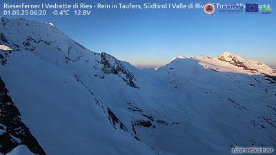 Rieserferner I Vedrette di Ries - Rein in Taufers, Südtirol I Valle di Riva di Tures, Alto Adige12 km from the summit
 Kürsingerhütte - Blick nach Süden zum Großen Geiger13 km from the summit
 Kürsingerhütte - Blick nach Osten zum Großvenediger13 km from the summit
 Krimmler Tauernhaus14 km from the summit
Towns near Tredeberspitze
- Bressanone54 km away
- Saalfelden am Steinernen Meer66 km away
- Innsbruck68 km away