Hochvogel
2.592 m8.504 pés
Montanha · Alpes de Algovia · Alemanha · Áustria
The Hochvogel is a 2,592-metre-high (8,504 ft) mountain in the Allgäu Alps. The national border between Germany and Austria runs over the summit. Although only the thirteenth highest summit in the Allgäu Alps, the Hochvogel dominates other parts of Allgäu Alps and the other ranges in the immediate neighbourhood.
Da Wikipedia, CC BY-SA · Ler o artigo
O ponto mais alto de Hochvogel-Rosszahn Chain
No cume · previsão para 6:00
-0 °CPoucas nuvens · vento de 4 km/h de SE
 Ver em 3D
Clima no cume de Hochvogel, 2.592 m
- 6:00-0 °CSE 4 km/h–
- 9:004 °CSE 5 km/h–
- 12:009 °CNO 4 km/h–
- 15:008 °CNO 6 km/h–
- 18:002 °CS 3 km/h–
- 21:000 °CS 5 km/h–
- 0:00-1 °CS 6 km/h–
- 3:00-1 °CSO 6 km/h–
| Dia | Céu | Máx. / mín. | Chuva | Vento até |
|---|---|---|---|---|
| Hoje | Céu limpo | 9 °C / -1 °C | – | 7 km/h |
| qua., 28 de out. | Neve | 1 °C / -3 °C | 3,3 mm | 9 km/h |
| qui., 29 de out. | Céu limpo | 2 °C / -6 °C | – | 11 km/h |
| sex., 30 de out. | Céu limpo | 3 °C / -8 °C | – | 6 km/h |
| sáb., 31 de out. | Céu limpo | 4 °C / -7 °C | – | 5 km/h |
| dom., 1 de nov. | Céu limpo | 4 °C / -4 °C | – | 6 km/h |
| seg., 2 de nov. | Céu limpo | 2 °C / -7 °C | – | 5 km/h |
Previsão: MET Norway (CC BY 4.0), atualizada às 02:17 GMT+1. Horários locais.
Ficha técnica
- Tipo
- Montanha
- Altitude acima do nível do mar
- 2.592 m (8.504 pés)
- Proeminência
- 572 m (1.877 pés)
- Isolamento
- a 5,4 km de um terreno mais alto
- Cordilheira
- Alpes de Algovia
- Pico pai
- Krottenkopf
- Primeira ascensão
- 1832
- Ponto mais alto de
- Hochvogel-Rosszahn Chain
- Coordenadas
- 47.380°N 10.437°E
- Fonte
- Wikidata, CC0
Hochvogel
Mountain on the border between Germany and Austria
The Hochvogel is a 2,592-metre-high (8,504 ft) mountain in the Allgäu Alps. The national border between Germany and Austria runs over the summit. Although only the thirteenth highest summit in the Allgäu Alps, the Hochvogel dominates other parts of Allgäu Alps and the other ranges in the immediate neighbourhood.
Da Wikipedia, CC BY-SA · Ler o artigo
Picos perto de Hochvogel
- Glasfelderkopf2.270 m · a 2,5 kmNo mapa
- Schneck2.268 m · a 4,1 kmNo mapa
- Schänzlekopf2.070 m · a 4,3 kmNo mapa
- Schänzlespitz2.052 m · a 5 kmNo mapa
- Bretterspitze2.608 m · a 5,6 kmNo mapa
- Lahnerkopf2.121 m · a 5,8 kmNo mapa
- Noppenspitze2.594 m · a 6,1 kmNo mapa
- Kreuzkarspitze2.587 m · a 6,3 kmNo mapa
- Großer Daumen2.280 m · a 8,2 kmNo mapa
- Nebelhorn2.224 m · a 8,5 kmNo mapa
Pico pai
O pico mais alto mais próximo em relação ao qual sua proeminência é medida.
- Krottenkopf2.656 mNo mapa
Os mais altos de Alpes de Algovia
- Krottenkopf2.656 mNo mapa
- Hohes Licht2.651 mNo mapa
- Biberkopf2.599 mNo mapa
- Hochvogel2.592 mNo mapa
- Widderstein2.533 mNo mapa
Montanhas mais altas de Alemanha
- Zugspitze2.962 mNo mapa
- Hochwanner2.744 mNo mapa
- Dreitorspitze2.682 mNo mapa
- Hochkalter2.607 mNo mapa
- Biberkopf2.599 mNo mapa
- Grosser Hundstod2.594 mNo mapa
- Hochvogel2.592 mNo mapa
- Östliche Karwendelspitze2.538 mNo mapa
- Hocheisspitze2.523 mNo mapa
- Hoher Göll2.522 mNo mapa
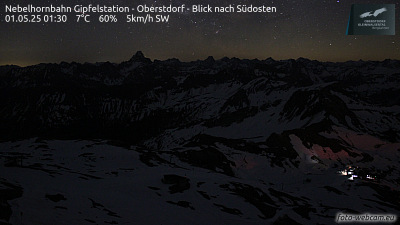
Webcams perto de Hochvogel


Cidades perto de Hochvogel
- Sonthofena 19 km
- Füssena 29 km
- Kempten (Allgäu)a 40 km
- Marktoberdorfa 46 km
- Telfsa 48 km
- Garmisch-Partenkirchena 51 km