Hochvogel
2592 m8504 ft
Montaña · Alpes de Allgäu · Alemania · Austria
The Hochvogel is a 2,592-metre-high (8,504 ft) mountain in the Allgäu Alps. The national border between Germany and Austria runs over the summit. Although only the thirteenth highest summit in the Allgäu Alps, the Hochvogel dominates other parts of Allgäu Alps and the other ranges in the immediate neighbourhood.
De Wikipedia, CC BY-SA · Leer el artículo
El punto más alto de Hochvogel-Rosszahn Chain
En la cumbre · pronóstico para las 8:00
-0 °CNublado · viento de 5 km/h del S
 Verla en 3D
Clima en la cumbre de Hochvogel, 2592 m
- 8:00-0 °CS 5 km/h0,8 mm
- 11:000 °CNO 7 km/h1,3 mm
- 14:00-1 °CNO 9 km/h0,6 mm
- 17:00-2 °CNO 5 km/h0,3 mm
- 20:00-3 °CN 6 km/h0,1 mm
- 23:00-3 °CNE 5 km/h–
- 2:00-4 °CE 4 km/h–
- 5:00-5 °CSE 4 km/h–
| Día | Cielo | Máx. / mín. | Lluvia | Viento hasta |
|---|---|---|---|---|
| Hoy | Nieve | 1 °C / -3 °C | 3,1 mm | 9 km/h |
| jue, 29 oct | Despejado | 2 °C / -7 °C | – | 10 km/h |
| vie, 30 oct | Despejado | 2 °C / -9 °C | – | 10 km/h |
| sáb, 31 oct | Despejado | 2 °C / -8 °C | – | 8 km/h |
| dom, 1 nov | Despejado | -2 °C / -8 °C | – | 7 km/h |
| lun, 2 nov | Nieve | -7 °C / -10 °C | 9,5 mm | 6 km/h |
| mar, 3 nov | Nublado | -7 °C / -9 °C | 1,3 mm | 6 km/h |
Pronóstico de MET Norway (CC BY 4.0), actualizado a las 02:17 CET. Horas locales.
Ficha técnica
- Tipo
- Montaña
- Altitud sobre el nivel del mar
- 2592 m (8504 ft)
- Prominencia
- 572 m (1877 ft)
- Aislamiento
- a 5,4 km de un terreno más alto
- Cordillera
- Alpes de Allgäu
- Pico padre
- Großer Krottenkopf
- Primer ascenso
- 1832
- Punto más alto de
- Hochvogel-Rosszahn Chain
- Coordenadas
- 47.380°N 10.437°E
- Fuente
- Wikidata, CC0
Hochvogel
Mountain on the border between Germany and Austria
The Hochvogel is a 2,592-metre-high (8,504 ft) mountain in the Allgäu Alps. The national border between Germany and Austria runs over the summit. Although only the thirteenth highest summit in the Allgäu Alps, the Hochvogel dominates other parts of Allgäu Alps and the other ranges in the immediate neighbourhood.
De Wikipedia, CC BY-SA · Leer el artículo
Picos cerca de Hochvogel
- Glasfelderkopf2270 m · a 2,5 kmEn el mapa
- Schneck (montaña)2268 m · a 4,1 kmEn el mapa
- Schänzlekopf2070 m · a 4,3 kmEn el mapa
- Schänzlespitz2052 m · a 5 kmEn el mapa
- Bretterspitze2608 m · a 5,6 kmEn el mapa
- Lahnerkopf2121 m · a 5,8 kmEn el mapa
- Noppenspitze2594 m · a 6,1 kmEn el mapa
- Kreuzkarspitze2587 m · a 6,3 kmEn el mapa
- Großer Daumen2280 m · a 8,2 kmEn el mapa
- Nebelhorn2224 m · a 8,5 kmEn el mapa
Pico padre
El pico más alto más cercano respecto al que se mide su prominencia.
Los más altos de Alpes de Allgäu
- Großer Krottenkopf2656 mEn el mapa
- Hohes Licht2651 mEn el mapa
- Biberkopf2599 mEn el mapa
- Hochvogel2592 mEn el mapa
- Widderstein2533 mEn el mapa
Montañas más altas de Alemania
- Zugspitze2962 mEn el mapa
- Hochwanner2744 mEn el mapa
- Dreitorspitze2682 mEn el mapa
- Hochkalter2607 mEn el mapa
- Biberkopf2599 mEn el mapa
- Großer Hundstod2594 mEn el mapa
- Hochvogel2592 mEn el mapa
- Östliche Karwendelspitze2538 mEn el mapa
- Hocheisspitze2523 mEn el mapa
- Hoher Göll2522 mEn el mapa
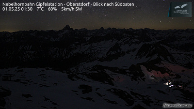
Cámaras web cerca de Hochvogel


Ciudades cerca de Hochvogel
- Sonthofena 19 km
- Füssena 29 km
- Kempten (Allgäu)a 40 km
- Marktoberdorfa 46 km
- Telfsa 48 km
- Garmisch-Partenkirchena 51 km