Knocknahillion
607 m1.991 pés
Montanha · Maumturks · Irlanda
Knocknahillion is one of the Maumturk Mountains of Connemara in County Galway, Ireland. At 607 metres (1,991 ft), it is the 210th–highest peak in Ireland on the Arderin list, and 256th–highest on the Vandeleur-Lynam list.
Da Wikipedia, CC BY-SA · Ler o artigo
No cume · previsão para 2:00
8 °CChuva · vento de 31 km/h de O
 Ver em 3D
Clima no cume de Knocknahillion, 607 m
- 2:008 °CO 31 km/h0,7 mm
- 5:008 °CO 27 km/h0,4 mm
- 8:008 °CSO 19 km/h0,5 mm
- 11:009 °CSO 23 km/h0,5 mm
- 14:0010 °CSO 24 km/h0,6 mm
- 17:009 °CSO 17 km/h0,4 mm
- 20:009 °CS 21 km/h0,5 mm
- 23:008 °CS 24 km/h0,7 mm
| Dia | Céu | Máx. / mín. | Chuva | Vento até |
|---|---|---|---|---|
| Hoje | Chuva fraca | 10 °C / 8 °C | 3,8 mm | 31 km/h |
| qui., 29 de out. | Nublado | 11 °C / 8 °C | 0,9 mm | 35 km/h |
| sex., 30 de out. | Poucas nuvens | 11 °C / 6 °C | 9,8 mm | 32 km/h |
| sáb., 31 de out. | Chuva | 10 °C / 6 °C | 10,7 mm | 13 km/h |
| dom., 1 de nov. | Parcialmente nublado | 8 °C / 4 °C | – | 15 km/h |
| seg., 2 de nov. | Nublado | 8 °C / 5 °C | – | 22 km/h |
| ter., 3 de nov. | Nublado | 9 °C / 5 °C | 0,4 mm | 19 km/h |
Previsão: MET Norway (CC BY 4.0), atualizada às 19:17 GMT. Horários locais.
Ficha técnica
- Tipo
- Montanha
- Altitude acima do nível do mar
- 607 m (1.991 pés)
- Proeminência
- 152 m (499 pés)
- Cordilheira
- Maumturks
- País
- Irlanda
- Coordenadas
- 53.522°N 9.704°W
- Fonte
- Wikidata, CC0
Knocknahillion
Mountain in County Galway, Ireland
Knocknahillion is one of the Maumturk Mountains of Connemara in County Galway, Ireland. At 607 metres (1,991 ft), it is the 210th–highest peak in Ireland on the Arderin list, and 256th–highest on the Vandeleur-Lynam list. Knocknahillion is in the middle sector of the long north-west to the south-east spine of the Maumturks.
Da Wikipedia, CC BY-SA · Ler o artigo
Picos perto de Knocknahillion
- Letterbreckaun667 m · a 1,9 kmNo mapa
- Binn idir an dá Log702 m · a 2 kmNo mapa
- Binn Chaonaigh633 m · a 3,7 kmNo mapa
- Leenaun Hill618 m · a 5,6 kmNo mapa
- Binn Mhór661 m · a 6,5 kmNo mapa
- Bencorr711 m · a 6,8 kmNo mapa
- Bencollaghduff696 m · a 7,3 kmNo mapa
- Mullach Glas622 m · a 8,1 kmNo mapa
- Benbaun729 m · a 8,4 kmNo mapa
- Corcogemore609 m · a 9,4 kmNo mapa
Os mais altos de Maumturks
- Binn idir an dá Log702 mNo mapa
- Letterbreckaun667 mNo mapa
- Binn Mhór661 mNo mapa
- Leenaun Hill618 mNo mapa
- Knocknahillion607 mNo mapa
- Lackavrea396 mNo mapa
Montanhas mais altas de Irlanda
Webcams perto de Knocknahillion
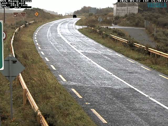
História ao redor de Knocknahillion
Cidades perto de Knocknahillion
- Galwaya 51 km