Rotwand
1.884 m6.181 pés
Montanha · Schliersee Mountains · Alemanha
The Rotwand is a 1,884 m high peak in the Mangfall Mountains in Bavaria, the highest summit in the Spitzingsee region and one of the most popular of Munich's local mountains (Hausberge). The summit may be reached in an easy hike from the lake of Spitzingsee on various routes .
Da Wikipedia, CC BY-SA · Ler o artigo
O ponto mais alto de Alpes de Mangfall
No cume · previsão para 5:00
4 °CParcialmente nublado · vento de 3 km/h de SO
 Ver em 3D
Clima no cume de Rotwand, 1.884 m
- 5:004 °CSO 3 km/h–
- 8:004 °CS 5 km/h–
- 11:0010 °CSE 7 km/h–
- 14:0011 °CNE 8 km/h–
- 17:006 °CSE 5 km/h–
- 20:004 °CS 4 km/h–
- 23:006 °CO 10 km/h–
- 2:005 °CO 12 km/h–
| Dia | Céu | Máx. / mín. | Chuva | Vento até |
|---|---|---|---|---|
| Hoje | Céu limpo | 11 °C / 3 °C | – | 10 km/h |
| qua., 28 de out. | Chuva com neve | 6 °C / 0 °C | 4,5 mm | 15 km/h |
| qui., 29 de out. | Parcialmente nublado | 3 °C / -2 °C | – | 12 km/h |
| sex., 30 de out. | Poucas nuvens | 3 °C / -3 °C | – | 8 km/h |
| sáb., 31 de out. | Poucas nuvens | 4 °C / -3 °C | – | 9 km/h |
| dom., 1 de nov. | Poucas nuvens | 6 °C / -2 °C | – | 6 km/h |
| seg., 2 de nov. | Céu limpo | 3 °C / -4 °C | – | 6 km/h |
Previsão: MET Norway (CC BY 4.0), atualizada às 00:20 GMT+1. Horários locais.
Ficha técnica
- Tipo
- Montanha
- Altitude acima do nível do mar
- 1.884 m (6.181 pés)
- Proeminência
- 741 m (2.431 pés)
- Isolamento
- a 5,7 km de um terreno mais alto
- Cordilheira
- Schliersee Mountains
- País
- Alemanha
- Ponto mais alto de
- Alpes de Mangfall
- Coordenadas
- 47.650°N 11.934°E
- Fonte
- Wikidata, CC0
Rotwand (Bavaria)
The Rotwand is a 1,884 m high peak in the Mangfall Mountains in Bavaria, the highest summit in the Spitzingsee region and one of the most popular of Munich's local mountains (Hausberge). The summit may be reached in an easy hike from the lake of Spitzingsee on various routes . The summit can be attained even more easily from the nearby mountain station on the Taubenstein and, as a result, can often become rather over…
Da Wikipedia, CC BY-SA · Ler o artigo
Picos perto de Rotwand
- Aiplspitz1.759 m · a 2,7 kmNo mapa
- Wendelstein1.838 m · a 8,2 kmNo mapa
- Wallberg1.722 m · a 11 kmNo mapa
- Naunspitze1.633 m · a 24 kmNo mapa
- Petersköpfl1.745 m · a 24 kmNo mapa
- Hochiss2.299 m · a 25 kmNo mapa
- Scheffauer2.111 m · a 25 kmNo mapa
- Hackenköpfe2.126 m · a 26 kmNo mapa
- Sonneck2.260 m · a 28 kmNo mapa
- Treffauer2.304 m · a 29 kmNo mapa
Os mais altos de Schliersee Mountains
- Rotwand1.884 mNo mapa
- Großer Traithen1.852 mNo mapa
- Wendelstein1.838 mNo mapa
- Trainsjoch1.708 mNo mapa
- Brecherspitz1.683 mNo mapa
- Bodenschneid1.668 mNo mapa
- Brünnstein1.634 mNo mapa
- Schmaleggerjoch1.633 mNo mapa
Montanhas mais altas de Alemanha
- Zugspitze2.962 mNo mapa
- Hochwanner2.744 mNo mapa
- Dreitorspitze2.682 mNo mapa
- Hochkalter2.607 mNo mapa
- Biberkopf2.599 mNo mapa
- Grosser Hundstod2.594 mNo mapa
- Hochvogel2.592 mNo mapa
- Östliche Karwendelspitze2.538 mNo mapa
- Hocheisspitze2.523 mNo mapa
- Hoher Göll2.522 mNo mapa
Webcams perto de Rotwand


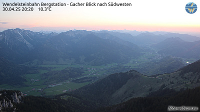
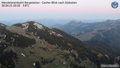
História ao redor de Rotwand
Cidades perto de Rotwand
- Kolbermoora 24 km
- Bad Aiblinga 24 km
- Bruckmühla 25 km
- Rosenheima 27 km
- Holzkirchena 31 km
- Bad Tölza 31 km