Steinkopf
518 m1.699 pés
Montanha · Taunus · Alemanha
The Steinkopf near Ober-Rosbach in the county of Wetteraukreis and Pfaffenwiesbach in the county of Hochtaunuskreis in the German state of Hesse is a hill, 518 m above sea level (NHN), in the eastern Taunus and the easternmost Taunus eminence over 300 m. It has an isolation of 10.170 km and a prominence of 173 m and…
Da Wikipedia, CC BY-SA · Ler o artigo
No cume · previsão para 11:00
9 °CParcialmente nublado · vento de 12 km/h de NO
 Ver em 3D
Clima no cume de Steinkopf, 518 m
- 11:009 °CNO 12 km/h–
- 14:0011 °CNO 12 km/h–
- 17:008 °CNO 5 km/h–
- 20:004 °CO 4 km/h–
- 23:003 °CO 5 km/h–
- 2:003 °CO 5 km/h–
- 5:003 °CNO 3 km/h–
- 8:003 °CNO 5 km/h–
| Dia | Céu | Máx. / mín. | Chuva | Vento até |
|---|---|---|---|---|
| Hoje | Poucas nuvens | 11 °C / 3 °C | – | 13 km/h |
| qui., 29 de out. | Poucas nuvens | 11 °C / 2 °C | – | 7 km/h |
| sex., 30 de out. | Nublado | 10 °C / 3 °C | – | 12 km/h |
| sáb., 31 de out. | Nublado | 9 °C / 1 °C | – | 12 km/h |
| dom., 1 de nov. | Poucas nuvens | 9 °C / 2 °C | – | 6 km/h |
| seg., 2 de nov. | Nublado | 8 °C / 5 °C | 0,4 mm | 18 km/h |
| ter., 3 de nov. | Parcialmente nublado | 7 °C / 2 °C | 0,1 mm | 14 km/h |
Previsão: MET Norway (CC BY 4.0), atualizada às 09:19 GMT+1. Horários locais.
Ficha técnica
- Tipo
- Montanha
- Altitude acima do nível do mar
- 518 m (1.699 pés)
- Proeminência
- 173 m (568 pés)
- Cordilheira
- Taunus
- País
- Alemanha
- Coordenadas
- 50.327°N 8.661°E
- Fonte
- Wikidata, CC0
Steinkopf (Taunus)
Mountain in Hesse, Germany
The Steinkopf near Ober-Rosbach in the county of Wetteraukreis and Pfaffenwiesbach in the county of Hochtaunuskreis in the German state of Hesse is a hill, 518 m above sea level (NHN), in the eastern Taunus and the easternmost Taunus eminence over 300 m. It has an isolation of 10.170 km and a prominence of 173 m and is thus one of the five independent summits in the Taunus.
Da Wikipedia, CC BY-SA · Ler o artigo
Picos perto de Steinkopf
- Gickelsburg471 m · a 8,3 kmNo mapa
- Herzberg591 m · a 11 kmNo mapa
- Roßkopf (Taunus)632 m · a 12 kmNo mapa
- Bleibeskopf480 m · a 12 kmNo mapa
- Kolbenberg690 m · a 15 kmNo mapa
- Pferdskopf663 m · a 17 kmNo mapa
- Hünerberg375 m · a 17 kmNo mapa
- Wolfsküppel545 m · a 18 kmNo mapa
- Großer Feldberg879 m · a 18 kmNo mapa
- Sängelberg665 m · a 18 kmNo mapa
Os mais altos de Taunus
- Großer Feldberg879 mNo mapa
- Langhals574 mNo mapa
- Dreibornsköpfe548 mNo mapa
- Steinkopf518 mNo mapa
Montanhas mais altas de Alemanha
- Zugspitze2.962 mNo mapa
- Hochwanner2.744 mNo mapa
- Dreitorspitze2.682 mNo mapa
- Hochkalter2.607 mNo mapa
- Biberkopf2.599 mNo mapa
- Grosser Hundstod2.594 mNo mapa
- Hochvogel2.592 mNo mapa
- Östliche Karwendelspitze2.538 mNo mapa
- Hocheisspitze2.523 mNo mapa
- Hoher Göll2.522 mNo mapa
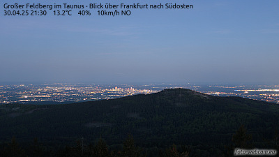
Webcams perto de Steinkopf


História ao redor de Steinkopf
Cidades perto de Steinkopf
- Friedberga 6,9 km
- Bad Nauheima 6,9 km
- Friedrichsdorfa 8,7 km
- Neu-Anspacha 11 km
- Bad Homburg vor der Höhea 12 km
- Butzbacha 12 km