Tray Mountain
4.430 pés1.350 m
Montanha · Montanhas Blue Ridge · Estados Unidos
Tray Mountain, with an elevation of 4,430 ft (1,350 m) is the seventh-highest peak in Georgia. The boundary line between White and Towns counties bisects the mountain, but leaves the summit in Towns County. Habersham County lies on a lower part of the mountain, but not on the summit.
Da Wikipedia, CC BY-SA · Ler o artigo
No cume · previsão para 9:00
46 °FCéu limpo · vento de 4 mph de NE
 Ver em 3D
Clima no cume de Tray Mountain, 4.430 pés
- 9:0046 °FNE 4 mph–
- 12:0060 °FSE 8 mph–
- 15:0064 °FSE 6 mph–
- 18:0059 °FL 6 mph–
- 21:0048 °FL 6 mph–
- 0:0045 °FL 7 mph–
- 3:0043 °FL 9 mph–
- 6:0042 °FL 6 mph–
| Dia | Céu | Máx. / mín. | Chuva | Vento até |
|---|---|---|---|---|
| Hoje | Céu limpo | 64 °F / 46 °F | – | 8 mph |
| qua., 28 de out. | Parcialmente nublado | 62 °F / 41 °F | – | 9 mph |
| qui., 29 de out. | Céu limpo | 64 °F / 40 °F | – | 7 mph |
| sex., 30 de out. | Céu limpo | 67 °F / 42 °F | – | 4 mph |
| sáb., 31 de out. | Nublado | 58 °F / 48 °F | – | 9 mph |
| dom., 1 de nov. | Chuva | 50 °F / 48 °F | 0,63 pol. | 9 mph |
| seg., 2 de nov. | Nublado | 58 °F / 50 °F | 0,04 pol. | 5 mph |
Previsão: MET Norway (CC BY 4.0), atualizada às 05:21 GMT-4. Horários locais.
Ficha técnica
- Tipo
- Montanha
- Altitude acima do nível do mar
- 4.430 pés (1.350 m)
- Cordilheira
- Montanhas Blue Ridge
- País
- Estados Unidos
- Coordenadas
- 34.801°N 83.684°W
- Fonte
- Wikidata, CC0
Tray Mountain
Mountain in Georgia, United States
Tray Mountain, with an elevation of 4,430 ft (1,350 m) is the seventh-highest peak in Georgia. The boundary line between White and Towns counties bisects the mountain, but leaves the summit in Towns County. Habersham County lies on a lower part of the mountain, but not on the summit. Tray Mountain is within the borders of the Chattahoochee National Forest and is part of the Tray Mountain Wilderness.
Da Wikipedia, CC BY-SA · Ler o artigo
Picos perto de Tray Mountain
- Young Lick3.809 pés · a 3,7 kmNo mapa
- Double Spring Knob4.280 pés · a 8,9 kmNo mapa
- Jacks Knob3.813 pés · a 10 kmNo mapa
- Wolfpen Ridge4.561 pés · a 13 kmNo mapa
- Brasstown Bald4.783 pés · a 14 kmNo mapa
- Wildcat Mountain3.760 pés · a 17 kmNo mapa
- Cowrock Mountain3.852 pés · a 18 kmNo mapa
- Yonah Mountain3.166 pés · a 18 kmNo mapa
- Hightower Bald4.568 pés · a 21 kmNo mapa
- Blood Mountain4.458 pés · a 24 kmNo mapa
Os mais altos de Montanhas Blue Ridge
- Monte Rogers5.988 pésNo mapa
- Grandfather Mountain5.965 pésNo mapa
- Mount Pisgah5.721 pésNo mapa
- Devil's Courthouse5.720 pésNo mapa
- Snake Mountain (North Carolina)5.564 pésNo mapa
- Elk Knob5.538 pésNo mapa
- Whitetop Mountain5.518 pésNo mapa
- Beech Mountain5.506 pésNo mapa
- Tray Mountain4.430 pésNo mapa
Montanhas mais altas de Estados Unidos
- Monte Denali20.308 pésNo mapa
- Monte Santo Elias18.009 pésNo mapa
- Monte Foraker17.402 pésNo mapa
- Mount Bona16.535 pésNo mapa
- Monte Blackburn16.390 pésNo mapa
- Monte Sanford16.237 pésNo mapa
- Monte Vancouver15.787 pésNo mapa
- Monte Churchill15.636 pésNo mapa
- Monte Fairweather15.325 pésNo mapa
- Monte Hubbard14.951 pésNo mapa
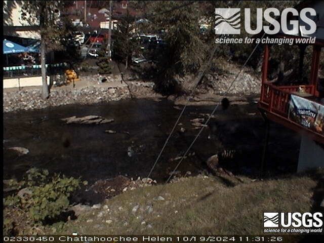
Webcams perto de Tray Mountain
Cidades perto de Tray Mountain
- Helena 11 km
- Hiawasseea 17 km
- Young Harrisa 21 km
- Clarkesvillea 26 km
- Claytona 27 km
- Mountain Citya 31 km