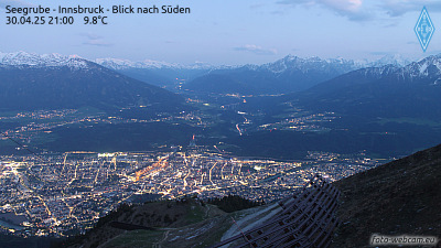
Vordere Brandjochspitze
2.559 m8.396 pés
Montanha · Áustria
The Vordere Brandjochspitze is a peak, 2,559 m (AA) high, in the Nordkette in the Karwendel range and is one of its highest and most striking peaks. In its immediate vicinity to the north-northwest is its sister summit, the Hintere Brandjochspitze, which is about 40 metres higher.
Da Wikipedia, CC BY-SA · Ler o artigo
No cume · previsão para 15:00
0 °CNeve · vento de 6 km/h de NO
 Ver em 3D
Clima no cume de Vordere Brandjochspitze, 2.559 m
- 15:000 °CNO 6 km/h0,7 mm
- 18:00-1 °CN 7 km/h0,7 mm
- 21:00-2 °CNO 6 km/h0,2 mm
- 0:00-2 °CN 5 km/h–
- 3:00-3 °CN 4 km/h–
- 6:00-3 °CNO 3 km/h–
- 9:00-3 °CSE 3 km/h–
- 12:001 °CSE 4 km/h–
| Dia | Céu | Máx. / mín. | Chuva | Vento até |
|---|---|---|---|---|
| qui., 29 de out. | Parcialmente nublado | 2 °C / -8 °C | – | 7 km/h |
| sex., 30 de out. | Céu limpo | 2 °C / -11 °C | – | 8 km/h |
| sáb., 31 de out. | Céu limpo | 3 °C / -9 °C | – | 4 km/h |
| dom., 1 de nov. | Neve | -4 °C / -8 °C | 1,7 mm | 8 km/h |
| seg., 2 de nov. | Parcialmente nublado | -5 °C / -8 °C | – | 4 km/h |
| ter., 3 de nov. | Nublado | -5 °C / -8 °C | 0,3 mm | 4 km/h |
| qua., 4 de nov. | Céu limpo | 2 °C / -12 °C | 0,1 mm | 4 km/h |
Previsão: MET Norway (CC BY 4.0), atualizada às 14:17 GMT+1. Horários locais.
Ficha técnica
- Tipo
- Montanha
- Altitude acima do nível do mar
- 2.559 m (8.396 pés)
- Isolamento
- a 0,1 km de um terreno mais alto
- País
- Áustria
- Coordenadas
- 47.302°N 11.341°E
- Fonte
- Wikidata, CC0
Vordere Brandjochspitze
The Vordere Brandjochspitze is a peak, 2,559 m (AA) high, in the Nordkette in the Karwendel range and is one of its highest and most striking peaks. In its immediate vicinity to the north-northwest is its sister summit, the Hintere Brandjochspitze, which is about 40 metres higher. To the south a prominent arête runs over to the Brandjochkreuz and the Achselkopf and down to the Innsbruck quarter of Hötting.
Da Wikipedia, CC BY-SA · Ler o artigo
Picos perto de Vordere Brandjochspitze
- Nordkette2.637 m · a 0,7 kmNo mapa
- Bergisel746 m · a 7,6 kmNo mapa
- Patscherkofel2.246 m · a 14 kmNo mapa
- Birkkarspitze2.749 m · a 14 kmNo mapa
- Dreitorspitze2.682 m · a 20 kmNo mapa
- Serles2.717 m · a 20 kmNo mapa
- Hochwanner2.744 m · a 24 kmNo mapa
- Alpspitze2.628 m · a 26 kmNo mapa
- Wank1.780 m · a 27 kmNo mapa
- Höllentalspitzen2.743 m · a 27 kmNo mapa
Montanhas mais altas de Áustria
- Grossglockner3.798 mNo mapa
- Wildspitze3.768 mNo mapa
- Weißkugel3.738 mNo mapa
- Großvenediger3.657 mNo mapa
- Hintere Schwärze3.624 mNo mapa
- Großes Wiesbachhorn3.564 mNo mapa
- Ramolkogel3.549 mNo mapa
- Schalfkogel3.537 mNo mapa
- Watzespitze3.532 mNo mapa
- Fineilspitze3.514 mNo mapa