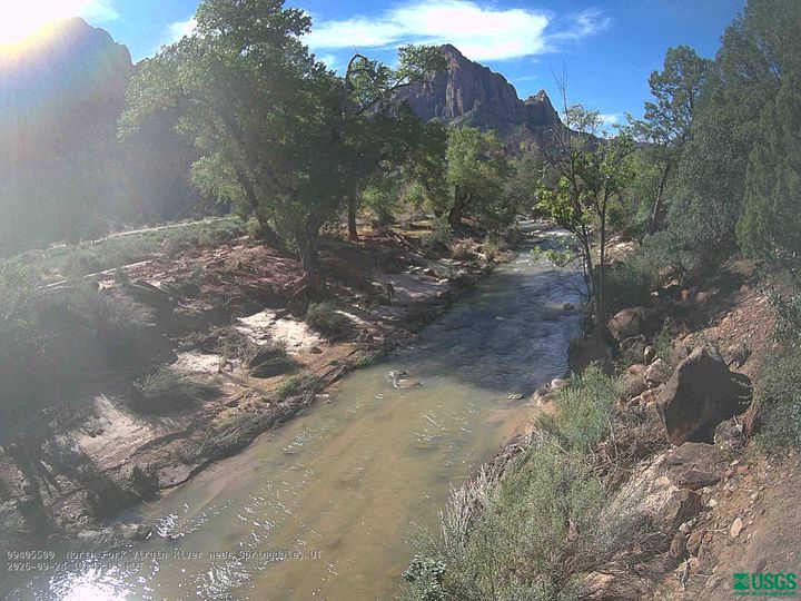
Aires Butte
6,492 英尺1,979 米
山 · 美国
Aires Butte is a 6,492-foot (1,979 m) summit located in Zion National Park, in Washington County of southwest Utah, United States. It is composed of white Navajo Sandstone, and rises 1,100-foot (340-meter) above the Zion – Mount Carmel Highway.
来自Wikipedia,CC BY-SA · 阅读文章
山顶 · 11:00 的预报
52 °F晴 · 东南风 5 英里/小时
 3D 查看
Aires Butte山顶天气,6,492 英尺
- 11:0052 °F东南 5 英里/小时–
- 14:0058 °F西南 7 英里/小时–
- 17:0058 °F西南 8 英里/小时–
- 20:0045 °F东北 3 英里/小时–
- 23:0039 °F东北 4 英里/小时–
- 2:0037 °F东北 4 英里/小时–
- 5:0033 °F东北 4 英里/小时–
- 8:0031 °F东北 6 英里/小时–
| 日期 | 天气 | 最高 / 最低 | 雨 | 最大风速 |
|---|---|---|---|---|
| 今天 | 晴 | 58 °F / 39 °F | – | 8 英里/小时 |
| 10月28日周三 | 晴 | 58 °F / 30 °F | – | 7 英里/小时 |
| 10月29日周四 | 多云 | 60 °F / 31 °F | – | 8 英里/小时 |
| 10月30日周五 | 大雨 | 47 °F / 38 °F | 1.19 英寸 | 7 英里/小时 |
| 10月31日周六 | 中雨 | 51 °F / 40 °F | 0.43 英寸 | 6 英里/小时 |
| 11月1日周日 | 大雨 | 45 °F / 36 °F | 1.05 英寸 | 8 英里/小时 |
| 11月2日周一 | 晴 | 45 °F / 29 °F | – | 7 英里/小时 |
预报来自 MET Norway(CC BY 4.0),更新于 GMT-6 11:17。时间均为当地时间。
基本信息
Aires Butte
Mountain in Utah, United States
Aires Butte is a 6,492-foot (1,979 m) summit located in Zion National Park, in Washington County of southwest Utah, United States. It is composed of white Navajo Sandstone, and rises 1,100-foot (340-meter) above the Zion – Mount Carmel Highway. Aires Butte is situated 0.9 mi (1.4 km) east-northeast of Ant Hill, 1.5 mi (2.4 km) north of Nippletop, and 1.9 mi (3.1 km) northwest of Checkerboard Mesa.
来自Wikipedia,CC BY-SA · 阅读文章
Aires Butte附近的山峰
- Ant Hill6,640 英尺 · 1.4 公里外地图上
- Deertrap Mountain6,837 英尺 · 3.3 公里外地图上
- Mountain of the Sun6,716 英尺 · 4.1 公里外地图上
- Twin Brothers6,860 英尺 · 4.1 公里外地图上
- Red Arch Mountain5,892 英尺 · 4.4 公里外地图上
- Cable Mountain6,940 英尺 · 4.5 公里外地图上
- Three Patriarchs7,014 英尺 · 5.1 公里外地图上
- Mount Moroni5,650 英尺 · 5.1 公里外地图上
- Mount Spry5,758 英尺 · 5.2 公里外地图上
- 天使降臨之頂5,774 英尺 · 5.4 公里外地图上