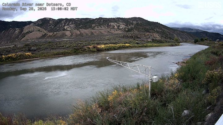
Dotsero
6,783 英尺2,068 米
火山 · 美国
Dotsero Crater is an elongate, 2,300 ft (700 m) long by 1,300 ft (400 m) wide, maar incised into sedimentary strata of the side of a mountain, called Blowout Hill, and local, irregular, mountainous topography. At an elevation of 7,316 ft (2,230 m), its north rim lies about 330 ft (100 m) higher than its south rim.
来自Wikipedia,CC BY-SA · 阅读文章
山顶 · 0:00 的预报
32 °F晴 · 东北风 3 英里/小时
 3D 查看
Dotsero山顶天气,6,783 英尺
- 0:0032 °F东北 3 英里/小时–
- 3:0030 °F东北 4 英里/小时–
- 6:0030 °F东 3 英里/小时–
- 9:0037 °F东北 4 英里/小时–
- 12:0053 °F南 8 英里/小时–
- 15:0059 °F西南 9 英里/小时–
- 18:0050 °F南 5 英里/小时–
- 21:0040 °F南 4 英里/小时–
| 日期 | 天气 | 最高 / 最低 | 雨 | 最大风速 |
|---|---|---|---|---|
| 今天 | 晴 | 59 °F / 29 °F | – | 9 英里/小时 |
| 10月28日周三 | 晴 | 59 °F / 30 °F | – | 9 英里/小时 |
| 10月29日周四 | 多云 | 54 °F / 30 °F | – | 4 英里/小时 |
| 10月30日周五 | 阴 | 54 °F / 33 °F | – | 2 英里/小时 |
| 10月31日周六 | 少云 | 52 °F / 34 °F | 0.02 英寸 | 4 英里/小时 |
| 11月1日周日 | 中雨 | 48 °F / 33 °F | 0.46 英寸 | 3 英里/小时 |
| 11月2日周一 | 多云 | 33 °F / 28 °F | 0.04 英寸 | 3 英里/小时 |
预报来自 MET Norway(CC BY 4.0),更新于 GMT-6 19:17。时间均为当地时间。
基本信息
Dotsero
Volcano in Colorado, United States
Dotsero Crater is an elongate, 2,300 ft (700 m) long by 1,300 ft (400 m) wide, maar incised into sedimentary strata of the side of a mountain, called Blowout Hill, and local, irregular, mountainous topography. At an elevation of 7,316 ft (2,230 m), its north rim lies about 330 ft (100 m) higher than its south rim. Dotsero Crater is about 1,300 ft (400 m) deep.
来自Wikipedia,CC BY-SA · 阅读文章
有记录的喷发 1 次
Dotsero附近的山峰
- Castle Peak (Sawatch Range)11,305 英尺 · 21 公里外地图上
- 斯多姆金山8,797 英尺 · 32 公里外地图上
- Red Table Mountain12,043 英尺 · 35 公里外地图上
- Blair Mountain (Colorado)11,465 英尺 · 36 公里外地图上
- New York Mountain12,546 英尺 · 40 公里外地图上
- Flat Top Mountain12,361 英尺 · 40 公里外地图上
- Mount Sopris12,965 英尺 · 46 公里外地图上
- Mount Jackson13,676 英尺 · 47 公里外地图上
- Mount of the Holy Cross14,006 英尺 · 52 公里外地图上
- Meridian Peak12,432 英尺 · 57 公里外地图上