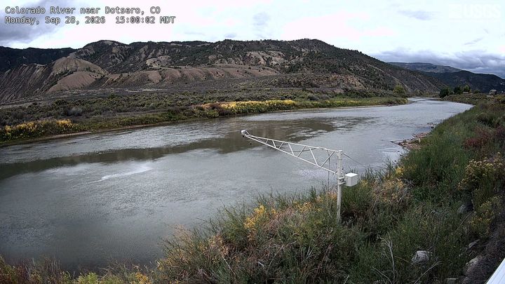
Dotsero
6,783 ft2,068 m
Volcano · United States
Dotsero Crater is an elongate, 2,300 ft (700 m) long by 1,300 ft (400 m) wide, maar incised into sedimentary strata of the side of a mountain, called Blowout Hill, and local, irregular, mountainous topography. At an elevation of 7,316 ft (2,230 m), its north rim lies about 330 ft (100 m) higher than its south rim.
From Wikipedia, CC BY-SA · Read the article
At the summit · forecast for 6:00 PM
47 °FClear · wind 3 mph from the S
 See it in 3D
Weather at the summit of Dotsero, 6,783 ft
- 6:00 PM47 °FS 3 mph–
- 9:00 PM36 °FW 4 mph–
- 12:00 AM32 °FNE 3 mph–
- 3:00 AM30 °FNE 4 mph–
- 6:00 AM30 °FE 3 mph–
- 9:00 AM37 °FNE 4 mph–
- 12:00 PM53 °FS 8 mph–
- 3:00 PM59 °FSW 8 mph–
| Day | Sky | High / low | Rain | Wind up to |
|---|---|---|---|---|
| Tue, Oct 27 | Clear | 59 °F / 30 °F | – | 9 mph |
| Wed, Oct 28 | Clear | 58 °F / 30 °F | – | 9 mph |
| Thu, Oct 29 | Partly cloudy | 53 °F / 30 °F | – | 4 mph |
| Fri, Oct 30 | Cloudy | 55 °F / 32 °F | – | 4 mph |
| Sat, Oct 31 | Mostly clear | 52 °F / 36 °F | 0 in | 6 mph |
| Sun, Nov 1 | Rain | 48 °F / 35 °F | 0.19 in | 2 mph |
| Mon, Nov 2 | Cloudy | 41 °F / 28 °F | 0.16 in | 4 mph |
Forecast by MET Norway (CC BY 4.0), updated 01:16 PM MDT. Times are local.
Facts
- What it is
- Volcano
- Height above sea level
- 6,783 ft (2,068 m)
- Country
- United States
- Coordinates
- 39.661°N 107.035°W
- Volcano number
- 328010 at the Global Volcanism Program
- Source
- Wikidata, CC0
Dotsero
Volcano in Colorado, United States
Dotsero Crater is an elongate, 2,300 ft (700 m) long by 1,300 ft (400 m) wide, maar incised into sedimentary strata of the side of a mountain, called Blowout Hill, and local, irregular, mountainous topography. At an elevation of 7,316 ft (2,230 m), its north rim lies about 330 ft (100 m) higher than its south rim. Dotsero Crater is about 1,300 ft (400 m) deep.
From Wikipedia, CC BY-SA · Read the article
1 recorded eruption
Peaks near Dotsero
- Castle Peak (Sawatch Range)11,305 ft · 21 km awayOn the map
- Storm King Mountain8,797 ft · 32 km awayOn the map
- Red Table Mountain12,043 ft · 35 km awayOn the map
- Blair Mountain (Colorado)11,465 ft · 36 km awayOn the map
- New York Mountain12,546 ft · 40 km awayOn the map
- Flat Top Mountain12,361 ft · 40 km awayOn the map
- Mount Sopris12,965 ft · 46 km awayOn the map
- Mount Jackson13,676 ft · 47 km awayOn the map
- Mount of the Holy Cross14,006 ft · 52 km awayOn the map
- Meridian Peak12,432 ft · 57 km awayOn the map
Highest mountains in United States
- Denali20,308 ftOn the map
- Mount Saint Elias18,009 ftOn the map
- Mount Foraker17,402 ftOn the map
- Mount Bona16,535 ftOn the map
- Mount Blackburn16,390 ftOn the map
- Mount Sanford16,237 ftOn the map
- Mount Vancouver15,787 ftOn the map
- Mount Churchill15,636 ftOn the map
- Mount Fairweather15,325 ftOn the map
- Mount Hubbard14,951 ftOn the map