Fort Rock
4,699 英尺1,432 米
火山 · 盆地-山岭区域 · 美国
Fort Rock is a tuff ring located on an ice age lake bed in north Lake County, Oregon, United States. The ring is about 4,460 feet (1,360 m) in diameter and stands about 200 feet (60 m) high above the surrounding plain. Its name is derived from the tall, straight sides that resemble the palisades of a fort.
来自Wikipedia,CC BY-SA · 阅读文章
山顶 · 22:00 的预报
37 °F多云 · 西风 10 英里/小时
 3D 查看
Fort Rock山顶天气,4,699 英尺
- 22:0037 °F西 10 英里/小时–
- 1:0036 °F西南 7 英里/小时–
- 4:0036 °F东南 3 英里/小时–
- 7:0036 °F东南 4 英里/小时0.04 英寸
- 10:0037 °F西 4 英里/小时0.13 英寸
- 13:0039 °F西北 11 英里/小时–
- 16:0043 °F西北 15 英里/小时–
- 19:0036 °F西北 11 英里/小时–
| 日期 | 天气 | 最高 / 最低 | 雨 | 最大风速 |
|---|---|---|---|---|
| 10月27日周二 | 阴 | 44 °F / 33 °F | 0.16 英寸 | 16 英里/小时 |
| 10月28日周三 | 少云 | 45 °F / 26 °F | – | 14 英里/小时 |
| 10月29日周四 | 多云 | 46 °F / 28 °F | 0 英寸 | 7 英里/小时 |
| 10月30日周五 | 晴 | 45 °F / 27 °F | 0 英寸 | 6 英里/小时 |
| 10月31日周六 | 多云 | 41 °F / 28 °F | 0.01 英寸 | 12 英里/小时 |
| 11月1日周日 | 晴 | 42 °F / 26 °F | – | 6 英里/小时 |
| 11月2日周一 | 多云 | 48 °F / 29 °F | – | 5 英里/小时 |
预报来自 MET Norway(CC BY 4.0),更新于 GMT-7 16:19。时间均为当地时间。
基本信息
Fort Rock
Rock formation in Oregon, United States
Fort Rock is a tuff ring located on an ice age lake bed in north Lake County, Oregon, United States. The ring is about 4,460 feet (1,360 m) in diameter and stands about 200 feet (60 m) high above the surrounding plain. Its name is derived from the tall, straight sides that resemble the palisades of a fort.
来自Wikipedia,CC BY-SA · 阅读文章
Fort Rock附近的山峰
- East Lava Field5,614 英尺 · 28 公里外地图上
- Four Craters Lava Field4,924 英尺 · 33 公里外地图上
- 纽贝里火山7,986 英尺 · 38 公里外地图上
- Hager Mountain7,189 英尺 · 40 公里外地图上
- Yamsay Mountain8,196 英尺 · 54 公里外地图上
- Crack in the Ground火山 · 33 公里外地图上
- China Hat火山 · 34 公里外地图上
- Paulina Peak山 · 38 公里外地图上
- Pine Mountain山 · 50 公里外地图上
- Christmas Valley Sand Dunes丘陵 · 52 公里外地图上
盆地-山岭区域最高峰
- Diamond Craters4,707 英尺地图上
- Fort Rock4,699 英尺地图上
美国最高的山
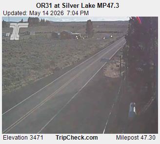
Fort Rock附近的网络摄像头
Fort Rock附近的城镇
- 本德79 公里外