Hausberg
486 米1,594 英尺
山 · 陶努斯山 · 德国
The Hausberg is a mountain with an elevation of 486 m next to Butzbach in Hesse, Germany. It is part of the Taunus mountain range and located at its easternmost part, bordering the fertile landscape of the Wetterau, which is of a much lower altitude.
来自Wikipedia,CC BY-SA · 阅读文章
山顶 · 13:00 的预报
13 °C少云 · 南风 16 km/h
 3D 查看
Hausberg山顶天气,486 米
- 13:0013 °C南 16 km/h–
- 16:0013 °C南 10 km/h–
- 19:009 °C南 11 km/h–
- 22:0010 °C西南 12 km/h0.7 mm
- 1:0010 °C西北 17 km/h2.4 mm
- 4:009 °C西 12 km/h–
- 7:008 °C西 15 km/h–
- 10:009 °C西北 15 km/h–
| 日期 | 天气 | 最高 / 最低 | 雨 | 最大风速 |
|---|---|---|---|---|
| 10月28日周三 | 少云 | 11 °C / 5 °C | 2.8 mm | 17 km/h |
| 10月29日周四 | 晴 | 11 °C / 3 °C | – | 7 km/h |
| 10月30日周五 | 晴 | 10 °C / 2 °C | – | 7 km/h |
| 10月31日周六 | 晴 | 9 °C / 2 °C | – | 7 km/h |
| 11月1日周日 | 少云 | 10 °C / 2 °C | – | 10 km/h |
| 11月2日周一 | 多云 | 9 °C / 5 °C | 0.1 mm | 13 km/h |
| 11月3日周二 | 多云 | 9 °C / 2 °C | 0.1 mm | 13 km/h |
预报来自 MET Norway(CC BY 4.0),更新于 GMT+1 10:22。时间均为当地时间。
基本信息
Hausberg (Taunus)
The Hausberg is a mountain with an elevation of 486 m next to Butzbach in Hesse, Germany. It is part of the Taunus mountain range and located at its easternmost part, bordering the fertile landscape of the Wetterau, which is of a much lower altitude. Therefore, the mountain is well situated for look-out and in 1873 a first lookout tower was erected on its top.
来自Wikipedia,CC BY-SA · 阅读文章
Hausberg附近的山峰
- Gickelsburg471 米 · 16 公里外地图上
- Roßkopf (Taunus)632 米 · 18 公里外地图上
- Herzberg591 米 · 18 公里外地图上
- Pferdskopf663 米 · 19 公里外地图上
- Wolfsküppel545 米 · 19 公里外地图上
- Bleibeskopf480 米 · 19 公里外地图上
- Kolbenberg690 米 · 21 公里外地图上
- Sängelberg665 米 · 22 公里外地图上
- Koberg461 米 · 22 公里外地图上
- Sommerberg461 米 · 22 公里外地图上
陶努斯山最高峰
- Großer Feldberg879 米地图上
- Langhals574 米地图上
- Dreibornsköpfe548 米地图上
- Hausberg486 米地图上
德国最高的山
Hausberg附近的网络摄像头
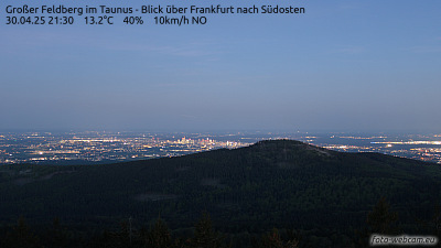
Hausberg周边的历史
Hausberg附近的城镇
- Butzbach4.7 公里外
- Bad Nauheim10 公里外
- Friedberg13 公里外
- Neu-Anspach13 公里外
- Friedrichsdorf18 公里外
- Wetzlar18 公里外