Hausberg
486 m1,594 ft
山 · タウヌス山地 · ドイツ
The Hausberg is a mountain with an elevation of 486 m next to Butzbach in Hesse, Germany. It is part of the Taunus mountain range and located at its easternmost part, bordering the fertile landscape of the Wetterau, which is of a much lower altitude.
出典: Wikipedia、CC BY-SA · 記事を読む
山頂 · 0:00 の予報
10 °C小雨 · 西の風 16 km/h
 3D で見る
Hausberg 山頂の天気(486 m)
- 0:0010 °C西 16 km/h0.3 mm
- 3:009 °C北西 16 km/h0.2 mm
- 6:009 °C北西 13 km/h–
- 9:008 °C西 14 km/h–
- 12:0011 °C北西 14 km/h–
- 15:0011 °C北西 12 km/h–
- 18:007 °C西 7 km/h–
- 21:006 °C西 4 km/h–
| 日付 | 天気 | 最高 / 最低 | 雨 | 最大風速 |
|---|---|---|---|---|
| 今日 | 晴れ | 11 °C / 5 °C | 0.5 mm | 17 km/h |
| 10月29日(木) | 晴れ時々曇り | 11 °C / 3 °C | – | 6 km/h |
| 10月30日(金) | 晴れ時々曇り | 10 °C / 2 °C | – | 10 km/h |
| 10月31日(土) | 晴れ時々曇り | 8 °C / 2 °C | – | 8 km/h |
| 11月1日(日) | 晴れ時々曇り | 9 °C / 1 °C | – | 8 km/h |
| 11月2日(月) | 曇り | 9 °C / 4 °C | 0.1 mm | 14 km/h |
| 11月3日(火) | 曇り | 8 °C / 3 °C | 0.5 mm | 14 km/h |
MET Norway(CC BY 4.0)による予報。20:17 GMT+1 更新。時刻は現地時間です。
基本データ
- 種類
- 山
- 標高
- 486 m (1,594 ft)
- プロミネンス
- 53 m (174 ft)
- 山脈
- タウヌス山地
- 国
- ドイツ
- 座標
- 50.411°N 8.615°E
Hausberg (Taunus)
The Hausberg is a mountain with an elevation of 486 m next to Butzbach in Hesse, Germany. It is part of the Taunus mountain range and located at its easternmost part, bordering the fertile landscape of the Wetterau, which is of a much lower altitude. Therefore, the mountain is well situated for look-out and in 1873 a first lookout tower was erected on its top.
出典: Wikipedia、CC BY-SA · 記事を読む
Hausberg周辺の山
- Gickelsburg471 m · 16 km先地図上
- Roßkopf (Taunus)632 m · 18 km先地図上
- Herzberg591 m · 18 km先地図上
- Pferdskopf663 m · 19 km先地図上
- Wolfsküppel545 m · 19 km先地図上
- Bleibeskopf480 m · 19 km先地図上
- Kolbenberg690 m · 21 km先地図上
- Sängelberg665 m · 22 km先地図上
- Koberg461 m · 22 km先地図上
- Sommerberg461 m · 22 km先地図上
タウヌス山地の最高峰
- グローサー・フェルトベルク879 m地図上
- Langhals574 m地図上
- Dreibornsköpfe548 m地図上
- Hausberg486 m地図上
ドイツの高い山
- ツークシュピッツェ2,962 m地図上
- Hochwanner2,744 m地図上
- Dreitorspitze2,682 m地図上
- ホッホカルター2,607 m地図上
- Biberkopf2,599 m地図上
- Großer Hundstod2,594 m地図上
- Hochvogel2,592 m地図上
- Östliche Karwendelspitze2,538 m地図上
- Hocheisspitze2,523 m地図上
- Hoher Göll2,522 m地図上
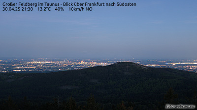
Hausberg周辺のライブカメラ
Hausberg周辺の歴史
Hausberg周辺の町
- Butzbach4.7 km先
- Bad Nauheim10 km先
- Friedberg13 km先
- Neu-Anspach13 km先
- Friedrichsdorf18 km先
- Wetzlar18 km先