德国的山
Hohe Wurzel
618 米2,027 英尺
山 · 陶努斯山 · 德国
Hohe Wurzel, at 618 m, is the highest peak in the Rheingau-Taunus-Kreis mountain range and the 2nd highest mountain near Wiesbaden, Hesse, Germany.
来自Wikipedia,CC BY-SA · 阅读文章
山顶 · 5:00 的预报
3 °C晴 · 东北风 2 km/h
 3D 查看
Hohe Wurzel山顶天气,618 米
- 5:003 °C东北 2 km/h–
- 8:004 °C东北 1 km/h–
- 11:009 °C东 3 km/h–
- 14:0011 °C东 6 km/h–
- 17:007 °C东北 5 km/h–
- 20:005 °C东北 6 km/h–
- 23:005 °C东北 6 km/h–
- 2:004 °C东北 7 km/h–
| 日期 | 天气 | 最高 / 最低 | 雨 | 最大风速 |
|---|---|---|---|---|
| 今天 | 晴 | 11 °C / 3 °C | – | 8 km/h |
| 10月30日周五 | 多云 | 10 °C / 2 °C | – | 14 km/h |
| 10月31日周六 | 多云 | 7 °C / 0 °C | – | 12 km/h |
| 11月1日周日 | 阴 | 7 °C / 2 °C | 0.1 mm | 11 km/h |
| 11月2日周一 | 阴 | 7 °C / -1 °C | 0.8 mm | 7 km/h |
| 11月3日周二 | 阴 | 6 °C / 4 °C | 0.7 mm | 15 km/h |
| 11月4日周三 | 晴 | 6 °C / -1 °C | – | 10 km/h |
预报来自 MET Norway(CC BY 4.0),更新于 GMT+1 02:17。时间均为当地时间。
基本信息
Hohe Wurzel (Taunus)
Mountain in Hesse, Germany
Hohe Wurzel, at 618 m, is the highest peak in the Rheingau-Taunus-Kreis mountain range and the 2nd highest mountain near Wiesbaden, Hesse, Germany. A 133 m reinforced concrete telecommunications tower is located on the peak, which supplies the Rhine Main area and other locations with digital television service as well as DAB and FM sound broadcasts.
来自Wikipedia,CC BY-SA · 阅读文章
Hohe Wurzel附近的山峰
- Neroberg245 米 · 7.4 公里外地图上
- Hohe Kanzel592 米 · 11 公里外地图上
- Kellerskopf474 米 · 11 公里外地图上
- Mappershainer Kopf548 米 · 12 公里外地图上
- Großer Lindenkopf499 米 · 17 公里外地图上
- Grauer Kopf543 米 · 17 公里外地图上
- Rossert516 米 · 20 公里外地图上
- Glaskopf687 米 · 24 公里外地图上
- Weilsberg701 米 · 25 公里外地图上
- Kleiner Feldberg825 米 · 26 公里外地图上
陶努斯山最高峰
- Großer Feldberg879 米地图上
- Hohe Wurzel618 米地图上
- Langhals574 米地图上
- Dreibornsköpfe548 米地图上
德国最高的山
Hohe Wurzel附近的网络摄像头


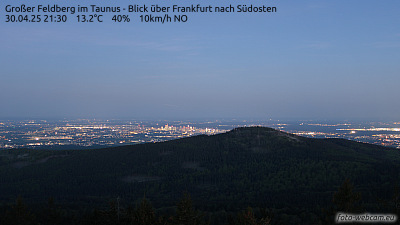

Hohe Wurzel周边的历史
Hohe Wurzel附近的城镇
- Taunusstein4.5 公里外
- 威斯巴登8.7 公里外
- Eltville9.3 公里外
- Idstein15 公里外
- Ingelheim am Rhein16 公里外
- 美因茨18 公里外