Hohe Wurzel
618 m2027 ft
Montaña · Cordillera del Taunus · Alemania
Hohe Wurzel, at 618 m, is the highest peak in the Rheingau-Taunus-Kreis mountain range and the 2nd highest mountain near Wiesbaden, Hesse, Germany.
De Wikipedia, CC BY-SA · Leer el artículo
En la cumbre · pronóstico para las 11:00
9 °CParcialmente nublado · viento de 14 km/h del NO
 Verla en 3D
Clima en la cumbre de Hohe Wurzel, 618 m
- 11:009 °CNO 14 km/h–
- 14:0011 °CNO 12 km/h–
- 17:008 °CNO 4 km/h–
- 20:004 °CN 3 km/h–
- 23:004 °CN 2 km/h–
- 2:003 °CN 3 km/h–
- 5:004 °CNE 1 km/h–
- 8:004 °CN 1 km/h–
| Día | Cielo | Máx. / mín. | Lluvia | Viento hasta |
|---|---|---|---|---|
| Hoy | Mayormente despejado | 11 °C / 4 °C | – | 14 km/h |
| jue, 29 oct | Parcialmente nublado | 11 °C / 3 °C | – | 8 km/h |
| vie, 30 oct | Parcialmente nublado | 10 °C / 3 °C | – | 14 km/h |
| sáb, 31 oct | Despejado | 9 °C / 2 °C | – | 9 km/h |
| dom, 1 nov | Parcialmente nublado | 9 °C / 1 °C | – | 6 km/h |
| lun, 2 nov | Nublado | 8 °C / 4 °C | 0,5 mm | 16 km/h |
| mar, 3 nov | Despejado | 7 °C / -0 °C | 0,1 mm | 11 km/h |
Pronóstico de MET Norway (CC BY 4.0), actualizado a las 09:19 CET. Horas locales.
Ficha técnica
- Tipo
- Montaña
- Altitud sobre el nivel del mar
- 618 m (2027 ft)
- Prominencia
- 173 m (568 ft)
- Cordillera
- Cordillera del Taunus
- País
- Alemania
- Coordenadas
- 50.112°N 8.129°E
- Fuente
- Wikidata, CC0
Hohe Wurzel (Taunus)
Mountain in Hesse, Germany
Hohe Wurzel, at 618 m, is the highest peak in the Rheingau-Taunus-Kreis mountain range and the 2nd highest mountain near Wiesbaden, Hesse, Germany. A 133 m reinforced concrete telecommunications tower is located on the peak, which supplies the Rhine Main area and other locations with digital television service as well as DAB and FM sound broadcasts.
De Wikipedia, CC BY-SA · Leer el artículo
Picos cerca de Hohe Wurzel
- Neroberg245 m · a 7,4 kmEn el mapa
- Hohe Kanzel592 m · a 11 kmEn el mapa
- Kellerskopf474 m · a 11 kmEn el mapa
- Mappershainer Kopf548 m · a 12 kmEn el mapa
- Großer Lindenkopf499 m · a 17 kmEn el mapa
- Grauer Kopf543 m · a 17 kmEn el mapa
- Rossert516 m · a 20 kmEn el mapa
- Glaskopf687 m · a 24 kmEn el mapa
- Weilsberg701 m · a 25 kmEn el mapa
- Kleiner Feldberg825 m · a 26 kmEn el mapa
Los más altos de Cordillera del Taunus
- Großer Feldberg879 mEn el mapa
- Hohe Wurzel618 mEn el mapa
- Langhals574 mEn el mapa
- Dreibornsköpfe548 mEn el mapa
Montañas más altas de Alemania
- Zugspitze2962 mEn el mapa
- Hochwanner2744 mEn el mapa
- Dreitorspitze2682 mEn el mapa
- Hochkalter2607 mEn el mapa
- Biberkopf2599 mEn el mapa
- Großer Hundstod2594 mEn el mapa
- Hochvogel2592 mEn el mapa
- Östliche Karwendelspitze2538 mEn el mapa
- Hocheisspitze2523 mEn el mapa
- Hoher Göll2522 mEn el mapa
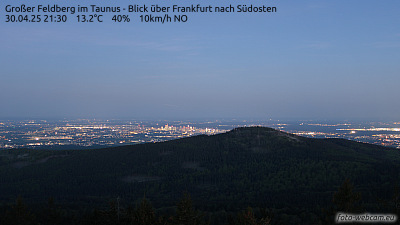
Cámaras web cerca de Hohe Wurzel



Historia alrededor de Hohe Wurzel
Ciudades cerca de Hohe Wurzel
- Taunussteina 4,5 km
- Wiesbadena 8,7 km
- Eltvillea 9,3 km
- Idsteina 15 km
- Ingelheim am Rheina 16 km
- Magunciaa 18 km