德国的山
Neunkircher Höhe
605 米1,985 英尺
山 · 奥登林山 · 德国
The Neunkircher Höhe is the highest elevation of the Hessian part of the Odenwald. The hill is located near the village Neunkirchen and is the origin of the rivers Modau, Gersprenz and Lauter.
来自Wikipedia,CC BY-SA · 阅读文章
Vorderer Odenwald的最高点
山顶 · 21:00 的预报
10 °C少云 · 南风 12 km/h
 3D 查看
Neunkircher Höhe山顶天气,605 米
- 21:0010 °C南 12 km/h–
- 0:009 °C西南 11 km/h0.7 mm
- 3:009 °C西北 13 km/h0.7 mm
- 6:008 °C西 12 km/h–
- 9:007 °C西北 12 km/h–
- 12:0010 °C西北 10 km/h–
- 15:0011 °C西北 11 km/h–
- 18:007 °C北 5 km/h–
| 日期 | 天气 | 最高 / 最低 | 雨 | 最大风速 |
|---|---|---|---|---|
| 10月28日周三 | 少云 | 11 °C / 5 °C | 1.4 mm | 14 km/h |
| 10月29日周四 | 晴 | 11 °C / 3 °C | – | 11 km/h |
| 10月30日周五 | 晴 | 10 °C / 2 °C | – | 12 km/h |
| 10月31日周六 | 阴 | 7 °C / 3 °C | – | 14 km/h |
| 11月1日周日 | 多云 | 9 °C / 1 °C | – | 10 km/h |
| 11月2日周一 | 阴 | 6 °C / 2 °C | 0.2 mm | 7 km/h |
| 11月3日周二 | 小雨 | 6 °C / 1 °C | 1.1 mm | 9 km/h |
预报来自 MET Norway(CC BY 4.0),更新于 GMT+1 18:17。时间均为当地时间。
基本信息
Neunkircher Höhe附近的山峰
- Krehberg576 米 · 4.8 公里外地图上
- Melibokus517 米 · 9.6 公里外地图上
- Tromm577 米 · 13 公里外地图上
- Otzberg368 米 · 15 公里外地图上
- Stiefelhöhe587 米 · 22 公里外地图上
- Weißer Stein548 米 · 30 公里外地图上
- Heiligenberg440 米 · 33 公里外地图上
- Katzenbuckel626 米 · 34 公里外地图上
- 王座山570 米 · 35 公里外地图上
- Schanzenkopf343 米 · 45 公里外地图上
奥登林山最高峰
- Neunkircher Höhe605 米地图上
- Markgrafenwald585 米地图上
- 王座山570 米地图上
- Krähberg555 米地图上
- Gickelsberg554 米地图上
德国最高的山
Neunkircher Höhe附近的网络摄像头



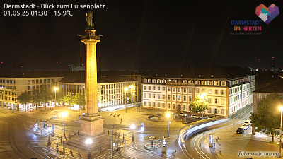
Neunkircher Höhe周边的历史
Neunkircher Höhe附近的城镇
- Seeheim-Jugenheim9.9 公里外
- Bensheim12 公里外
- Ober-Ramstadt13 公里外
- Reinheim13 公里外
- Heppenheim an der Bergstrasse13 公里外
- Pfungstadt15 公里外