Montagnes de Allemagne
Neunkircher Höhe
605 m1 985 ft
Montagne · Odenwald · Allemagne
The Neunkircher Höhe is the highest elevation of the Hessian part of the Odenwald. The hill is located near the village Neunkirchen and is the origin of the rivers Modau, Gersprenz and Lauter.
Source : Wikipedia, CC BY-SA · Lire l’article
Le point culminant de Vorderer Odenwald
Au sommet · prévision pour 23:00
10 °CNuageux · vent 13 km/h du SO
 Voir en 3D
Météo au sommet : Neunkircher Höhe, 605 m
- 23:0010 °CSO 13 km/h0,3 mm
- 2:009 °CO 13 km/h1,1 mm
- 5:008 °CNO 10 km/h–
- 8:007 °CNO 13 km/h–
- 11:009 °CNO 11 km/h–
- 14:0011 °CNO 10 km/h–
- 17:008 °CNO 5 km/h–
- 20:006 °CNE 4 km/h–
| Jour | Ciel | Max. / min. | Pluie | Vent jusqu’à |
|---|---|---|---|---|
| mer. 28 oct. | Plutôt dégagé | 11 °C / 5 °C | 1,4 mm | 14 km/h |
| jeu. 29 oct. | Dégagé | 11 °C / 3 °C | – | 11 km/h |
| ven. 30 oct. | Dégagé | 10 °C / 2 °C | – | 12 km/h |
| sam. 31 oct. | Nuageux | 7 °C / 3 °C | – | 14 km/h |
| dim. 1 nov. | Partiellement nuageux | 9 °C / 1 °C | – | 10 km/h |
| lun. 2 nov. | Nuageux | 6 °C / 2 °C | 0,2 mm | 7 km/h |
| mar. 3 nov. | Pluie faible | 6 °C / 1 °C | 1,1 mm | 9 km/h |
Prévisions de MET Norway (CC BY 4.0), mises à jour à 18:17 UTC+1. Heures locales.
Fiche technique
- Type
- Montagne
- Altitude
- 605 m (1 985 ft)
- Proéminence
- 332 m (1 089 ft)
- Massif
- Odenwald
- Pays
- Allemagne
- Point culminant de
- Vorderer Odenwald
- Coordonnées
- 49.719°N 8.770°E
- Source
- Wikidata, CC0
Sommets près de Neunkircher Höhe
- Krehberg576 m · à 4,8 kmSur la carte
- Melibokus517 m · à 9,6 kmSur la carte
- Tromm577 m · à 13 kmSur la carte
- Otzberg368 m · à 15 kmSur la carte
- Stiefelhöhe587 m · à 22 kmSur la carte
- Weißer Stein548 m · à 30 kmSur la carte
- Heiligenberg440 m · à 33 kmSur la carte
- Katzenbuckel626 m · à 34 kmSur la carte
- Königstuhl570 m · à 35 kmSur la carte
- Schanzenkopf343 m · à 45 kmSur la carte
Les plus hauts : Odenwald
- Neunkircher Höhe605 mSur la carte
- Markgrafenwald585 mSur la carte
- Königstuhl570 mSur la carte
- Krähberg555 mSur la carte
- Gickelsberg554 mSur la carte
Plus hautes montagnes : Allemagne
- Zugspitze2 962 mSur la carte
- Hochwanner2 744 mSur la carte
- Dreitorspitze2 682 mSur la carte
- Hochkalter2 607 mSur la carte
- Biberkopf2 599 mSur la carte
- Grosser Hundstod2 594 mSur la carte
- Hochvogel2 592 mSur la carte
- Östliche Karwendelspitze2 538 mSur la carte
- Hocheisspitze2 523 mSur la carte
- Hoher Göll2 522 mSur la carte
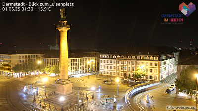
Webcams près de Neunkircher Höhe



Histoire autour de Neunkircher Höhe
Villes près de Neunkircher Höhe
- Seeheim-Jugenheimà 9,9 km
- Bensheimà 12 km
- Ober-Ramstadtà 13 km
- Reinheimà 13 km
- Heppenheim an der Bergstrasseà 13 km
- Pfungstadtà 15 km