Bernhartshöhe
549 م1,801 قدم
جبل · ألمانيا
The Bernhartshöhe is an artificial mountain of 549 m (1,801 ft) in the Stuttgart-Vaihingen Part of Stuttgart, covering the southwesternmost part of the city of Stuttgart, capital of the German Bundesland (state) of Baden-Württemberg. It is the city's highest point of elevation.
من Wikipedia، CC BY-SA · اقرأ المقال
على القمة · توقعات الساعة 12:00 م
11 °Cصافٍ غالبًا · رياح 13 km/h من شمالية غربية
 شاهده بالأبعاد الثلاثية
الطقس على قمة Bernhartshöhe، 549 م
- 12:00 م11 °Cشمالية غربية 13 km/h–
- 3:00 م11 °Cشمالية غربية 12 km/h–
- 6:00 م7 °Cشمالية غربية 6 km/h–
- 9:00 م6 °Cشمالية غربية 5 km/h–
- 12:00 ص5 °Cشمالية 3 km/h–
- 3:00 ص4 °Cغربية 2 km/h–
- 6:00 ص2 °Cجنوبية شرقية 5 km/h–
- 9:00 ص4 °Cشمالية شرقية 4 km/h–
| التاريخ | حالة السماء | العظمى / الصغرى | مطر | الرياح حتى |
|---|---|---|---|---|
| الخميس، 29 أكتوبر | صافٍ | 11 °C / 2 °C | – | 12 km/h |
| الجمعة، 30 أكتوبر | صافٍ | 11 °C / 1 °C | – | 13 km/h |
| السبت، 31 أكتوبر | صافٍ غالبًا | 9 °C / 2 °C | – | 11 km/h |
| الأحد، 1 نوفمبر | غائم جزئيًا | 9 °C / 3 °C | – | 11 km/h |
| الاثنين، 2 نوفمبر | غائم | 6 °C / 3 °C | 0.6 mm | 8 km/h |
| الثلاثاء، 3 نوفمبر | صافٍ غالبًا | 6 °C / 3 °C | 0.9 mm | 11 km/h |
| الأربعاء، 4 نوفمبر | غائم | 7 °C / 0 °C | – | 6 km/h |
التوقعات من MET Norway (CC BY 4.0)، آخر تحديث 10:22 ص غرينتش+1. الأوقات بالتوقيت المحلي.
حقائق
- النوع
- جبل
- الارتفاع عن سطح البحر
- 549 م (1,801 قدم)
- الدولة
- ألمانيا
- إحداثيات
- 48.729°N 9.065°E
- المصدر
- ويكي بيانات، CC0
Bernhartshöhe
The Bernhartshöhe is an artificial mountain of 549 m (1,801 ft) in the Stuttgart-Vaihingen Part of Stuttgart, covering the southwesternmost part of the city of Stuttgart, capital of the German Bundesland (state) of Baden-Württemberg. It is the city's highest point of elevation. Bernhartshöhe is directly adjacent to the crossing of the A 8 and A 81 motorways, two crucial traffic arteries of Southern Germany.
من Wikipedia، CC BY-SA · اقرأ المقال
قمم قرب Bernhartshöhe
- Birkenkopf511 م · على بعد 6.4 كمعلى الخريطة
- Grüner Heiner395 م · على بعد 12 كمعلى الخريطة
- جبل فورتمبيرغ411 م · على بعد 16 كمعلى الخريطة
- Jusi673 م · على بعد 28 كمعلى الخريطة
- Haselstein448 م · على بعد 29 كمعلى الخريطة
- Achalm707 م · على بعد 29 كمعلى الخريطة
- Hohenbol602 م · على بعد 33 كمعلى الخريطة
- Teckberg775 م · على بعد 34 كمعلى الخريطة
- Runder Berg711 م · على بعد 35 كمعلى الخريطة
- Roßberg870 م · على بعد 35 كمعلى الخريطة
أعلى الجبال في ألمانيا
- قمة تسوغشبيتسه2,962 معلى الخريطة
- Hochwanner2,744 معلى الخريطة
- Dreitorspitze2,682 معلى الخريطة
- Hochkalter2,607 معلى الخريطة
- Biberkopf2,599 معلى الخريطة
- Großer Hundstod2,594 معلى الخريطة
- Hochvogel2,592 معلى الخريطة
- Östliche Karwendelspitze2,538 معلى الخريطة
- Hocheisspitze2,523 معلى الخريطة
- Hoher Göll2,522 معلى الخريطة
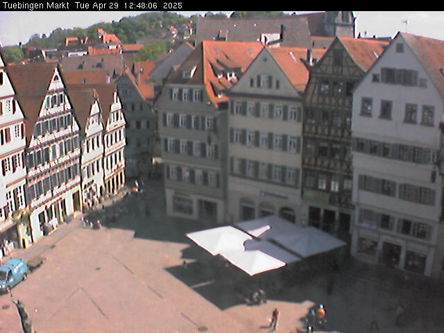
كاميرات ويب قرب Bernhartshöhe



التاريخ حول Bernhartshöhe
- Blood court at Cannstatt746
- The 1993 World Horticultural Exposition begins in Stuttgart1993
- Battle of Böblingen1525
- Battle of Döffingen1388
- 2020 Stuttgart Riots and Looting2020
- Kongsvinger IL draws with Juventus FC in the 1993–94 UEFA Cup, although Juventus wins over two rounds on aggregate1993
- Eisenbahnunfall von Esslingen1961
- Amokfahrt von Stuttgart und Möglingen1949
مدن قرب Bernhartshöhe
- Sindelfingenعلى بعد 4.8 كم
- Böblingenعلى بعد 6.5 كم
- Gerlingenعلى بعد 7.9 كم
- Leinfelden-Echterdingenعلى بعد 8.5 كم
- Leonbergعلى بعد 8.7 كم
- Stuttgartعلى بعد 10 كم