Bernhartshöhe
549 m1 801 ft
Montagne · Allemagne
The Bernhartshöhe is an artificial mountain of 549 m (1,801 ft) in the Stuttgart-Vaihingen Part of Stuttgart, covering the southwesternmost part of the city of Stuttgart, capital of the German Bundesland (state) of Baden-Württemberg. It is the city's highest point of elevation.
Source : Wikipedia, CC BY-SA · Lire l’article
Au sommet · prévision pour 1:00
8 °CNuageux · vent 9 km/h du SO
 Voir en 3D
Météo au sommet : Bernhartshöhe, 549 m
- 1:008 °CSO 9 km/h–
- 4:0010 °CO 9 km/h1,5 mm
- 7:009 °CNO 15 km/h0,1 mm
- 10:0010 °CNO 12 km/h–
- 13:0012 °CNO 12 km/h–
- 16:0011 °CNO 8 km/h–
- 19:007 °CN 4 km/h–
- 22:006 °CNO 3 km/h–
| Jour | Ciel | Max. / min. | Pluie | Vent jusqu’à |
|---|---|---|---|---|
| Aujourd’hui | Plutôt dégagé | 12 °C / 5 °C | 1,6 mm | 17 km/h |
| jeu. 29 oct. | Plutôt dégagé | 11 °C / 3 °C | – | 12 km/h |
| ven. 30 oct. | Dégagé | 10 °C / 2 °C | – | 14 km/h |
| sam. 31 oct. | Plutôt dégagé | 10 °C / 2 °C | – | 13 km/h |
| dim. 1 nov. | Nuageux | 7 °C / 1 °C | – | 8 km/h |
| lun. 2 nov. | Nuageux | 7 °C / -0 °C | 0,5 mm | 6 km/h |
| mar. 3 nov. | Partiellement nuageux | 6 °C / 4 °C | 0,6 mm | 9 km/h |
Prévisions de MET Norway (CC BY 4.0), mises à jour à 20:17 UTC+1. Heures locales.
Fiche technique
- Type
- Montagne
- Altitude
- 549 m (1 801 ft)
- Pays
- Allemagne
- Coordonnées
- 48.729°N 9.065°E
- Source
- Wikidata, CC0
Bernhartshöhe
The Bernhartshöhe is an artificial mountain of 549 m (1,801 ft) in the Stuttgart-Vaihingen Part of Stuttgart, covering the southwesternmost part of the city of Stuttgart, capital of the German Bundesland (state) of Baden-Württemberg. It is the city's highest point of elevation. Bernhartshöhe is directly adjacent to the crossing of the A 8 and A 81 motorways, two crucial traffic arteries of Southern Germany.
Source : Wikipedia, CC BY-SA · Lire l’article
Sommets près de Bernhartshöhe
- Birkenkopf511 m · à 6,4 kmSur la carte
- Grüner Heiner395 m · à 12 kmSur la carte
- Württemberg411 m · à 16 kmSur la carte
- Jusi673 m · à 28 kmSur la carte
- Haselstein448 m · à 29 kmSur la carte
- Achalm707 m · à 29 kmSur la carte
- Hohenbol602 m · à 33 kmSur la carte
- Teckberg775 m · à 34 kmSur la carte
- Runder Berg711 m · à 35 kmSur la carte
- Roßberg870 m · à 35 kmSur la carte
Plus hautes montagnes : Allemagne
- Zugspitze2 962 mSur la carte
- Hochwanner2 744 mSur la carte
- Dreitorspitze2 682 mSur la carte
- Hochkalter2 607 mSur la carte
- Biberkopf2 599 mSur la carte
- Grosser Hundstod2 594 mSur la carte
- Hochvogel2 592 mSur la carte
- Östliche Karwendelspitze2 538 mSur la carte
- Hocheisspitze2 523 mSur la carte
- Hoher Göll2 522 mSur la carte
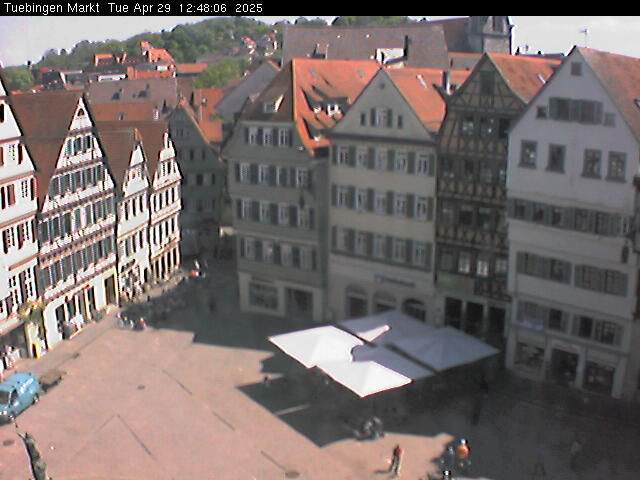
Webcams près de Bernhartshöhe



Histoire autour de Bernhartshöhe
- Blood court at Cannstatt746
- The 1993 World Horticultural Exposition begins in Stuttgart1993
- Battle of Böblingen1525
- Battle of Döffingen1388
- 2020 Stuttgart Riots and Looting2020
- Kongsvinger IL draws with Juventus FC in the 1993–94 UEFA Cup, although Juventus wins over two rounds on aggregate1993
- Eisenbahnunfall von Esslingen1961
- Amokfahrt von Stuttgart und Möglingen1949
Villes près de Bernhartshöhe
- Sindelfingenà 4,8 km
- Böblingenà 6,5 km
- Gerlingenà 7,9 km
- Leinfelden-Echterdingenà 8,5 km
- Leonbergà 8,7 km
- Stuttgartà 10 km