Hinterreintalschrofen
2,669 م8,757 قدم
جبل · Wetterstein · ألمانيا
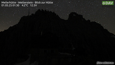
The Hinterreintalschrofen is a 2,669 m high peak on the main, east–west oriented crest of the Wetterstein Mountains in the Eastern Alps. It is a massive and dominant mountain with a high rock face that plunges into the Reintal valley to the north and stamps the appearance of the Wetterstein when seen from the north.
من Wikipedia، CC BY-SA · اقرأ المقال
على القمة · توقعات الساعة 3:00 م
8 °Cصافٍ · رياح 5 km/h من شمالية شرقية
 شاهده بالأبعاد الثلاثية
الطقس على قمة Hinterreintalschrofen، 2,669 م
- 3:00 م8 °Cشمالية شرقية 5 km/h–
- 6:00 م1 °Cشمالية 2 km/h–
- 9:00 م-1 °Cغربية 2 km/h–
- 12:00 ص-3 °Cجنوبية غربية 4 km/h–
- 3:00 ص-4 °Cجنوبية غربية 3 km/h–
- 6:00 ص-5 °Cجنوبية غربية 4 km/h–
- 9:00 ص-2 °Cجنوبية غربية 5 km/h0.4 mm
- 12:00 م0 °Cشمالية 6 km/h2.4 mm
| التاريخ | حالة السماء | العظمى / الصغرى | مطر | الرياح حتى |
|---|---|---|---|---|
| الأربعاء، 28 أكتوبر | ثلج | 1 °C / -5 °C | 5.5 mm | 8 km/h |
| الخميس، 29 أكتوبر | صافٍ | 1 °C / -6 °C | – | 8 km/h |
| الجمعة، 30 أكتوبر | صافٍ | 2 °C / -10 °C | – | 6 km/h |
| السبت، 31 أكتوبر | صافٍ | 2 °C / -10 °C | – | 5 km/h |
| الأحد، 1 نوفمبر | صافٍ | 1 °C / -10 °C | – | 5 km/h |
| الاثنين، 2 نوفمبر | صافٍ | -3 °C / -10 °C | 0.3 mm | 7 km/h |
| الثلاثاء، 3 نوفمبر | صافٍ غالبًا | -3 °C / -8 °C | 3.2 mm | 7 km/h |
التوقعات من MET Norway (CC BY 4.0)، آخر تحديث 12:19 م غرينتش+1. الأوقات بالتوقيت المحلي.
حقائق
- النوع
- جبل
- الارتفاع عن سطح البحر
- 2,669 م (8,757 قدم)
- البروز
- 110 م (361 قدم)
- السلسلة الجبلية
- Wetterstein
- الدولة
- ألمانيا
- أول صعود
- سبتمبر 1871
- إحداثيات
- 47.396°N 11.076°E
- المصدر
- ويكي بيانات، CC0
Hinterreintalschrofen
Peak in the Eastern Alps
The Hinterreintalschrofen is a 2,669 m high peak on the main, east–west oriented crest of the Wetterstein Mountains in the Eastern Alps. It is a massive and dominant mountain with a high rock face that plunges into the Reintal valley to the north and stamps the appearance of the Wetterstein when seen from the north. In spite of that, the mountain is rarely climbed.
من Wikipedia، CC BY-SA · اقرأ المقال
قمم قرب Hinterreintalschrofen
- Hochwanner2,744 م · على بعد 1.5 كمعلى الخريطة
- قمة تسوغشبيتسه2,962 م · على بعد 7.3 كمعلى الخريطة
- Schneefernerkopf2,874 م · على بعد 8.1 كمعلى الخريطة
- Daniel2,340 م · على بعد 15 كمعلى الخريطة
- Nordkette2,637 م · على بعد 23 كمعلى الخريطة
- Thaneller2,341 م · على بعد 27 كمعلى الخريطة
- Birkkarspitze2,749 م · على بعد 27 كمعلى الخريطة
- Bergisel746 م · على بعد 30 كمعلى الخريطة
- Gehrenspitze2,163 م · على بعد 34 كمعلى الخريطة
- Kellenspitze2,238 م · على بعد 35 كمعلى الخريطة
الأعلى في Wetterstein
- قمة تسوغشبيتسه2,962 معلى الخريطة
- Hochwanner2,744 معلى الخريطة
- Dreitorspitze2,682 معلى الخريطة
- Hinterreintalschrofen2,669 معلى الخريطة
- Hohe Munde2,662 معلى الخريطة
- Wannig2,493 معلى الخريطة
- Tschirgant2,370 معلى الخريطة
أعلى الجبال في ألمانيا
- قمة تسوغشبيتسه2,962 معلى الخريطة
- Hochwanner2,744 معلى الخريطة
- Dreitorspitze2,682 معلى الخريطة
- Hinterreintalschrofen2,669 معلى الخريطة
- Hochkalter2,607 معلى الخريطة
- Biberkopf2,599 معلى الخريطة
- Großer Hundstod2,594 معلى الخريطة
- Hochvogel2,592 معلى الخريطة
- Östliche Karwendelspitze2,538 معلى الخريطة
- Hocheisspitze2,523 معلى الخريطة