Hinterreintalschrofen
2.669 m8.757 ft
Dağ · Wetterstein · Almanya
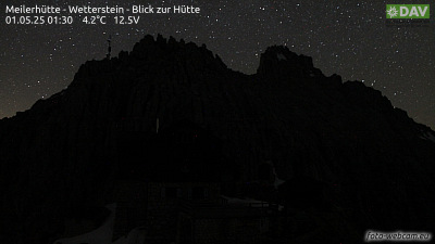
The Hinterreintalschrofen is a 2,669 m high peak on the main, east–west oriented crest of the Wetterstein Mountains in the Eastern Alps. It is a massive and dominant mountain with a high rock face that plunges into the Reintal valley to the north and stamps the appearance of the Wetterstein when seen from the north.
Kaynak: Wikipedia, CC BY-SA · Makaleyi oku
Zirvede · 14:00 tahmini
9 °CAçık · rüzgâr D yönünden 4 km/sa
 3D olarak gör
Hinterreintalschrofen zirvesinde hava durumu, 2.669 m
- 14:009 °CD 4 km/sa–
- 17:003 °CK 3 km/sa–
- 20:00-1 °CB 2 km/sa–
- 23:00-2 °CGB 3 km/sa–
- 2:00-4 °CGB 3 km/sa–
- 5:00-4 °CB 3 km/sa–
- 8:00-3 °CGB 6 km/sa–
- 11:001 °CK 5 km/sa2,1 mm
| Gün | Gökyüzü | En yüksek / en düşük | Yağmur | Maks. rüzgâr |
|---|---|---|---|---|
| 28 Eki Çar | Kar | 1 °C / -5 °C | 5,5 mm | 8 km/sa |
| 29 Eki Per | Açık | 1 °C / -6 °C | – | 8 km/sa |
| 30 Eki Cum | Açık | 2 °C / -10 °C | – | 6 km/sa |
| 31 Eki Cmt | Açık | 2 °C / -10 °C | – | 5 km/sa |
| 1 Kas Paz | Açık | 1 °C / -10 °C | – | 5 km/sa |
| 2 Kas Pzt | Açık | -3 °C / -10 °C | 0,3 mm | 7 km/sa |
| 3 Kas Sal | Az bulutlu | -3 °C / -8 °C | 3,2 mm | 7 km/sa |
Tahmin: MET Norway (CC BY 4.0), güncelleme 12:19 GMT+1. Saatler yerel saattir.
Temel bilgiler
- Türü
- Dağ
- Deniz seviyesinden yükseklik
- 2.669 m (8.757 ft)
- Doruk yüksekliği (prominens)
- 110 m (361 ft)
- Sıradağ
- Wetterstein
- Ülke
- Almanya
- İlk tırmanış
- Eylül 1871
- Koordinatlar
- 47.396°N 11.076°E
- Kaynak
- Wikidata, CC0
Hinterreintalschrofen
Peak in the Eastern Alps
The Hinterreintalschrofen is a 2,669 m high peak on the main, east–west oriented crest of the Wetterstein Mountains in the Eastern Alps. It is a massive and dominant mountain with a high rock face that plunges into the Reintal valley to the north and stamps the appearance of the Wetterstein when seen from the north. In spite of that, the mountain is rarely climbed.
Kaynak: Wikipedia, CC BY-SA · Makaleyi oku
Hinterreintalschrofen yakınındaki zirveler
- Hochwanner2.744 m · 1,5 km uzaktaHaritada
- Zugspitze Dağı2.962 m · 7,3 km uzaktaHaritada
- Schneefernerkopf2.874 m · 8,1 km uzaktaHaritada
- Daniel2.340 m · 15 km uzaktaHaritada
- Nordkette2.637 m · 23 km uzaktaHaritada
- Thaneller2.341 m · 27 km uzaktaHaritada
- Birkkarspitze2.749 m · 27 km uzaktaHaritada
- Bergisel746 m · 30 km uzaktaHaritada
- Gehrenspitze2.163 m · 34 km uzaktaHaritada
- Kellenspitze2.238 m · 35 km uzaktaHaritada
Wetterstein içinde en yüksekler
- Zugspitze Dağı2.962 mHaritada
- Hochwanner2.744 mHaritada
- Dreitorspitze2.682 mHaritada
- Hinterreintalschrofen2.669 mHaritada
- Hohe Munde2.662 mHaritada
- Wannig2.493 mHaritada
- Tschirgant2.370 mHaritada
Almanya en yüksek dağları
- Zugspitze Dağı2.962 mHaritada
- Hochwanner2.744 mHaritada
- Dreitorspitze2.682 mHaritada
- Hinterreintalschrofen2.669 mHaritada
- Hochkalter2.607 mHaritada
- Biberkopf2.599 mHaritada
- Großer Hundstod2.594 mHaritada
- Hochvogel2.592 mHaritada
- Östliche Karwendelspitze2.538 mHaritada
- Hocheisspitze2.523 mHaritada