Hinterreintalschrofen
2669 m8757 ft
Montaña · Montes de Mieming y del Wetterstein · Alemania
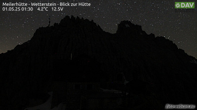
The Hinterreintalschrofen is a 2,669 m high peak on the main, east–west oriented crest of the Wetterstein Mountains in the Eastern Alps. It is a massive and dominant mountain with a high rock face that plunges into the Reintal valley to the north and stamps the appearance of the Wetterstein when seen from the north.
De Wikipedia, CC BY-SA · Leer el artículo
En la cumbre · pronóstico para las 14:00
-1 °CNieve · viento de 8 km/h del N
 Verla en 3D
Clima en la cumbre de Hinterreintalschrofen, 2669 m
- 14:00-1 °CN 8 km/h1,4 mm
- 17:00-2 °CN 6 km/h1 mm
- 20:00-3 °CN 6 km/h0,6 mm
- 23:00-4 °CN 5 km/h0,1 mm
- 2:00-5 °CNE 5 km/h–
- 5:00-5 °CNE 4 km/h–
- 8:00-5 °CSE 4 km/h–
- 11:00-1 °CNE 5 km/h–
| Día | Cielo | Máx. / mín. | Lluvia | Viento hasta |
|---|---|---|---|---|
| jue, 29 oct | Mayormente despejado | 0 °C / -8 °C | – | 8 km/h |
| vie, 30 oct | Despejado | 1 °C / -10 °C | – | 8 km/h |
| sáb, 31 oct | Despejado | 2 °C / -10 °C | – | 6 km/h |
| dom, 1 nov | Mayormente despejado | -3 °C / -9 °C | – | 7 km/h |
| lun, 2 nov | Nieve | -7 °C / -9 °C | 12 mm | 6 km/h |
| mar, 3 nov | Nublado | -8 °C / -10 °C | 1,7 mm | 5 km/h |
| mié, 4 nov | Despejado | -4 °C / -11 °C | 0,1 mm | 5 km/h |
Pronóstico de MET Norway (CC BY 4.0), actualizado a las 02:17 CET. Horas locales.
Ficha técnica
- Tipo
- Montaña
- Altitud sobre el nivel del mar
- 2669 m (8757 ft)
- Prominencia
- 110 m (361 ft)
- Cordillera
- Montes de Mieming y del Wetterstein
- País
- Alemania
- Primer ascenso
- septiembre de 1871
- Coordenadas
- 47.396°N 11.076°E
- Fuente
- Wikidata, CC0
Hinterreintalschrofen
Peak in the Eastern Alps
The Hinterreintalschrofen is a 2,669 m high peak on the main, east–west oriented crest of the Wetterstein Mountains in the Eastern Alps. It is a massive and dominant mountain with a high rock face that plunges into the Reintal valley to the north and stamps the appearance of the Wetterstein when seen from the north. In spite of that, the mountain is rarely climbed.
De Wikipedia, CC BY-SA · Leer el artículo
Picos cerca de Hinterreintalschrofen
- Hochwanner2744 m · a 1,5 kmEn el mapa
- Zugspitze2962 m · a 7,3 kmEn el mapa
- Schneefernerkopf2874 m · a 8,1 kmEn el mapa
- Daniel2340 m · a 15 kmEn el mapa
- Nordkette2637 m · a 23 kmEn el mapa
- Thaneller2341 m · a 27 kmEn el mapa
- Birkkarspitze2749 m · a 27 kmEn el mapa
- Bergisel746 m · a 30 kmEn el mapa
- Gehrenspitze (Alpes de Allgäu)2163 m · a 34 kmEn el mapa
- Kellenspitze2238 m · a 35 kmEn el mapa
Los más altos de Montes de Mieming y del Wetterstein
- Zugspitze2962 mEn el mapa
- Hochwanner2744 mEn el mapa
- Dreitorspitze2682 mEn el mapa
- Hinterreintalschrofen2669 mEn el mapa
- Hohe Munde2662 mEn el mapa
- Wannig2493 mEn el mapa
- Tschirgant2370 mEn el mapa
Montañas más altas de Alemania
- Zugspitze2962 mEn el mapa
- Hochwanner2744 mEn el mapa
- Dreitorspitze2682 mEn el mapa
- Hinterreintalschrofen2669 mEn el mapa
- Hochkalter2607 mEn el mapa
- Biberkopf2599 mEn el mapa
- Großer Hundstod2594 mEn el mapa
- Hochvogel2592 mEn el mapa
- Östliche Karwendelspitze2538 mEn el mapa
- Hocheisspitze2523 mEn el mapa