Montañas de Alemania
Grundübelhörner
2096 m6877 ft
Montaña · Reiter Alpe · Alemania
Die Grundübelhörner sind zwei Gipfel der Reiter Alm in den Berchtesgadener Alpen. Sie liegen östlich von Stadelhorn und den Mühlsturzhörnern im oberbayrischen Landkreis Berchtesgadener Land, unweit der Grenze zwischen Bayern und Salzburg.
De Wikipedia en alemán, CC BY-SA · Leer el artículo
En la cumbre · pronóstico para las 22:00
-0 °CNieve débil · viento de 7 km/h del NO
 Verla en 3D
Clima en la cumbre de Grundübelhörner, 2096 m
- 22:00-0 °CNO 7 km/h0,3 mm
- 1:00-1 °CNO 6 km/h–
- 4:00-2 °CO 5 km/h–
- 7:00-3 °CS 2 km/h–
- 10:00-0 °CNE 3 km/h–
- 13:001 °CNE 6 km/h–
- 16:000 °CNE 6 km/h–
- 19:00-2 °CE 3 km/h–
| Día | Cielo | Máx. / mín. | Lluvia | Viento hasta |
|---|---|---|---|---|
| jue, 29 oct | Nublado | 1 °C / -3 °C | – | 7 km/h |
| vie, 30 oct | Parcialmente nublado | 2 °C / -7 °C | – | 11 km/h |
| sáb, 31 oct | Despejado | 1 °C / -6 °C | 0,2 mm | 6 km/h |
| dom, 1 nov | Nieve débil | -5 °C / -6 °C | 7,8 mm | 5 km/h |
| lun, 2 nov | Nublado | -5 °C / -6 °C | 0,8 mm | 5 km/h |
| mar, 3 nov | Nublado | -5 °C / -7 °C | 1,5 mm | 8 km/h |
| mié, 4 nov | Despejado | -1 °C / -10 °C | – | 3 km/h |
Pronóstico de MET Norway (CC BY 4.0), actualizado a las 14:17 CET. Horas locales.
Ficha técnica
- Tipo
- Montaña
- Altitud sobre el nivel del mar
- 2096 m (6877 ft)
- Cordillera
- Reiter Alpe
- País
- Alemania
- Coordenadas
- 47.593°N 12.807°E
- Fuente
- Wikidata, CC0
Picos cerca de Grundübelhörner
- Stadelhorn2286 m · a 0,9 kmEn el mapa
- Schottmalhorn1982 m · a 2,8 kmEn el mapa
- Hochkalter2607 m · a 5,1 kmEn el mapa
- Großer Hundstod2594 m · a 11 kmEn el mapa
- Karkopf1738 m · a 12 kmEn el mapa
- Großes Ochsenhorn2511 m · a 13 kmEn el mapa
- Sonntagshorn1961 m · a 13 kmEn el mapa
- Birnhorn2634 m · a 14 kmEn el mapa
- Persailhorn2347 m · a 16 kmEn el mapa
- Breithorn2504 m · a 17 kmEn el mapa
Los más altos de Reiter Alpe
- Stadelhorn2286 mEn el mapa
- Grundübelhörner2096 mEn el mapa
- Großer Weitschartenkopf1979 mEn el mapa
Montañas más altas de Alemania
- Zugspitze2962 mEn el mapa
- Hochwanner2744 mEn el mapa
- Dreitorspitze2682 mEn el mapa
- Hochkalter2607 mEn el mapa
- Biberkopf2599 mEn el mapa
- Großer Hundstod2594 mEn el mapa
- Hochvogel2592 mEn el mapa
- Östliche Karwendelspitze2538 mEn el mapa
- Hocheisspitze2523 mEn el mapa
- Hoher Göll2522 mEn el mapa
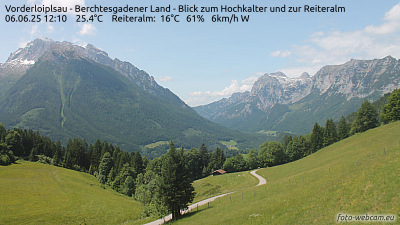
Cámaras web cerca de Grundübelhörner

Historia alrededor de Grundübelhörner
Ciudades cerca de Grundübelhörner
- Bad Reichenhalla 16 km
- Saalfelden am Steinernen Meera 19 km
- Salzburga 29 km
- Freilassinga 31 km
- Traunsteina 33 km
- Traunreuta 44 km