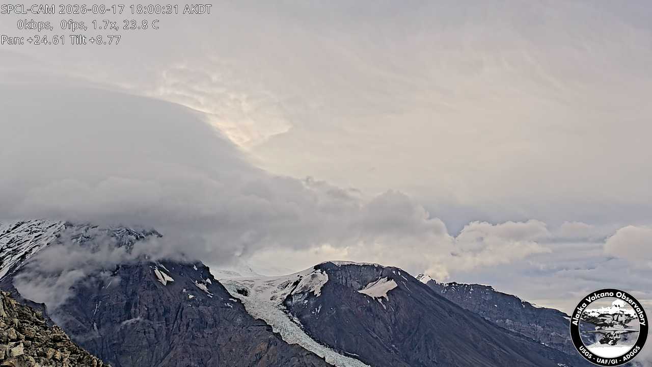
Mount Nagishlamina
Montaña · Montañas Tordrillo · Estados Unidos
Mount Nagishlamina is an 11,068-foot glaciated mountain summit located in the Tordrillo Mountains of the Alaska Range, in the US state of Alaska.
De Wikipedia, CC BY-SA · Leer el artículo
En la cumbre · pronóstico para las 6:00
11 °FDespejado · viento de 4 mph del S
 Verla en 3D
Pronóstico del tiempo en Mount Nagishlamina
- 6:0011 °FS 4 mph–
- 9:008 °FS 6 mph–
- 12:008 °FS 8 mph–
- 15:008 °FS 6 mph–
- 18:008 °FS 5 mph0,02 pulg.
- 21:009 °FS 6 mph0,11 pulg.
- 0:009 °FSO 5 mph0,02 pulg.
- 3:0011 °FSO 4 mph0,01 pulg.
| Día | Cielo | Máx. / mín. | Lluvia | Viento hasta |
|---|---|---|---|---|
| Hoy | Parcialmente nublado | 11 °F / 7 °F | 0,13 pulg. | 8 mph |
| jue, 29 oct | Nieve | 13 °F / 9 °F | 0,44 pulg. | 10 mph |
| vie, 30 oct | Nieve | 10 °F / 4 °F | 1 pulg. | 8 mph |
| sáb, 31 oct | Nublado | 6 °F / 3 °F | 0,17 pulg. | 2 mph |
| dom, 1 nov | Mayormente despejado | 5 °F / -1 °F | 0,03 pulg. | 2 mph |
| lun, 2 nov | Nieve fuerte | 6 °F / -2 °F | 1,12 pulg. | 7 mph |
| mar, 3 nov | Nieve | 6 °F / 3 °F | 0,97 pulg. | 5 mph |
Pronóstico de MET Norway (CC BY 4.0), actualizado a las 03:19 GMT-8. Horas locales.
Ficha técnica
- Tipo
- Montaña
- Cordillera
- Montañas Tordrillo
- País
- Estados Unidos
- Coordenadas
- 61.385°N 152.387°W
- Fuente
- Wikidata, CC0
Mount Nagishlamina
Mountain in Alaska, United States
Mount Nagishlamina is an 11,068-foot glaciated mountain summit located in the Tordrillo Mountains of the Alaska Range, in the US state of Alaska. The mountain is situated 90 mi (145 km) west of Anchorage, 7.4 mi (12 km) northwest of Mount Spurr, and 1.9 mi (3 km) southeast of Mount Torbert, which is the nearest higher neighbor. It is the fifth-highest peak in the Tordrillo Mountains, a subset of the Alaska Range.
De Wikipedia, CC BY-SA · Leer el artículo
Picos cerca de Mount Nagishlamina
- Mount Torbert11.266 ft · a 3 kmEn el mapa
- Mount Chichantna10.892 ft · a 8,2 kmEn el mapa
- Monte Spurr11.070 ft · a 12 kmEn el mapa
- Ch'akajabena Mountain7530 ft · a 25 kmEn el mapa
- Hayes Volcano9147 ft · a 28 kmEn el mapa
- The RowelMontaña · a 13 kmEn el mapa
- Mount GerdineMontaña · a 22 kmEn el mapa
- Black PeakMontaña · a 59 kmEn el mapa
Los más altos de Montañas Tordrillo
- Mount Torbert11.266 ftEn el mapa
- Monte Spurr11.070 ftEn el mapa
- Mount Chichantna10.892 ftEn el mapa
- Hayes Volcano9147 ftEn el mapa
Montañas más altas de Estados Unidos
- Denali20.308 ftEn el mapa
- Monte San Elías18.009 ftEn el mapa
- Monte Foraker17.402 ftEn el mapa
- Monte Bona16.535 ftEn el mapa
- Monte Blackburn16.390 ftEn el mapa
- Monte Sanford16.237 ftEn el mapa
- Monte Vancouver15.787 ftEn el mapa
- Monte Churchill15.636 ftEn el mapa
- Monte Fairweather15.325 ftEn el mapa
- Mount Hubbard14.951 ftEn el mapa