Rigi Hochflue
1699 m5574 ft
Montaña · Schwyzer Voralpen · Suiza
The Rigi Hochflue is a mountain summit west of the mountain range Urmiberg, in itself part of the Rigi massif, overlooking the Gersauerbecken of Lake Lucerne in Central Switzerland on its mountainside to the south, and Lake Lauerz on its north side.
De Wikipedia, CC BY-SA · Leer el artículo
En la cumbre · pronóstico para las 17:00
8 °CDespejado · viento de 1 km/h del E
 Verla en 3D
Clima en la cumbre de Rigi Hochflue, 1699 m
- 17:008 °CE 1 km/h–
- 20:006 °CE 3 km/h–
- 23:006 °CE 4 km/h–
- 2:004 °CSE 4 km/h0,1 mm
- 5:004 °CE 5 km/h–
- 8:005 °CNO 5 km/h1,3 mm
- 11:004 °CNO 6 km/h0,9 mm
- 14:004 °CNO 4 km/h–
| Día | Cielo | Máx. / mín. | Lluvia | Viento hasta |
|---|---|---|---|---|
| mié, 28 oct | Lluvia débil | 6 °C / 3 °C | 2,5 mm | 6 km/h |
| jue, 29 oct | Niebla | 5 °C / 0 °C | – | 8 km/h |
| vie, 30 oct | Nublado | 4 °C / -0 °C | 0,1 mm | 6 km/h |
| sáb, 31 oct | Parcialmente nublado | 4 °C / -2 °C | 0,1 mm | 5 km/h |
| dom, 1 nov | Mayormente despejado | 6 °C / -0 °C | – | 5 km/h |
| lun, 2 nov | Parcialmente nublado | 3 °C / -1 °C | 0,3 mm | 6 km/h |
| mar, 3 nov | Nublado | 3 °C / -1 °C | 0,5 mm | 6 km/h |
Pronóstico de MET Norway (CC BY 4.0), actualizado a las 02:17 CET. Horas locales.
Ficha técnica
- Tipo
- Montaña
- Altitud sobre el nivel del mar
- 1699 m (5574 ft)
- Prominencia
- 509 m (1670 ft)
- Cordillera
- Schwyzer Voralpen
- Pico padre
- Rigi
- País
- Suiza
- Coordenadas
- 47.010°N 8.560°E
- Fuente
- Wikidata, CC0
Rigi Hochflue
Mountain in Switzerland
The Rigi Hochflue is a mountain summit west of the mountain range Urmiberg, in itself part of the Rigi massif, overlooking the Gersauerbecken of Lake Lucerne in Central Switzerland on its mountainside to the south, and Lake Lauerz on its north side. It has an elevation of 1,699 metres (5,574 ft) above sea level and is located in the canton of Schwyz.
De Wikipedia, CC BY-SA · Leer el artículo
Picos cerca de Rigi Hochflue
- Rigi1797 m · a 7,6 kmEn el mapa
- Bürgenstock1128 m · a 12 kmEn el mapa
- Stanserhorn1898 m · a 19 kmEn el mapa
- Monte Pilatus2128 m · a 25 kmEn el mapa
- Titlis3238 m · a 28 kmEn el mapa
- Clariden3267 m · a 30 kmEn el mapa
- Albis915 m · a 31 kmEn el mapa
- Oberalpstock3328 m · a 34 kmEn el mapa
- Tödi3612 m · a 35 kmEn el mapa
- Bifertenstock3421 m · a 38 kmEn el mapa
Pico padre
El pico más alto más cercano respecto al que se mide su prominencia.
- Rigi1797 mEn el mapa
Los más altos de Schwyzer Voralpen
- Schächentaler Windgällen2764 mEn el mapa
- Chaiserstock2515 mEn el mapa
- Fulen2491 mEn el mapa
- Wasserbergfirst2341 mEn el mapa
- Mutteristock2294 mEn el mapa
- Rautispitz2283 mEn el mapa
- Druesberg2282 mEn el mapa
- Piet1965 mEn el mapa
- Rigi Hochflue1699 mEn el mapa
Montañas más altas de Suiza
- Pico Dufour4634 mEn el mapa
- Dom4546 mEn el mapa
- Liskamm4532 mEn el mapa
- Weisshorn4505 mEn el mapa
- Cervino4478 mEn el mapa
- Dent Blanche4357 mEn el mapa
- Grand Combin4309 mEn el mapa
- Finsteraarhorn4274 mEn el mapa
- Zinalrothorn4221 mEn el mapa
- Alphubel4206 mEn el mapa
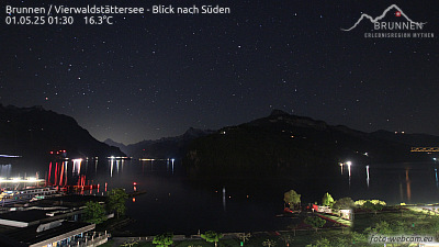
Cámaras web cerca de Rigi Hochflue


Historia alrededor de Rigi Hochflue
- Battle of Morgarten1315
- Zug massacre: In Zug, Switzerland, a gunman shoots 32 people, killing 14 members of parliament and then himself2001
- June 2024 Ukraine peace summit: World leaders meet at the Bürgenstock Resort to advance the Ukrainian peace process2024
- Stanser Verkommnis1481
- Siebnerkonkordat1832
- Earthquake — Switzerland1774
- fire in the Luzern railway station1971
- Battle of Gisikon1847