Rigi Hochflue
1 699 m5 574 ft
Montagne · Schwyzer Voralpen · Suisse
The Rigi Hochflue is a mountain summit west of the mountain range Urmiberg, in itself part of the Rigi massif, overlooking the Gersauerbecken of Lake Lucerne in Central Switzerland on its mountainside to the south, and Lake Lauerz on its north side.
Source : Wikipedia, CC BY-SA · Lire l’article
Au sommet · prévision pour 3:00
2 °CNuageux · vent 3 km/h du N
 Voir en 3D
Météo au sommet : Rigi Hochflue, 1 699 m
- 3:002 °CN 3 km/h–
- 6:001 °CNE 5 km/h–
- 9:002 °CNO 6 km/h–
- 12:004 °CNO 6 km/h–
- 15:005 °CNO 8 km/h–
- 18:003 °CNO 4 km/h–
- 21:001 °CN 3 km/h–
- 0:000 °CNO 4 km/h–
| Jour | Ciel | Max. / min. | Pluie | Vent jusqu’à |
|---|---|---|---|---|
| Aujourd’hui | Brouillard | 5 °C / 1 °C | – | 8 km/h |
| ven. 30 oct. | Brouillard | 3 °C / -1 °C | 0,2 mm | 8 km/h |
| sam. 31 oct. | Nuageux | 2 °C / -1 °C | 0,7 mm | 6 km/h |
| dim. 1 nov. | Nuageux | 2 °C / -1 °C | 0,9 mm | 6 km/h |
| lun. 2 nov. | Nuageux | 1 °C / -2 °C | 1,3 mm | 7 km/h |
| mar. 3 nov. | Partiellement nuageux | 2 °C / -2 °C | 0,3 mm | 9 km/h |
| mer. 4 nov. | Plutôt dégagé | 2 °C / -2 °C | – | 5 km/h |
Prévisions de MET Norway (CC BY 4.0), mises à jour à 09:19 UTC+1. Heures locales.
Fiche technique
- Type
- Montagne
- Altitude
- 1 699 m (5 574 ft)
- Proéminence
- 509 m (1 670 ft)
- Massif
- Schwyzer Voralpen
- Sommet parent
- Rigi
- Pays
- Suisse
- Coordonnées
- 47.010°N 8.560°E
- Source
- Wikidata, CC0
Rigi Hochflue
Mountain in Switzerland
The Rigi Hochflue is a mountain summit west of the mountain range Urmiberg, in itself part of the Rigi massif, overlooking the Gersauerbecken of Lake Lucerne in Central Switzerland on its mountainside to the south, and Lake Lauerz on its north side. It has an elevation of 1,699 metres (5,574 ft) above sea level and is located in the canton of Schwyz.
Source : Wikipedia, CC BY-SA · Lire l’article
Sommets près de Rigi Hochflue
- Rigi1 797 m · à 7,6 kmSur la carte
- Bürgenstock1 128 m · à 12 kmSur la carte
- Stanserhorn1 898 m · à 19 kmSur la carte
- Pilate2 128 m · à 25 kmSur la carte
- Titlis3 238 m · à 28 kmSur la carte
- montagne de Clariden3 267 m · à 30 kmSur la carte
- Albis915 m · à 31 kmSur la carte
- Oberalpstock3 328 m · à 34 kmSur la carte
- Tödi3 612 m · à 35 kmSur la carte
- Bifertenstock3 421 m · à 38 kmSur la carte
Sommet parent
Le sommet plus haut le plus proche, auquel se mesure sa proéminence.
- Rigi1 797 mSur la carte
Les plus hauts : Schwyzer Voralpen
- Schächentaler Windgällen2 764 mSur la carte
- Chaiserstock2 515 mSur la carte
- Fulen2 491 mSur la carte
- Wasserbergfirst2 341 mSur la carte
- Mutteristock2 294 mSur la carte
- Rautispitz2 283 mSur la carte
- Druesberg2 282 mSur la carte
- Piet1 965 mSur la carte
- Rigi Hochflue1 699 mSur la carte
Plus hautes montagnes : Suisse
- pointe Dufour4 634 mSur la carte
- Dom4 546 mSur la carte
- Liskamm4 532 mSur la carte
- Weisshorn4 505 mSur la carte
- Cervin4 478 mSur la carte
- dent Blanche4 357 mSur la carte
- Grand Combin4 309 mSur la carte
- Finsteraarhorn4 274 mSur la carte
- Zinalrothorn4 221 mSur la carte
- Alphubel4 206 mSur la carte
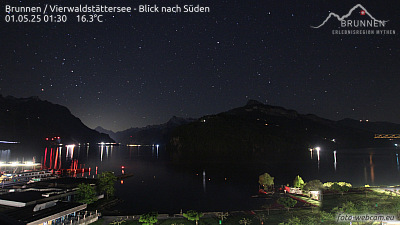
Webcams près de Rigi Hochflue


Histoire autour de Rigi Hochflue
- Battle of Morgarten1315
- Zug massacre: In Zug, Switzerland, a gunman shoots 32 people, killing 14 members of parliament and then himself2001
- June 2024 Ukraine peace summit: World leaders meet at the Bürgenstock Resort to advance the Ukrainian peace process2024
- Stanser Verkommnis1481
- Siebnerkonkordat1832
- Earthquake — Switzerland1774
- fire in the Luzern railway station1971
- Battle of Gisikon1847