Schächentaler Windgällen
2 764 m9 068 ft
Montagne · Schwyzer Voralpen · Suisse
The Schächentaler Windgällen is a mountain massif in the Schwyzer Alps, overlooking Unterschächen in the canton of Uri. The two named peaks are Höch Windgällen and Läged Windgällen. The mountain massif lies between the valley of Muotathal (north) and Schächental (south).
Source : Wikipedia, CC BY-SA · Lire l’article
Au sommet · prévision pour 17:00
3 °CDégagé · vent 1 km/h du N
 Voir en 3D
Météo au sommet : Schächentaler Windgällen, 2 764 m
- 17:003 °CN 1 km/h–
- 20:00-1 °CSE 2 km/h–
- 23:00-2 °CE 2 km/h–
- 2:00-3 °CSE 3 km/h0,1 mm
- 5:00-3 °CSE 4 km/h–
- 8:00-2 °CNO 4 km/h0,4 mm
- 11:00-2 °CNO 6 km/h0,5 mm
- 14:00-2 °CNO 5 km/h–
| Jour | Ciel | Max. / min. | Pluie | Vent jusqu’à |
|---|---|---|---|---|
| mer. 28 oct. | Neige faible | -2 °C / -4 °C | 1 mm | 6 km/h |
| jeu. 29 oct. | Plutôt dégagé | 2 °C / -7 °C | – | 8 km/h |
| ven. 30 oct. | Plutôt dégagé | 1 °C / -7 °C | – | 6 km/h |
| sam. 31 oct. | Plutôt dégagé | 2 °C / -8 °C | – | 4 km/h |
| dim. 1 nov. | Plutôt dégagé | 1 °C / -8 °C | – | 5 km/h |
| lun. 2 nov. | Partiellement nuageux | -2 °C / -7 °C | – | 6 km/h |
| mar. 3 nov. | Partiellement nuageux | -2 °C / -10 °C | – | 6 km/h |
Prévisions de MET Norway (CC BY 4.0), mises à jour à 14:17 UTC+1. Heures locales.
Fiche technique
- Type
- Montagne
- Altitude
- 2 764 m (9 068 ft)
- Proéminence
- 691 m (2 267 ft)
- Massif
- Schwyzer Voralpen
- Sommet parent
- Glärnisch
- Pays
- Suisse
- Coordonnées
- 46.888°N 8.792°E
- Source
- Wikidata, CC0
Schächentaler Windgällen
Mountain in Switzerland
The Schächentaler Windgällen is a mountain massif in the Schwyzer Alps, overlooking Unterschächen in the canton of Uri. The two named peaks are Höch Windgällen and Läged Windgällen. The mountain massif lies between the valley of Muotathal (north) and Schächental (south). The Schächentaler Windgällen are located a few kilometres west of Klausen Pass.
Source : Wikipedia, CC BY-SA · Lire l’article
Sommets près de Schächentaler Windgällen
- montagne de Clariden3 267 m · à 7,9 kmSur la carte
- Gross Düssi3 256 m · à 11 kmSur la carte
- Tödi3 612 m · à 13 kmSur la carte
- Bifertenstock3 421 m · à 16 kmSur la carte
- Oberalpstock3 328 m · à 16 kmSur la carte
- Gross Spannort3 198 m · à 23 kmSur la carte
- Rigi1 797 m · à 30 kmSur la carte
- Titlis3 238 m · à 30 kmSur la carte
- Piz Medel3 210 m · à 31 kmSur la carte
- Bürgenstock1 128 m · à 32 kmSur la carte
Sommet parent
Le sommet plus haut le plus proche, auquel se mesure sa proéminence.
- Glärnisch2 915 mSur la carte
Sommets sous Schächentaler Windgällen
- Ortstock2 717 mSur la carte
- Alpler Torstock2 622 mSur la carte
- Chaiserstock2 515 mSur la carte
- Alpler Horn2 380 mSur la carte
- Wasserbergfirst2 341 mSur la carte
Les plus hauts : Schwyzer Voralpen
- Schächentaler Windgällen2 764 mSur la carte
- Chaiserstock2 515 mSur la carte
- Fulen2 491 mSur la carte
- Wasserbergfirst2 341 mSur la carte
- Mutteristock2 294 mSur la carte
- Rautispitz2 283 mSur la carte
- Druesberg2 282 mSur la carte
- Piet1 965 mSur la carte
- Chlingenstock1 935 mSur la carte
Plus hautes montagnes : Suisse
- pointe Dufour4 634 mSur la carte
- Dom4 546 mSur la carte
- Liskamm4 532 mSur la carte
- Weisshorn4 505 mSur la carte
- Cervin4 478 mSur la carte
- dent Blanche4 357 mSur la carte
- Grand Combin4 309 mSur la carte
- Finsteraarhorn4 274 mSur la carte
- Zinalrothorn4 221 mSur la carte
- Alphubel4 206 mSur la carte
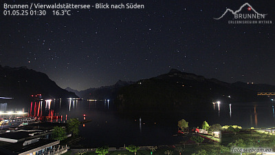
Webcams près de Schächentaler Windgällen



Histoire autour de Schächentaler Windgällen
Villes près de Schächentaler Windgällen
- Schwyzà 18 km
- Einsiedelnà 27 km
- Rapperswilà 38 km
- Zugà 38 km
- Jonaà 38 km
- Baarà 40 km